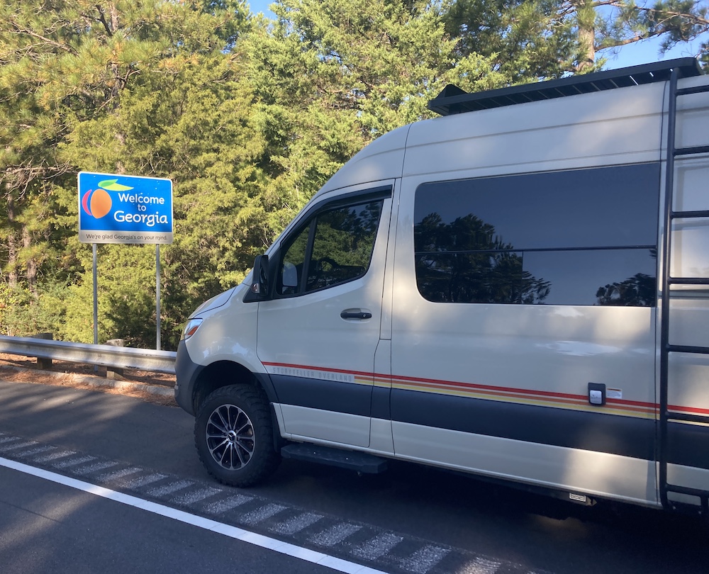
Day 25:
6400 miles and counting. Woohoo! Today is the day I get to scram out of Las Vegas. My pretty girl is all fixed up, and ready to get back on the road. She just needed a rest, like every beautiful lady, she needed time at the spa. After a fresh bath a bunch of new bolts, some new sway bars, and a whole lot of TLC, Pervvie is back on the road and ready for adventure. It felt so good getting into her after a few days absence.
On the way out of town I did a few miscellaneous Geocaching things, and a trip to the food market to get restocked up. I was hoping to steal some water from somewhere too, but I have plenty for now. I am heading directly north, into the desert. I plan to drive for a couple of oldest hides in Nevada, and some other highly favorited geocaches along the way. I believe my next destination is going to be rattling  around Idaho. But so far, my plans only work out 50% of the time. The other 50% of the time I end up doing something way better than I ever planned or imagined.
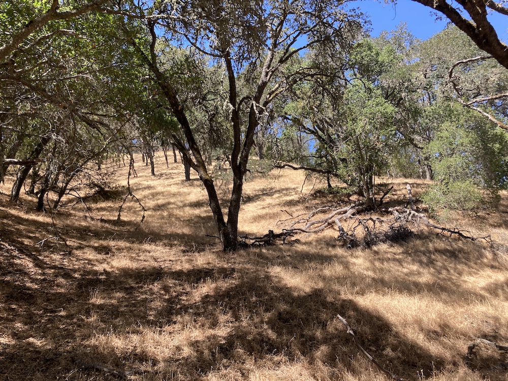
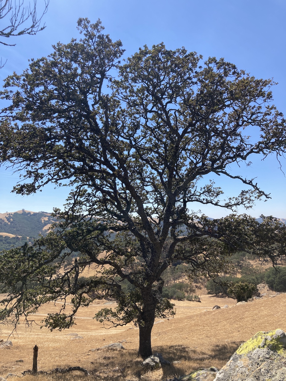
I drove all over, all through, and all around all of these power trails out here in the middle of nowhere. I stopped for more than I thought I would. But still very little. Just the high favorite ones, and the older ones. If I had the willingness, I could’ve had a find count of 20,000 higher than I do now. But that just doesn’t seem like having a fun. The fun for me is just driving around in the desert, getting lost in my own thoughts…not pretending I’m a mailman.
I found all the main ones that I wanted, and some others. Basically, where I stopped to pee, take pictures, sometimes both of those things.
Time to head north for the oldest one. I was in a big conundrum. The van said it has 90 miles left of fuel. I was 30 miles one way from the main road, and 30 miles from the town of Tonopah. I had to drive all the way from Golden Arrow, to Tonopah, turn around come all the way back, go to the old one north, turn around and back through Tonopah. Poor fuel planning.
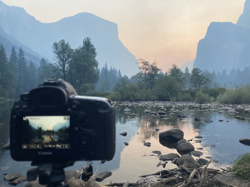
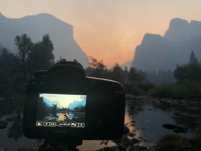
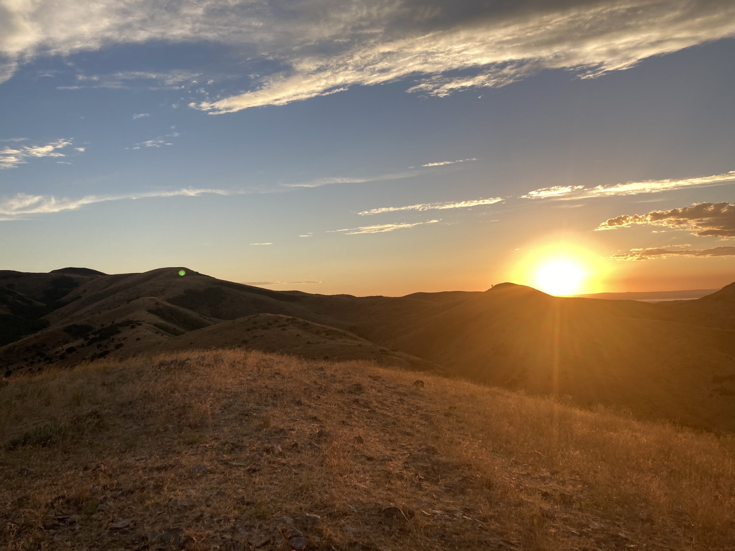
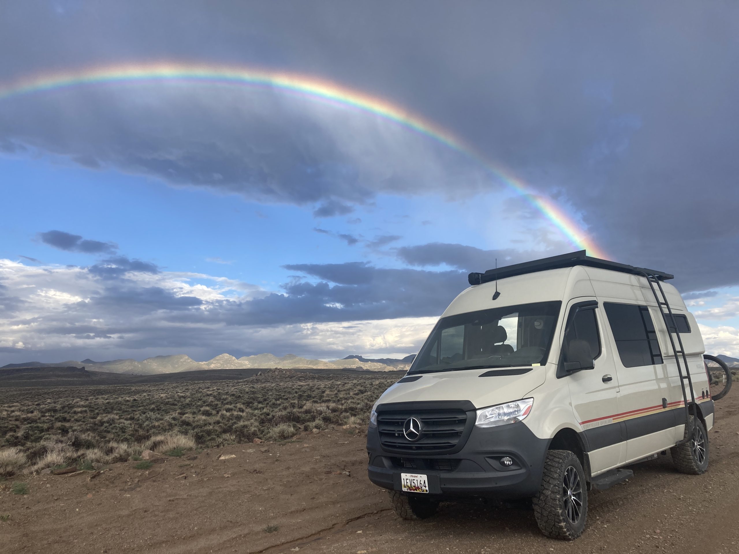
As I turned left off of the main road to go north on a dirt road, I noticed “I want to kill you” weather, in the distance. Behind me was the most beautiful bluebird skies you could ever imagine. However directly in front of me was the most terrifying, menacing sky I’ve seen yet on this trip. Oh well, that’s the way I must go.
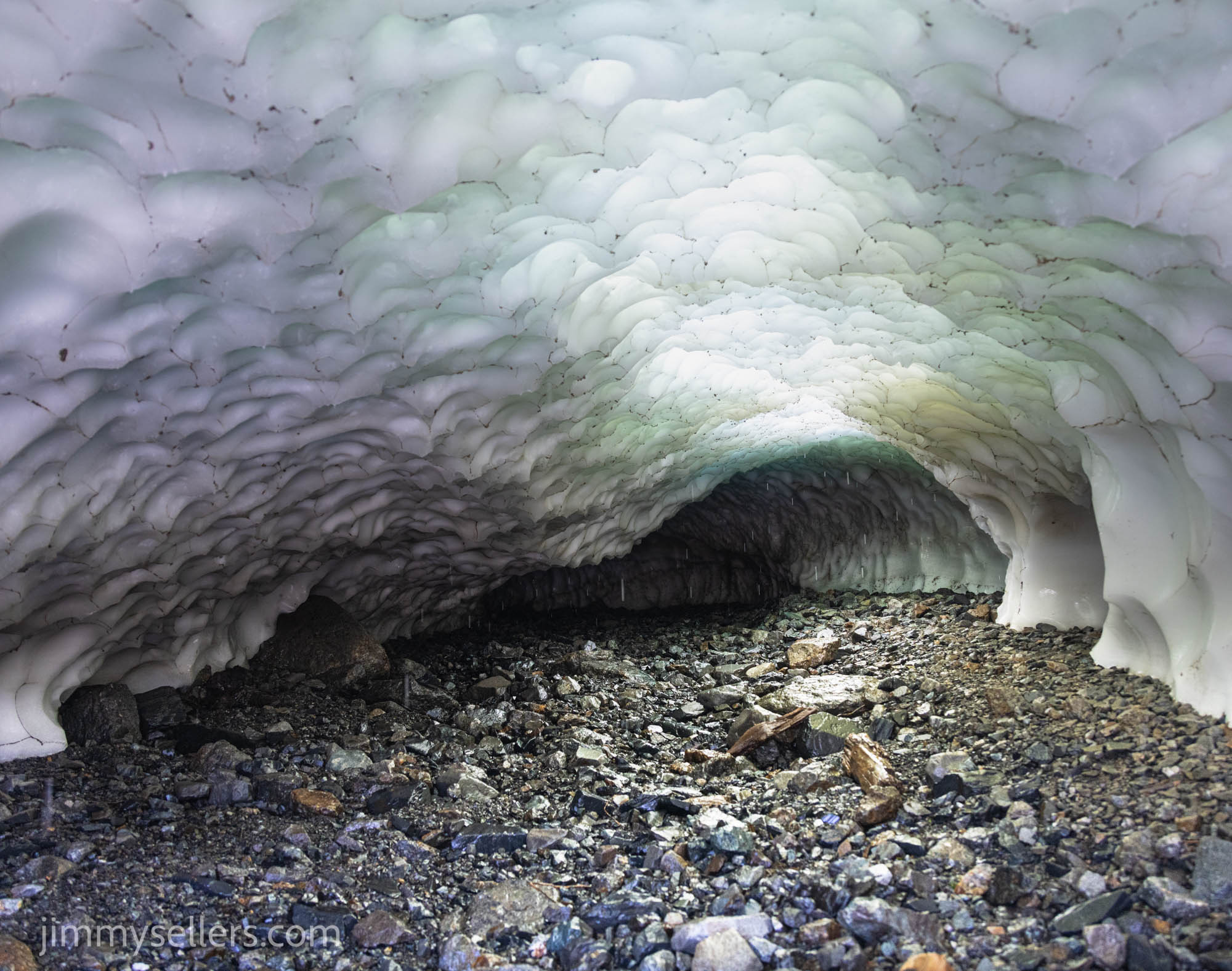
Thank you so much for bringing me to the location of Nevada’s oldest geocache. I was treated to a spectacular show of storms and skies and clouds and then ultimately rainbows. That’s right rainbows with an ‘S’ at the end.
From there I made my way to Ely, found a nice place to rest for the night. Tomorrow is hopefully north to Idaho.
Day 26:
I woke up in Ely, Nevada at a Love’s. 6900 miles and counting.
I am planning to head into Idaho. I got moving this morning not quite as early as I would’ve hoped, but after a few nights absence, I was extra cozy in my mobile home’s bed.
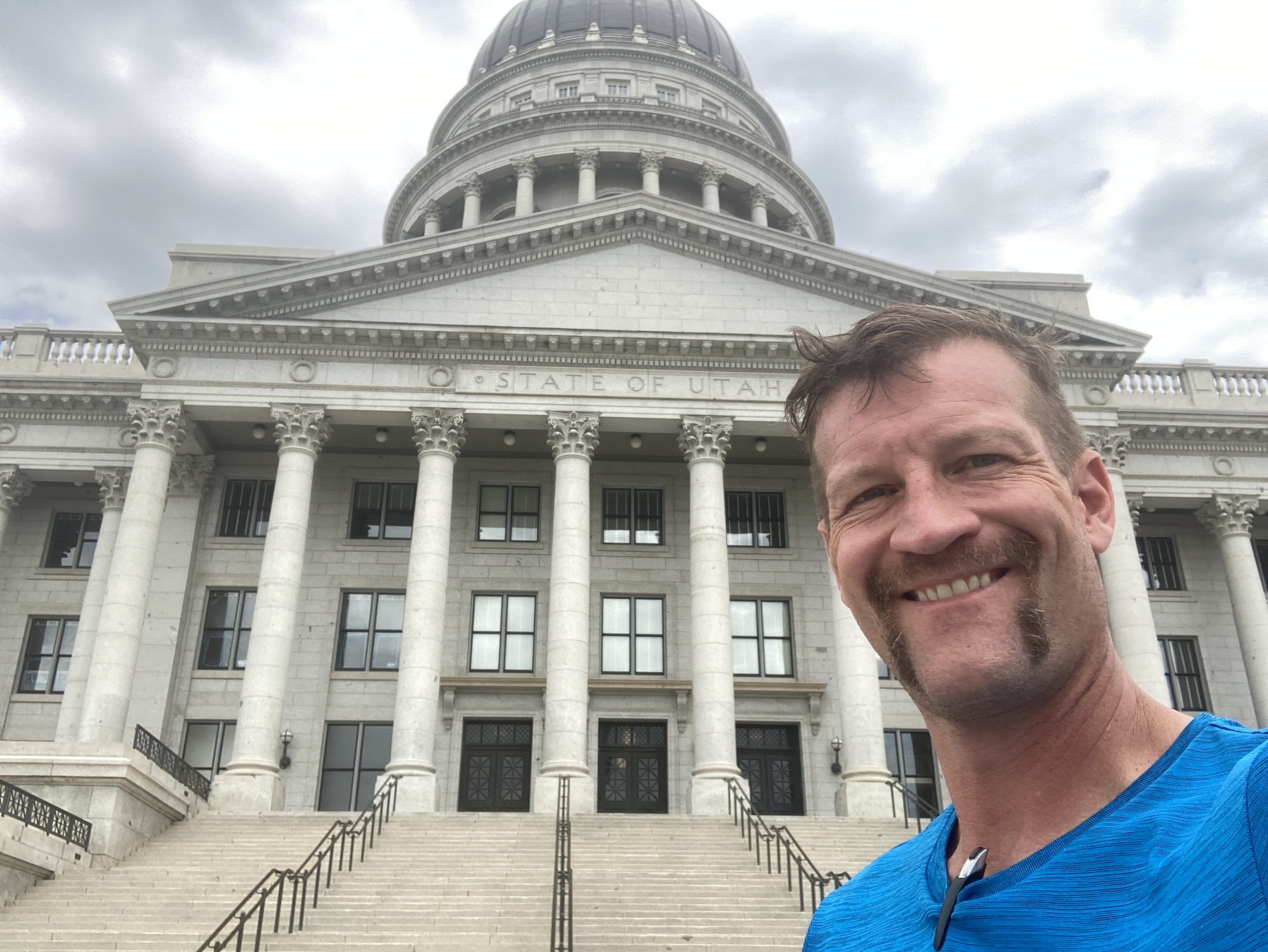
I changed my plans for the 10th time today and a millionth time this trip. I made a detour back through Salt Lake City. I couldn’t spend  much time there, because it was during a time when I thought I needed van repairs and was anxious to get that done. I drove and wandered around an empty Salt Lake City on a Sunday. The weather was beautiful, and it was a perfect time to be Geocaching as there was no one else around to see me acting weird.
Having grown up on the East Coast, I will never understand how I am able to drive 3 hours or more, at 80 miles an hour, and not see another human being. Did they build these roads just for me to use?
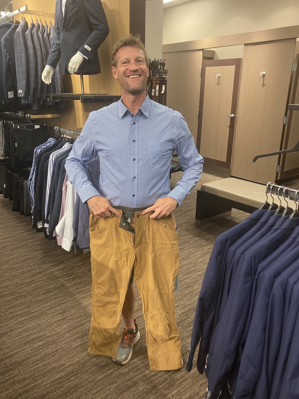
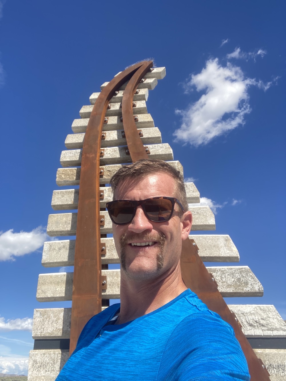
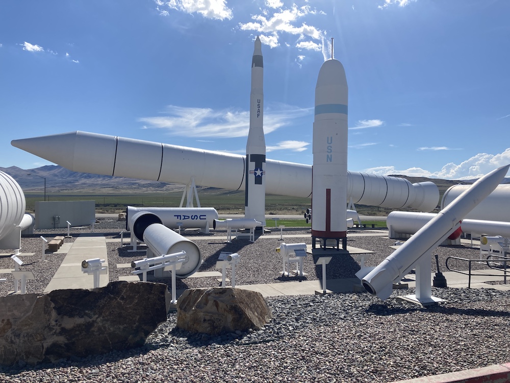
From there I was going to head to the Golden Spike. It occurred to me I had a few errands, and I was in a major suburban area. So, I stopped off at the Home Depot, the Office Depot, the Auto Depot, and luckily picked a town with some really highly favorited caches and a WebCam.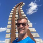 This detour was a lot longer than I had planned on.
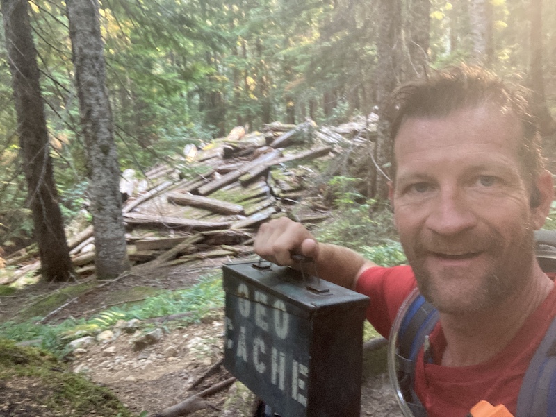
After visiting a choo-choo train history spot, I backtracked to the missile exhibit. That was so much more fascinating than I ever expected. I went there for the old virtual and the letter box. I spent about 40 minutes on that letterbox. First, I couldn’t find a sign. So, I did some alternate research and narrowed it down to a couple of options. But then I was messing 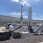 up on first letter second letter third letter first words 2nd word third word. There was a nice big hint in the combo description by the owner. And I still thought I knew what I was doing. I got about 10 minutes away driving, and it clicked. Turned around went back, got my name on that letterbox too.
So glad something routed me to that spot. I never would’ve made it here on my own.
Now it’s time to finally try and get in Idaho.
I made it to southeastern Idaho before I ran out of day. I was able to find the old one in Southeastern Idaho, but not without issues. For some reason I had notes that said I could drive pretty close to this one. I guess 2 miles round-trip walking is close, but it was probably also a half of a mile uphill. I was running out of daylight. Poor time management, so I had to jog the whole time up the hill and then back down to where I left my van. After that I was officially out of daylight. I found a nearby spot to park and sleep for the night.
Day 27:
7500 miles and counting.
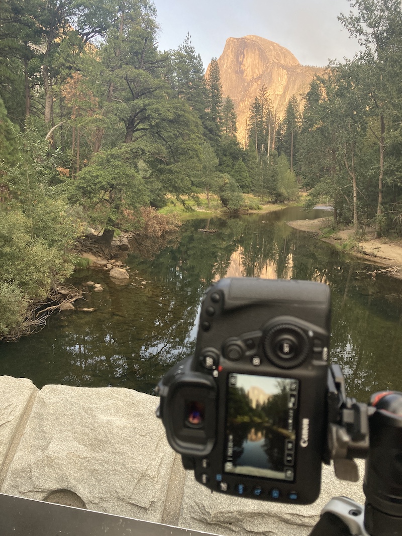
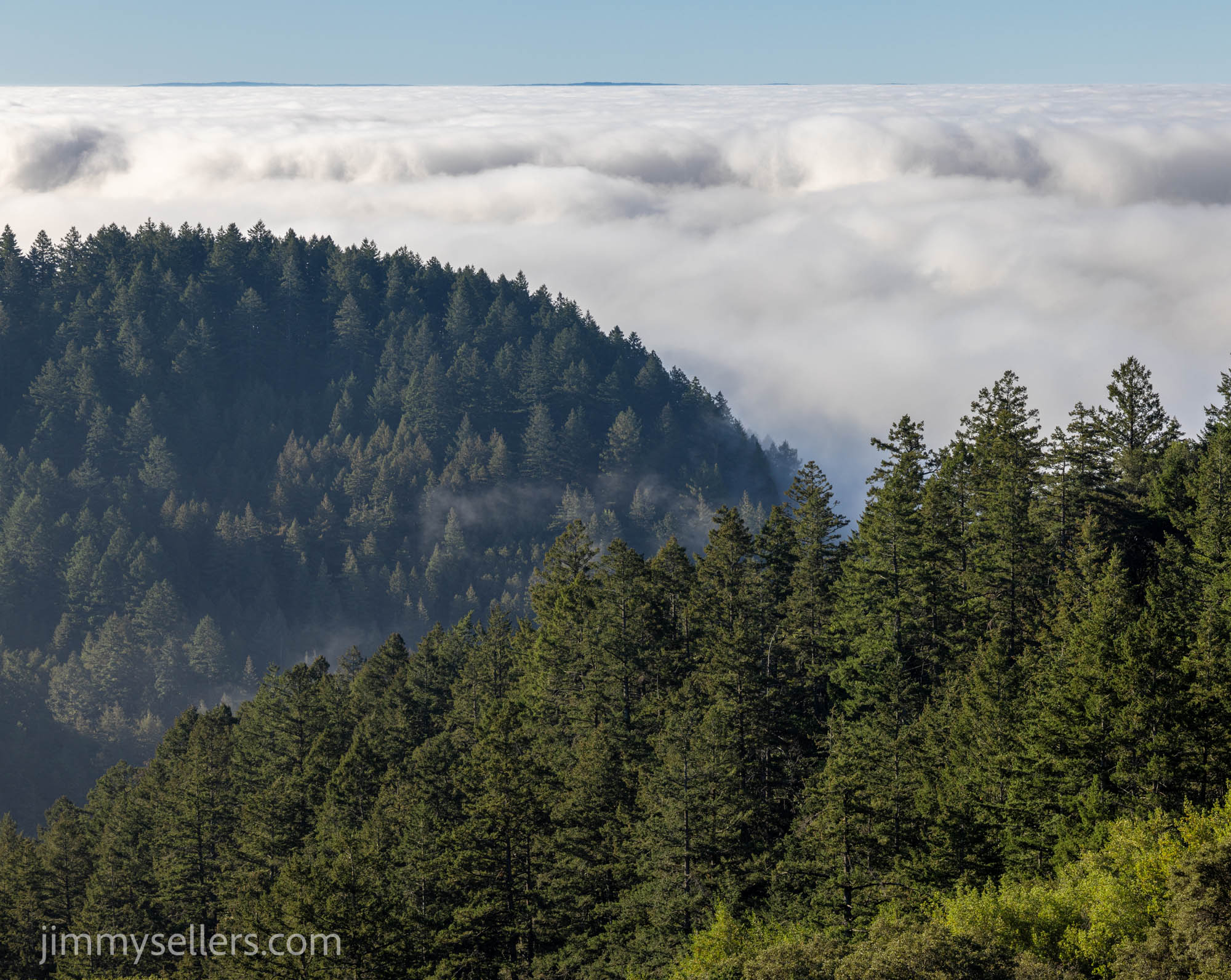
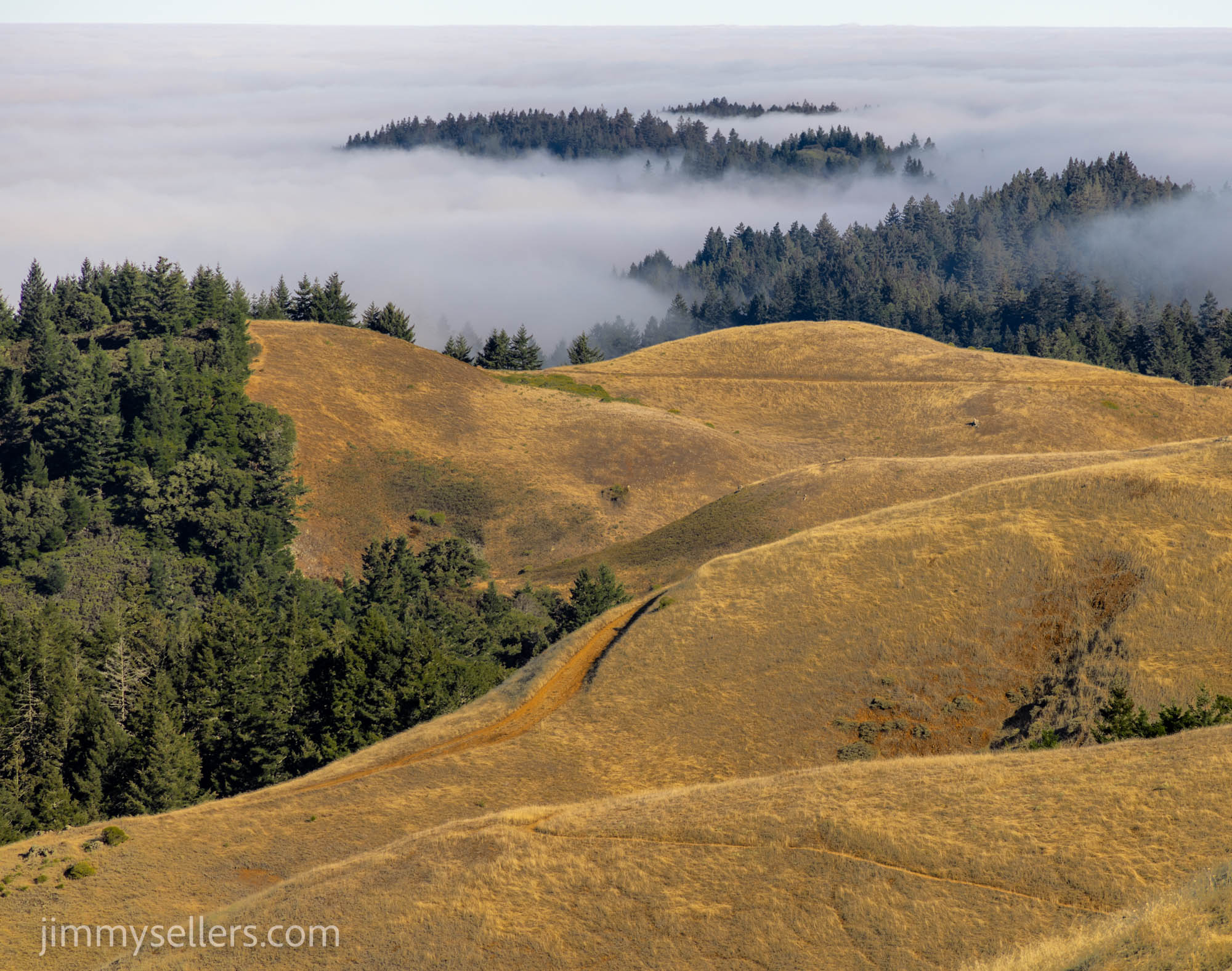
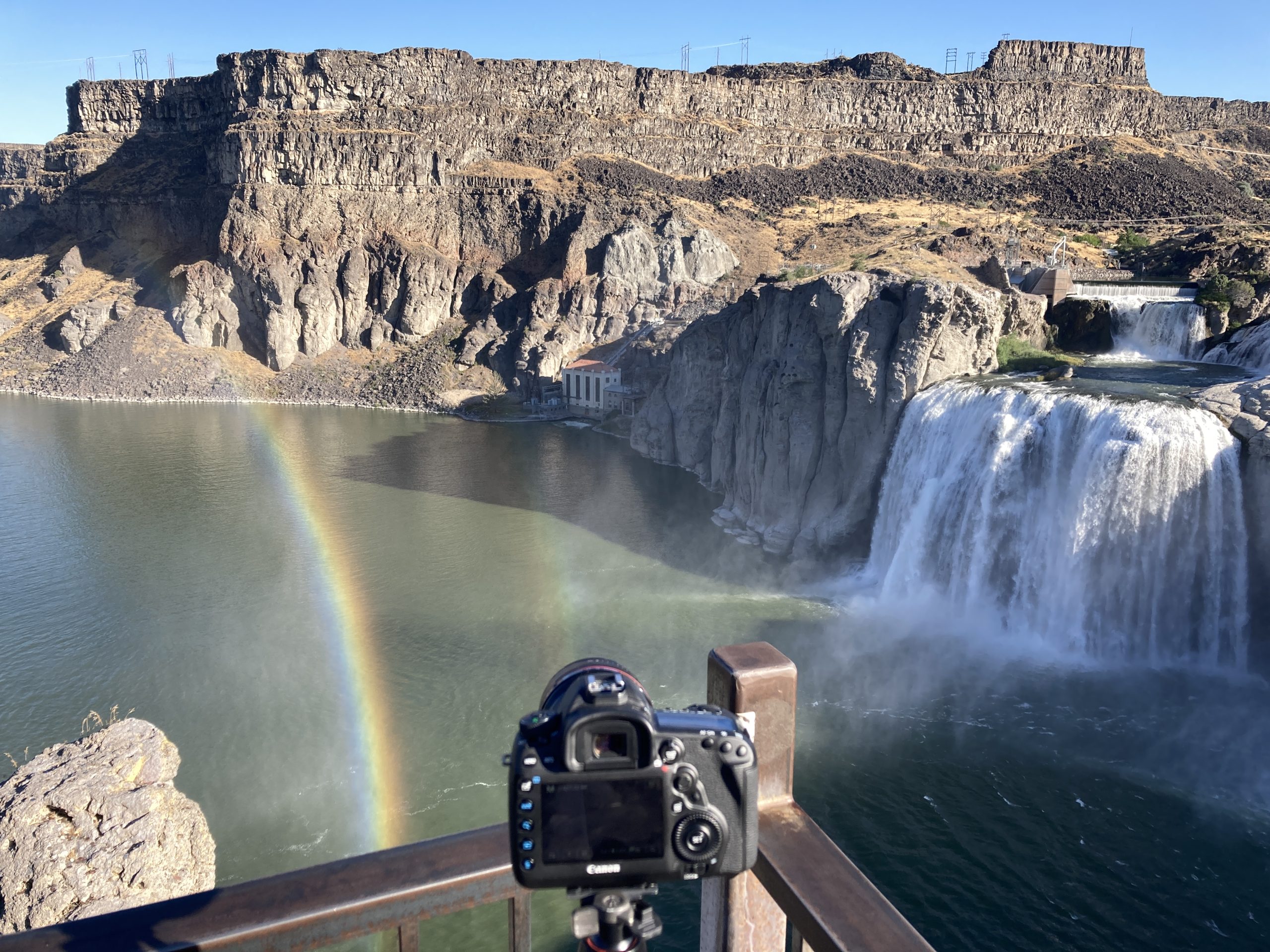
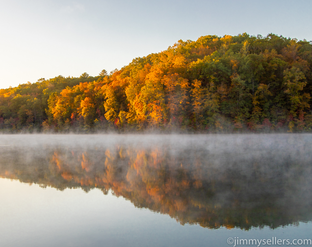
I woke up in Idaho and made my way to the waterfall earthcache. I spent much more time at the waterfall area than I ever imagined. I did a couple of short hikes, and found a bunch of geocaches. I took some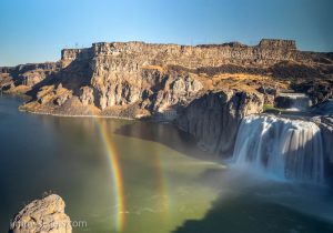 pictures and I chatted with some other nice travelers. I met some motorcycle enthusiasts from Australia. They told me they drove their bikes all the way to Idaho. What I thought would be a quick in and out ending up being several hours of my morning. Thank you for that.
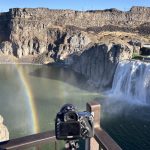 After a few miles of jogging and climbing around all these awesome rocks, the park filled up. People were swimming in a little lake/pond/pool area. I was hot and sweaty, and that look like an awesome thing to do. So, I did it. After a refreshing dip in the lake, I went and utilized my indoor shower. It’s a real special occasion when I use that thing.
On the way out of town I had a final of the Wherigo. I realized how I had to get there and said, damn, I just took a shower. So, I walk extra slow and tried to stay nice and zestfully clean.
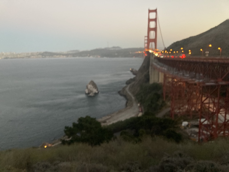
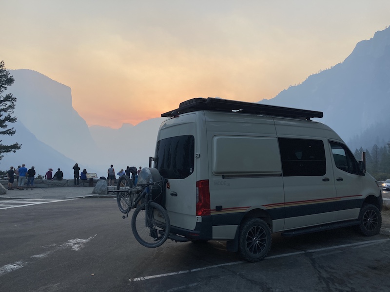
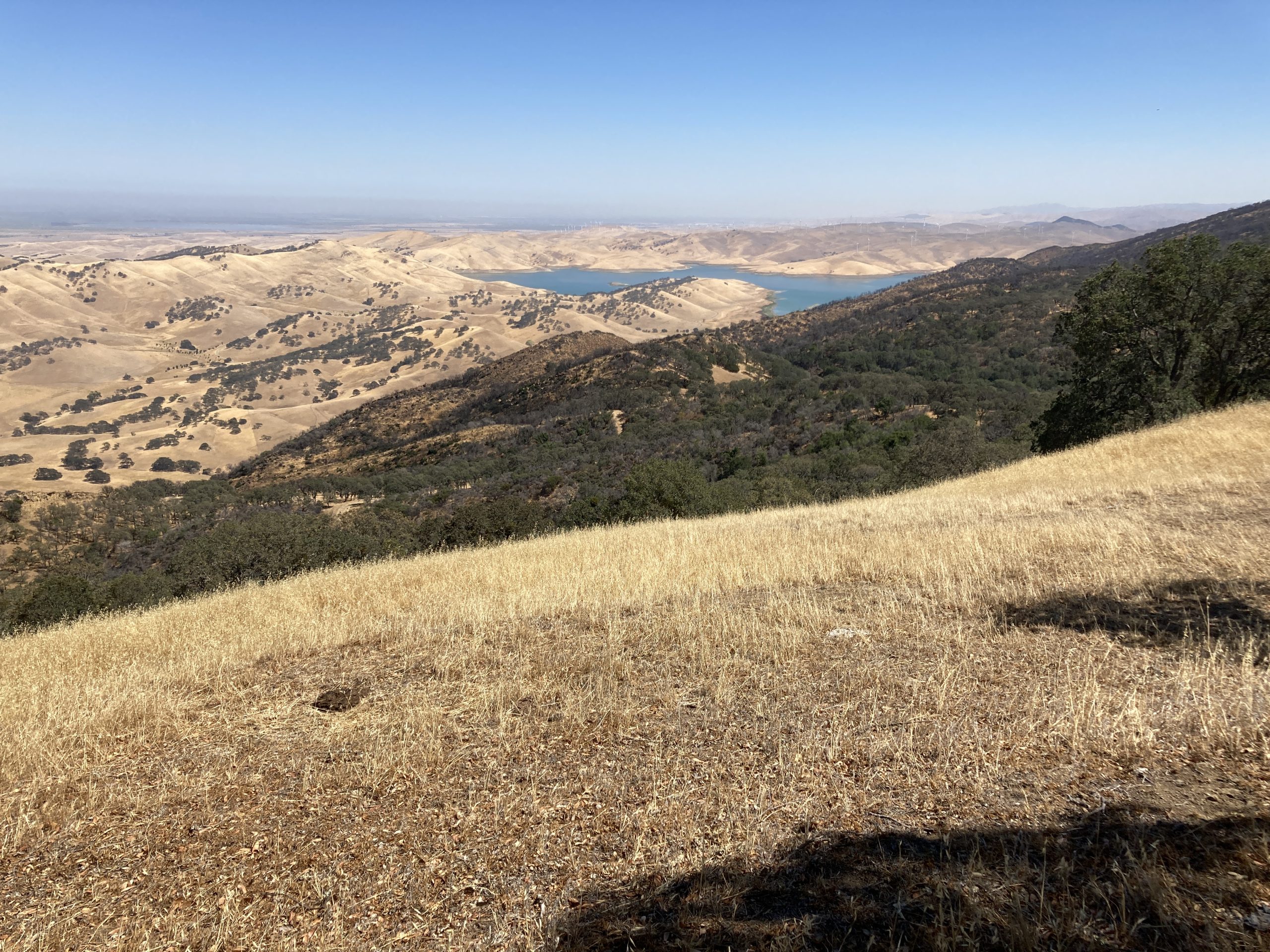
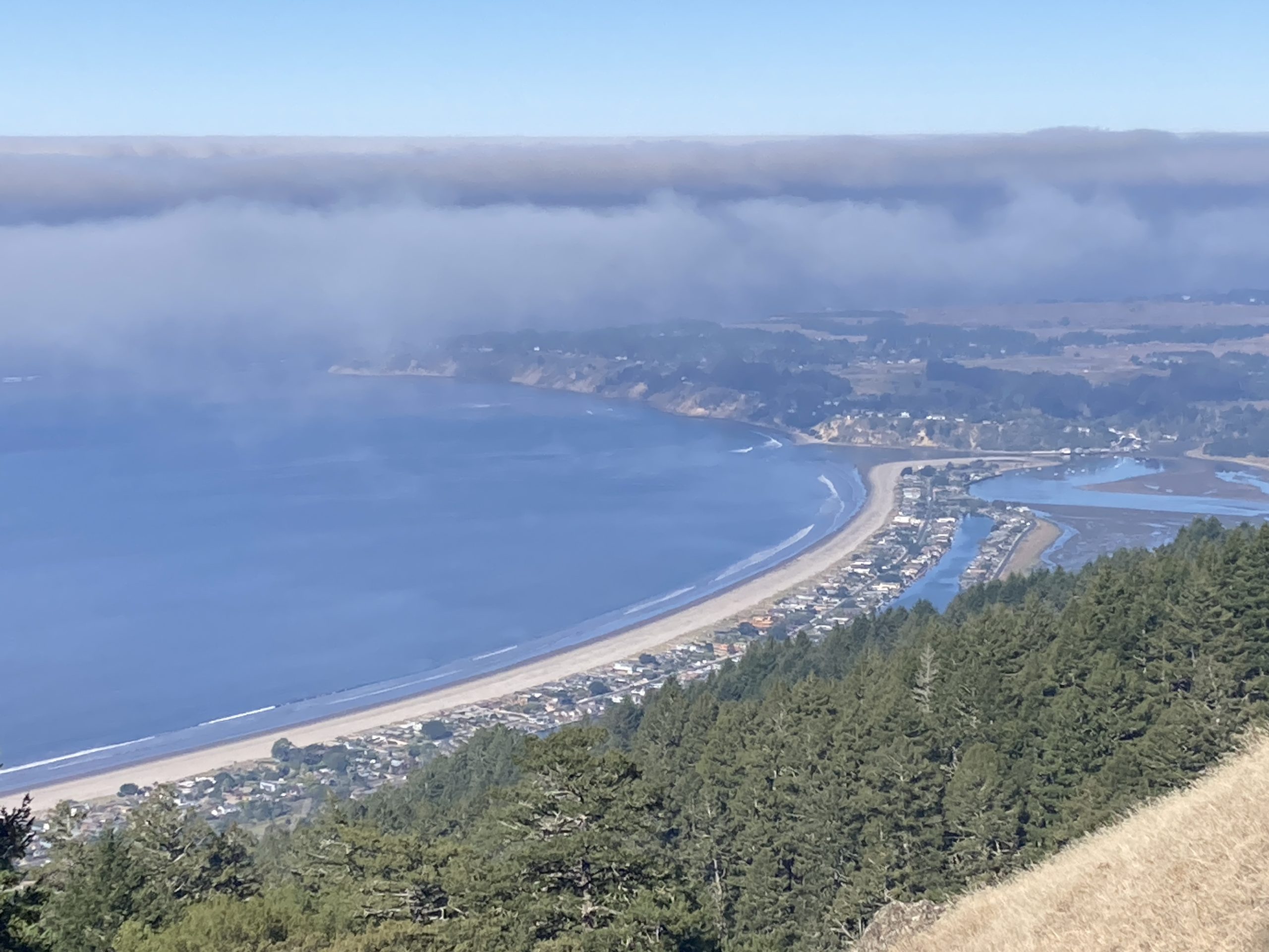
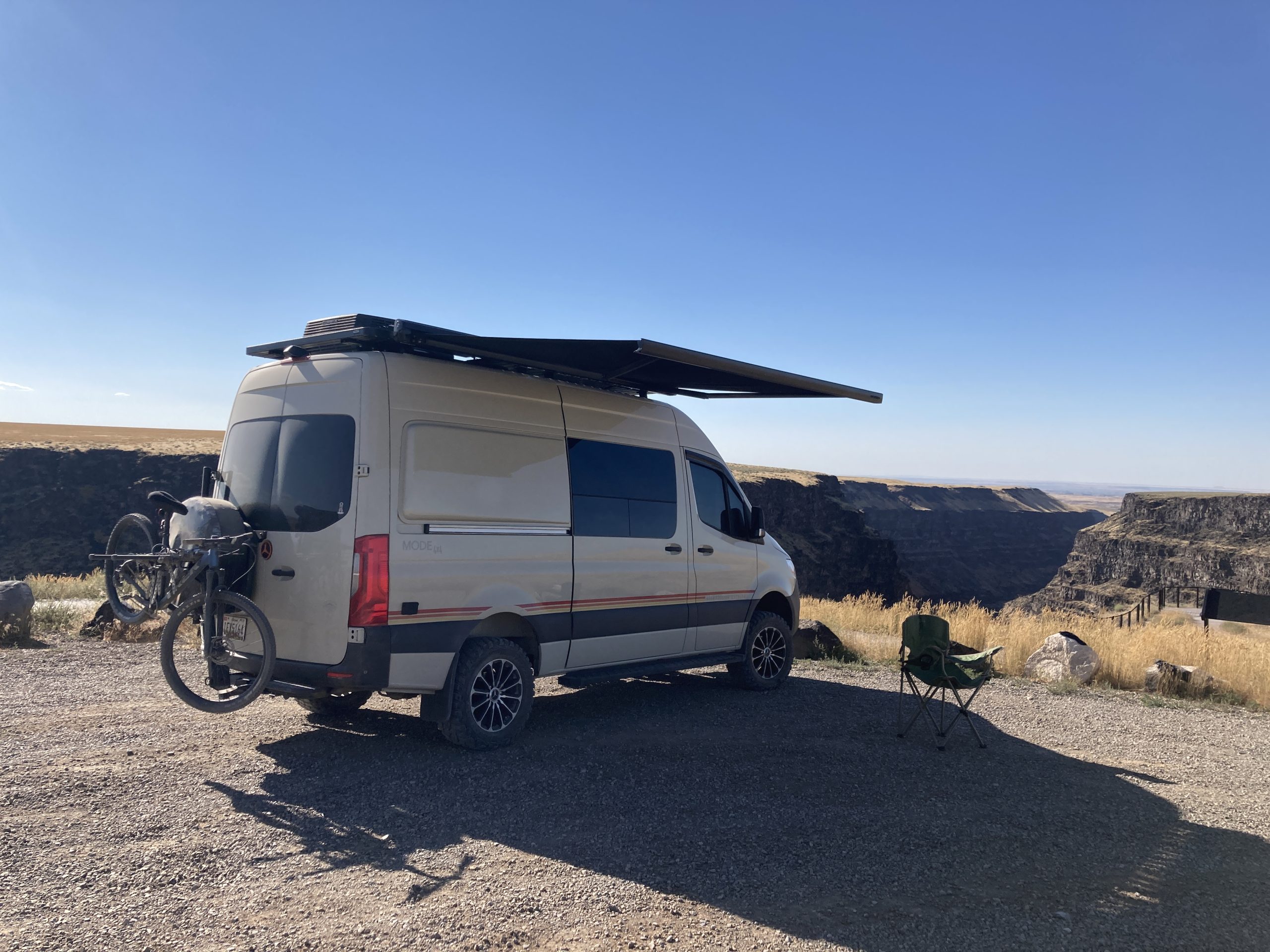
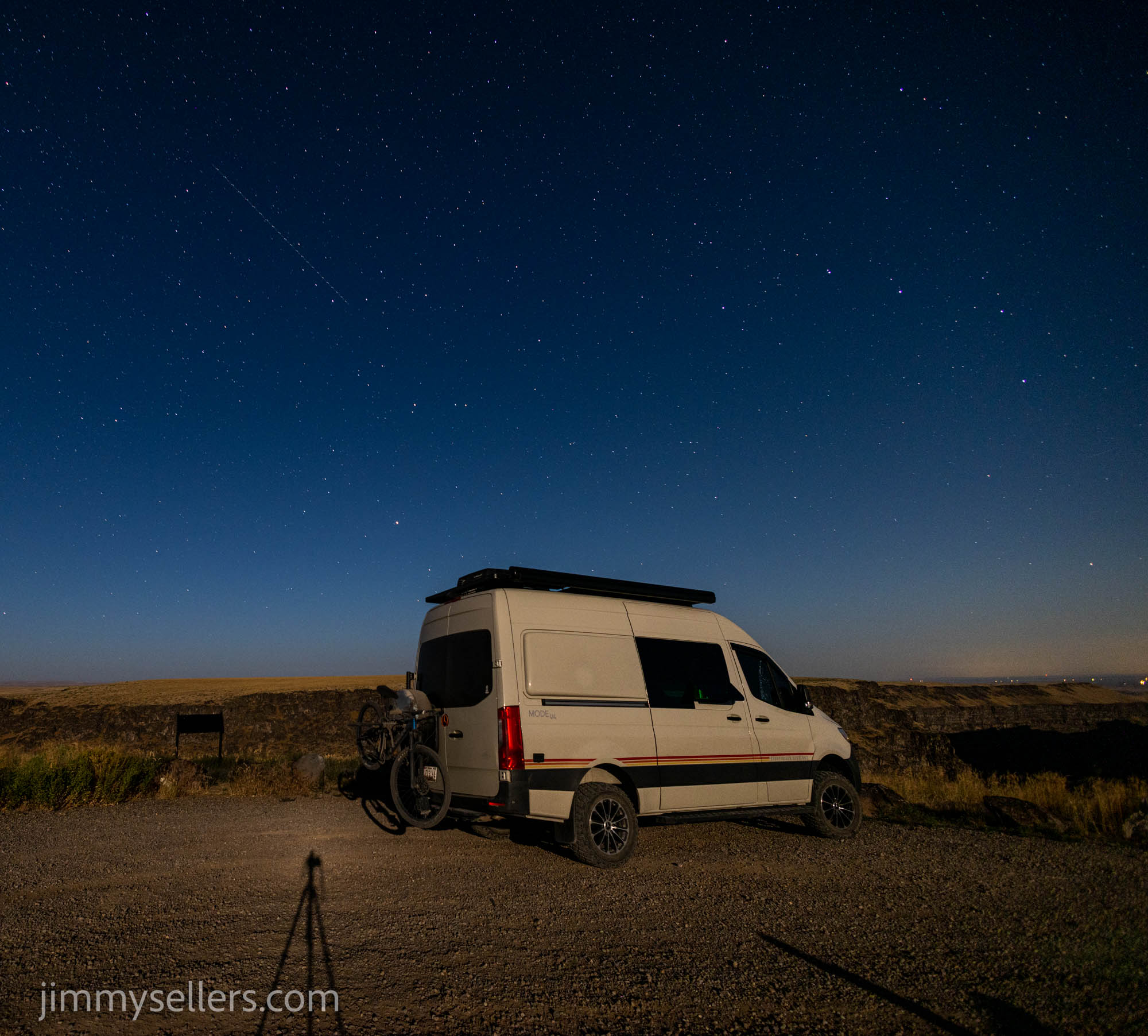
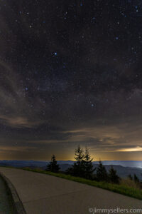
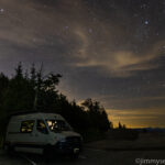
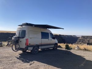
My second stop for the day was out at Bruneau Canyon. Even thought it was early in the day, I knew it was where I wanted to stay the night. 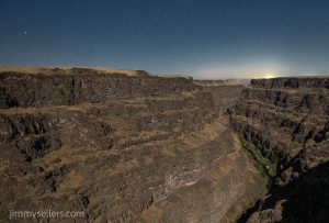 The possibility of amazing night skies were high at this location. If they skies stayed clear. I have my sights set on the Cache Across America Utah version, and I believe there is also a virtual there. I had a couple hour drive. I had hoped to get there, long before sunset, and set up camp. Everything worked out perfectly. I had hours to kill before photographing the sunset and night sky. There was telephone service, and I was shocked. I was able to use that and catch up on work. I put Pervvie into Work MODE!
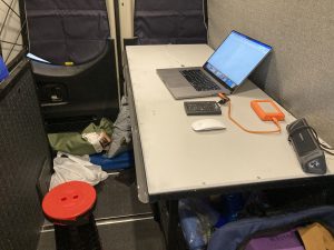
Day 28:
7700 miles and counting.
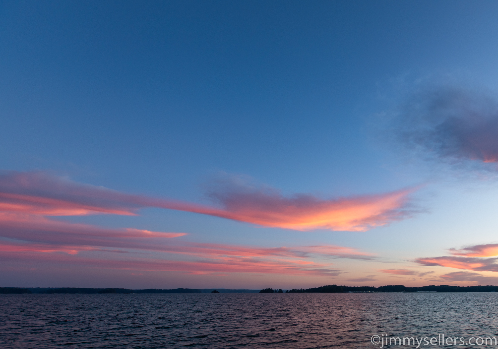
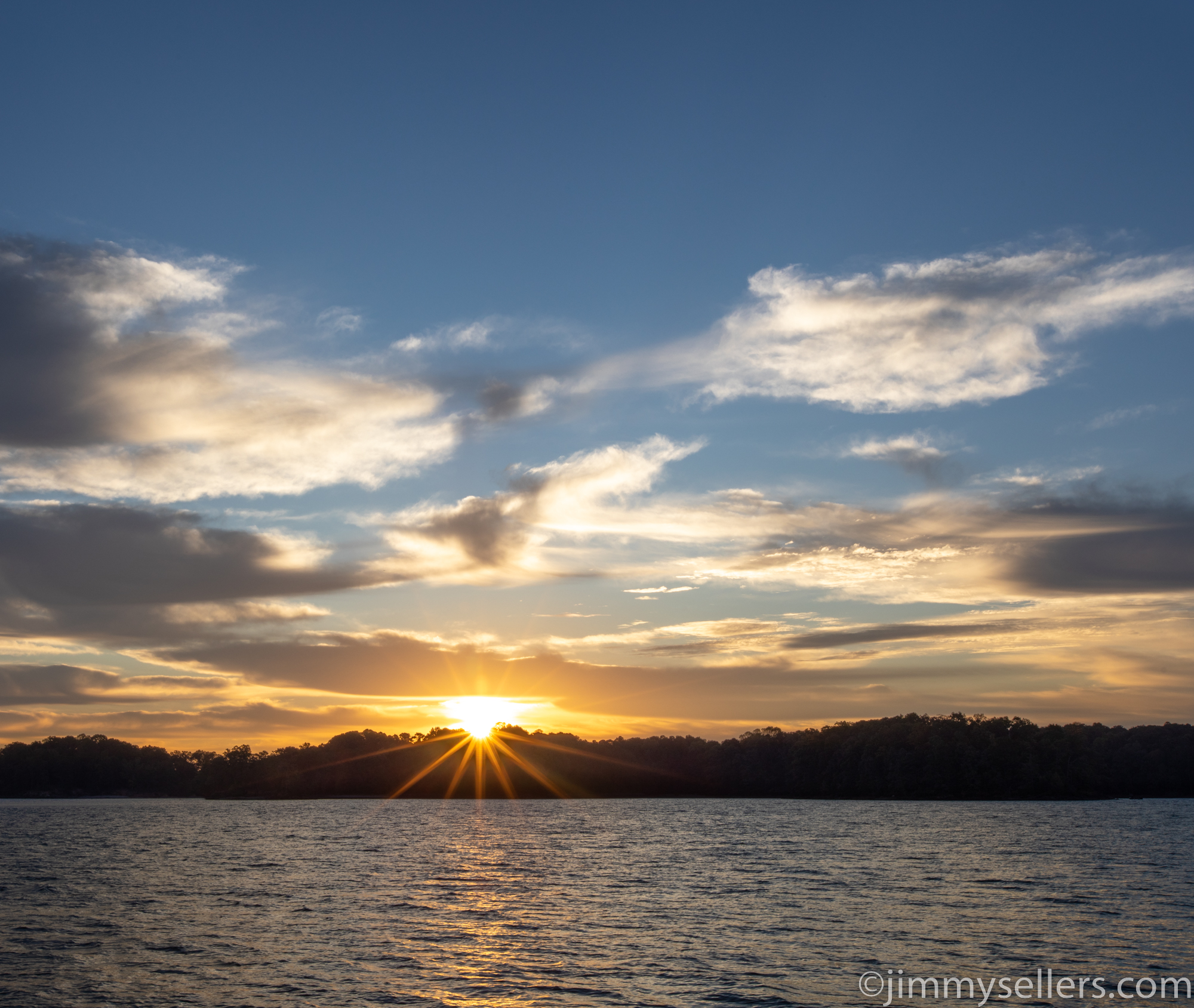
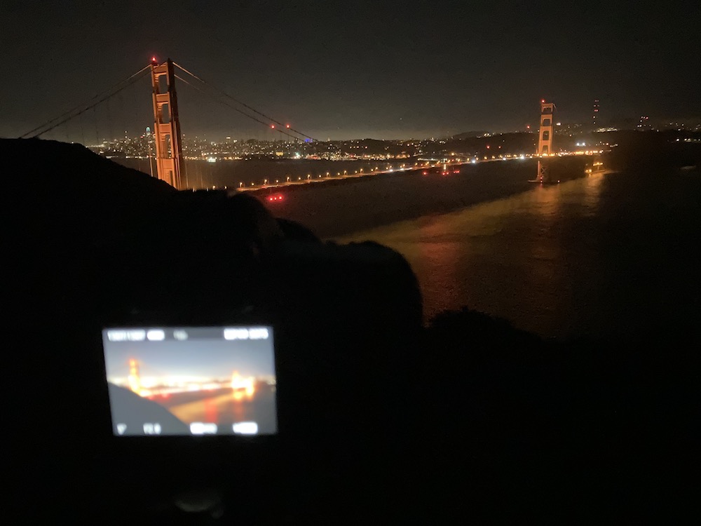
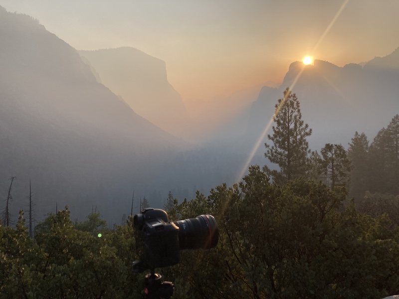
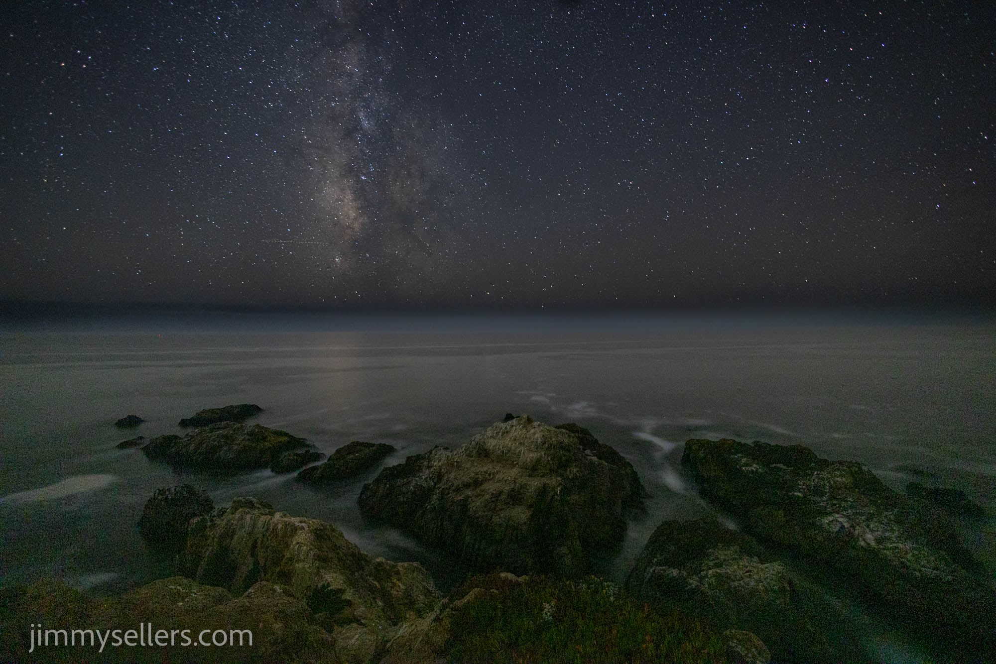
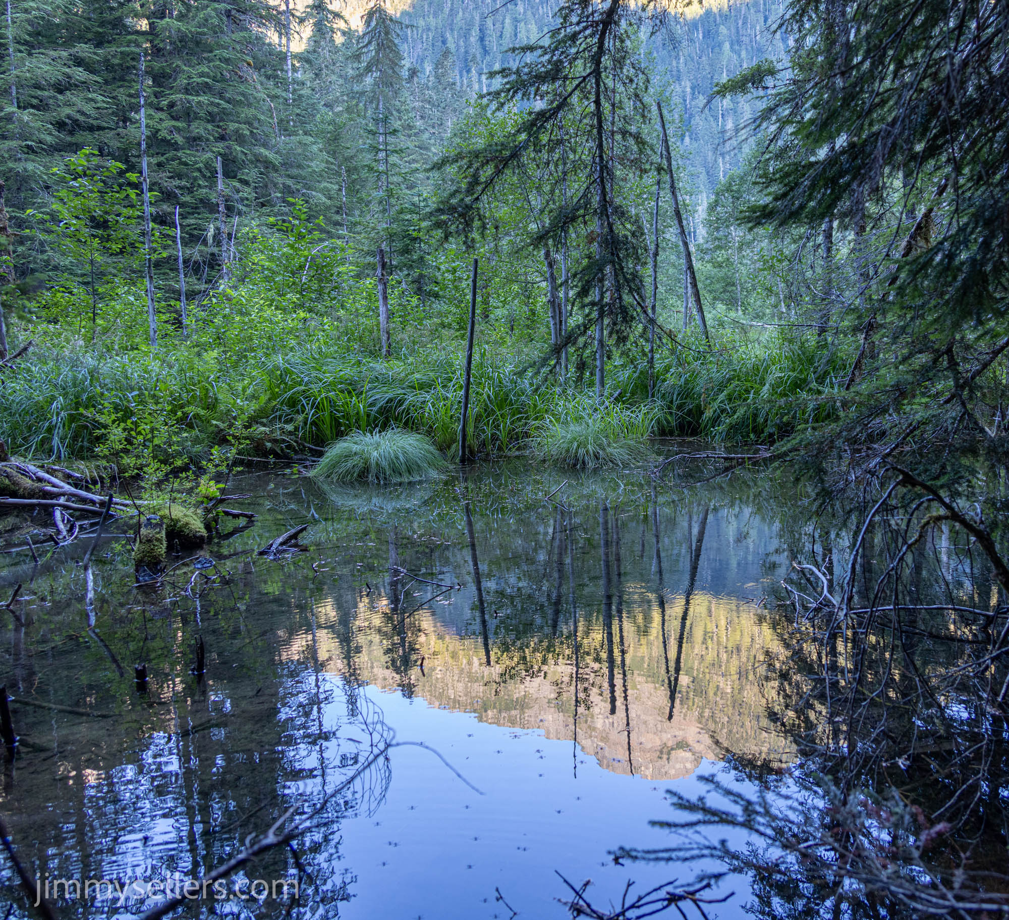
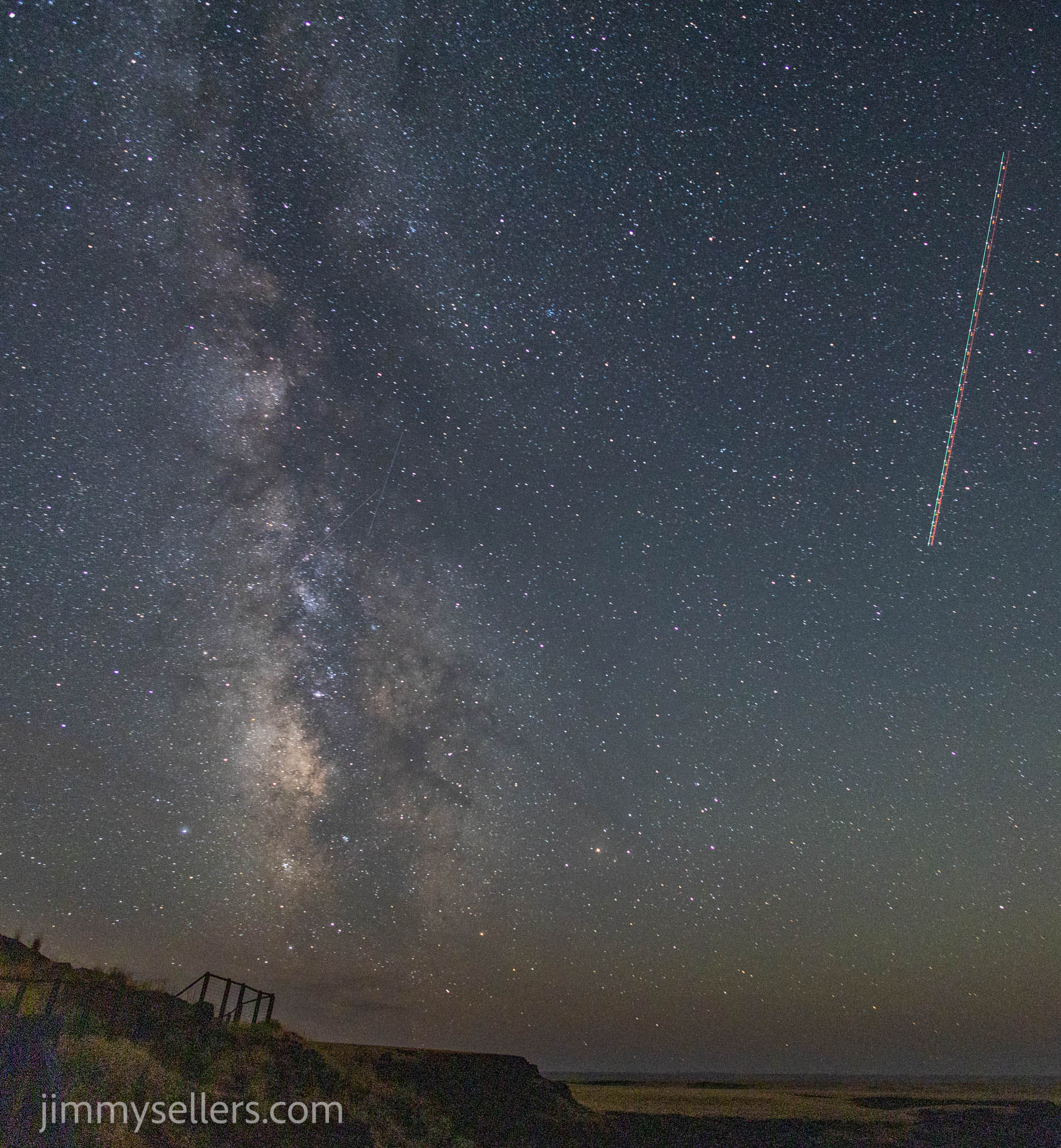
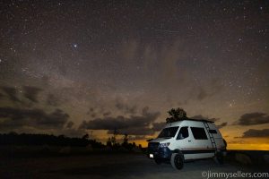
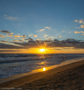
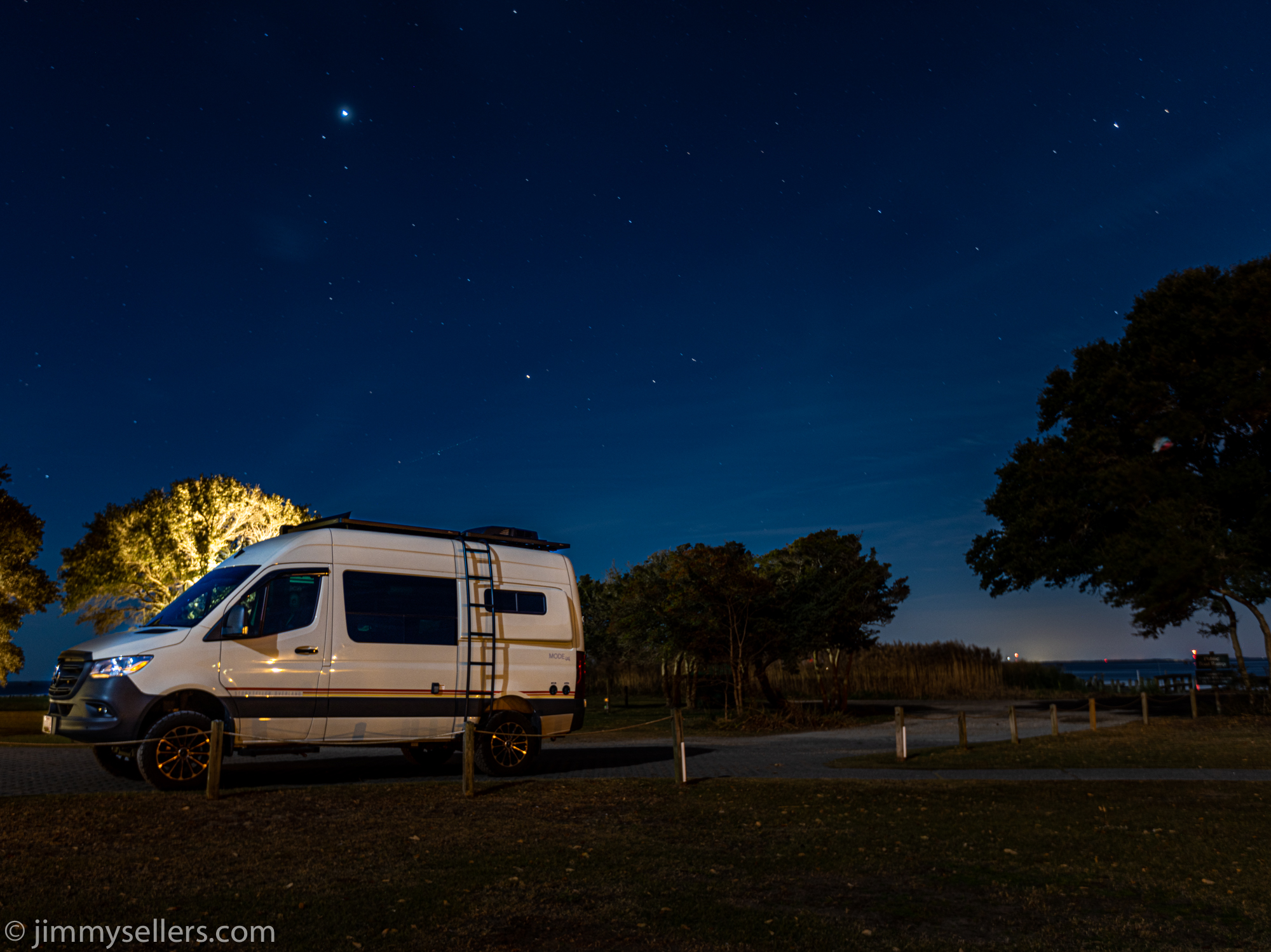
Last night I simply stayed where I landed around mid-day, at Bruneau Canyon. I had the entire place to myself from about 4PM on. I had some telephone service, so I spent a few hours catching up on real life work. I was basically just killing time waiting for the sun to scram. The skies were perfectly clear, and I was treated to a spectacular show of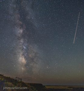 the moonlight rising and lighting up the canyon inch by inch. I got some great photographs of the Milky Way before the moon entered the show. And then some super fun shots of the canyon illuminated only by moonlight.
Now it’s time for me to head towards Boise, and then ultimately all the way north in Idaho. I have a few checklist items on my agenda, but I’m also open to getting into anything fun.
As I was driving away from the canyon on my way to Boise, I noticed a couple of power trails. Yikes, I don’t have time for that. But I noticed there was a whole bunch that were challenges. I made time for some of 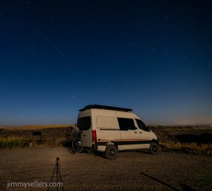 the more interesting ones that I knew I should qualify for.
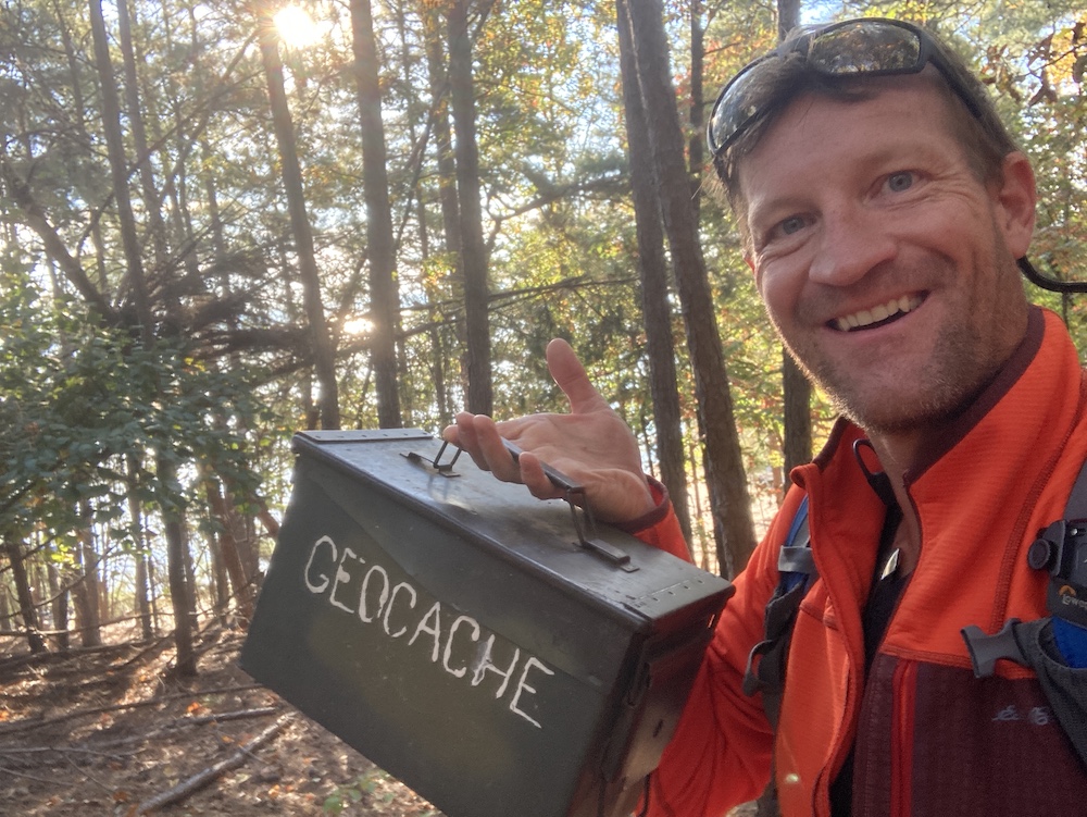
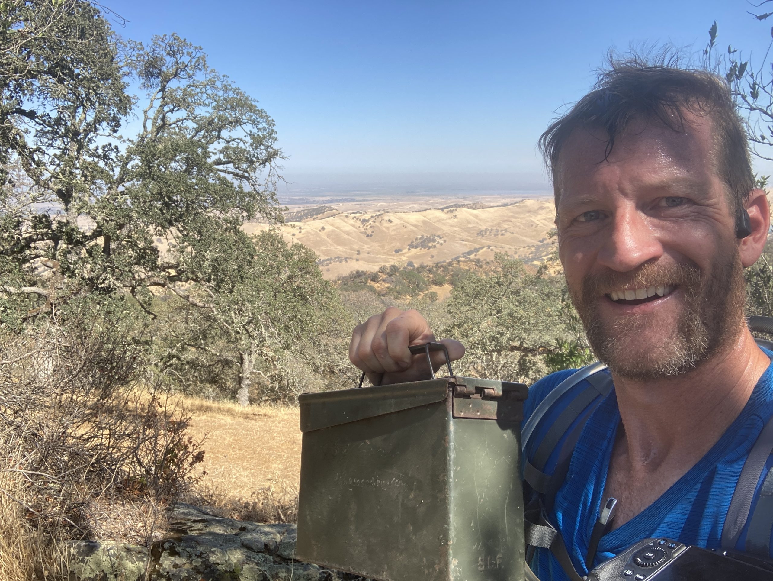
I made it into Boise to check off a few specific tasks. While I was there a few other things distracted me. I also refueled Pervvie, and restocked the refrigerator. Yes, that does include a box of Cinnabon‘s. I wasn’t there long, but I knew I had plenty of city already. It was time to start heading north and get back away from people and things. My destination was GC 26 and 27. Two very old geocaches, as evidenced by their GC codes. It would be nightfall before I got there. So, my hope is to get all the way there, and have that be what I do first thing in the morning. An absolutely gorgeous drive to start out with. Meandering, twisting back-and-forth following the river that was rushing at me. I didn’t get all the way there, so I found a nice place to park and sleep along the river, during the homestretch of my drive to GC26 and 27.
I did start an album of this trip that I am updating as I process. HERE.
 eating alone, and mostly being alone, doing everything alone. It’s been the most amazing adventure of my life and I couldn’t be more grateful for it. The last two days have been spent with some of my closest friends at a celebration of a wedding for two beautiful people. I could not be happier for them. I also could not be more thrilled to have been included in their beautiful day. They brought me somewhere I may have never come on my own,
 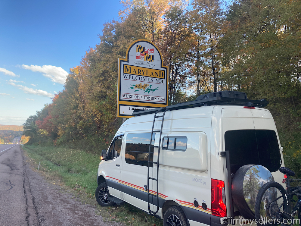 Table Rock State Park and the Pretty Place. I got on the road just before sunrise, and I believe I’m just heading to Western Maryland for the day. I should be able to get there before sunset and find somewhere to take some pictures and camp out for the night. But the day is early and my plans typically change 100 times before I get where I’m going.
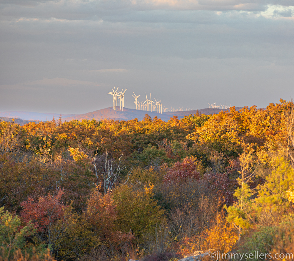 I spent most of the day speeding north, back to my home turf of Maryland. In a surprising plot twist, my wife asked me not to get home until Sunday, a full 48 hours from now. Either there’s a live-in boyfriend situation that needs to be cleaned out before I get home, or she has something to surprise me with when I get home, and wants to be there because it’s my birthday as well. Truth be told, I want her to be there when I get home too. The best way to ensure that is schedule my arrival around her busy life. I did not stop forward momentum today too much. Mainly for feeding Pervvie her
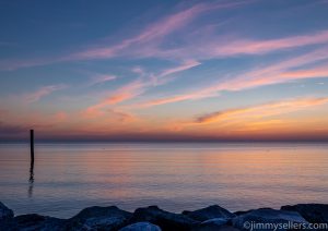
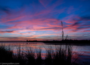
 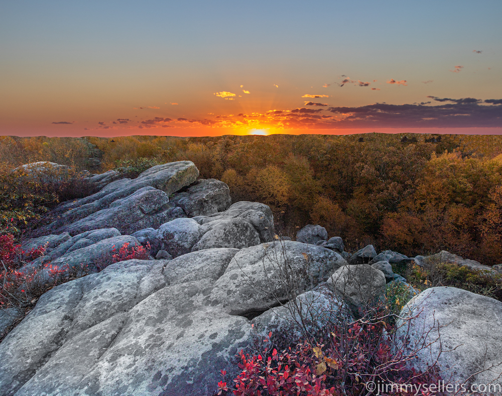 delicious liquids, and a few pictures and tinkle stops. I made it to the firetower trailhead in western Maryland that leads to High Rocks. I was a bit later than anticipated, and I had to jog most of the way up. I made it in plenty of time to see an amazing sunset, get some great pics, and find the really old geocache from 2001. This trailhead is the perfect spot to call home for the night. After a headlamp hike back down the mountain in the pitch black, I made some dinner and settled in for the night with some music and junk food. Tomorrow I will kill a
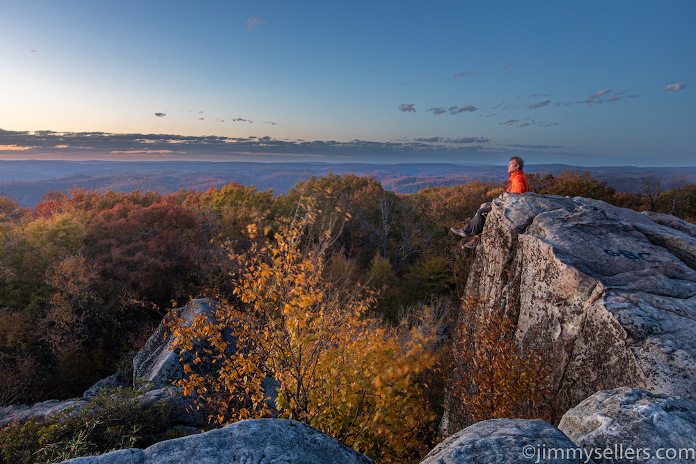 day hiking around western Maryland, and then hopefully head toward Arlington for 1 piece of unfinished business. After that, I will have successfully completed the most unrealistic, impossible, satisfying checklist of my life.
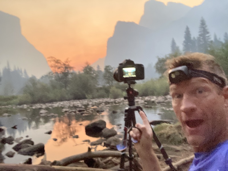
 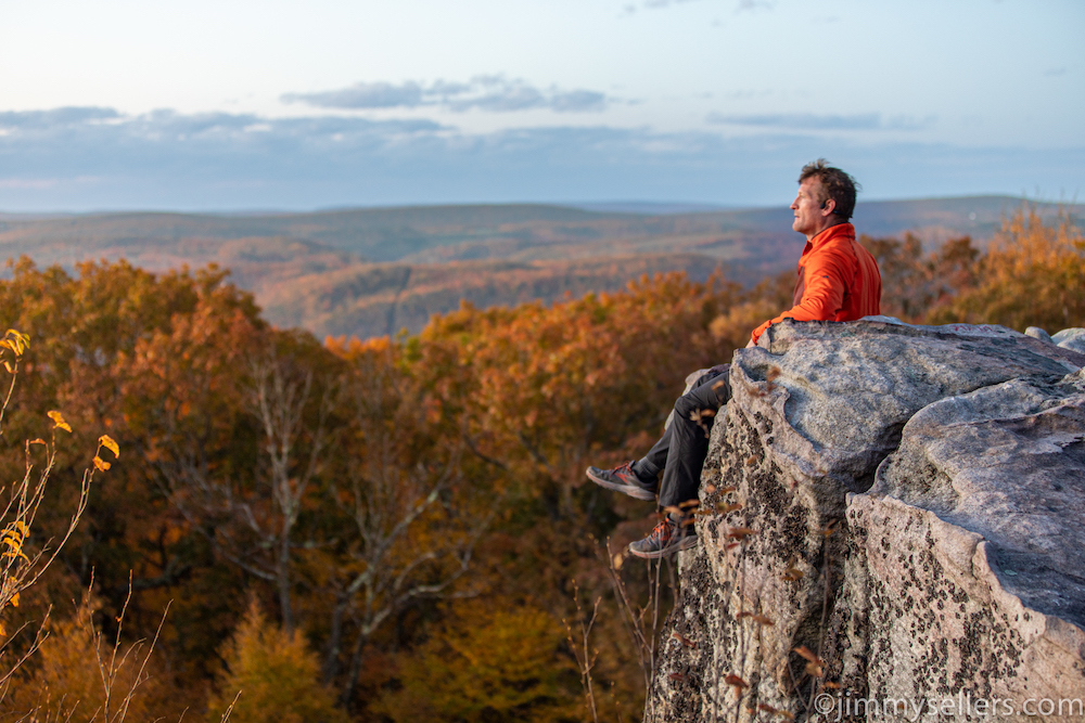 remote in the van. The van was a mile away, straight downhill. For these pics I used the built in, 10-second camera timer. I had to sprint into this position. I almost tumbled to my death each and every time. I said each and every time was the last time, but then the light kept getting better. Thankfully I did not die this time, but I will have to die sometime soon. Hopefully while failing
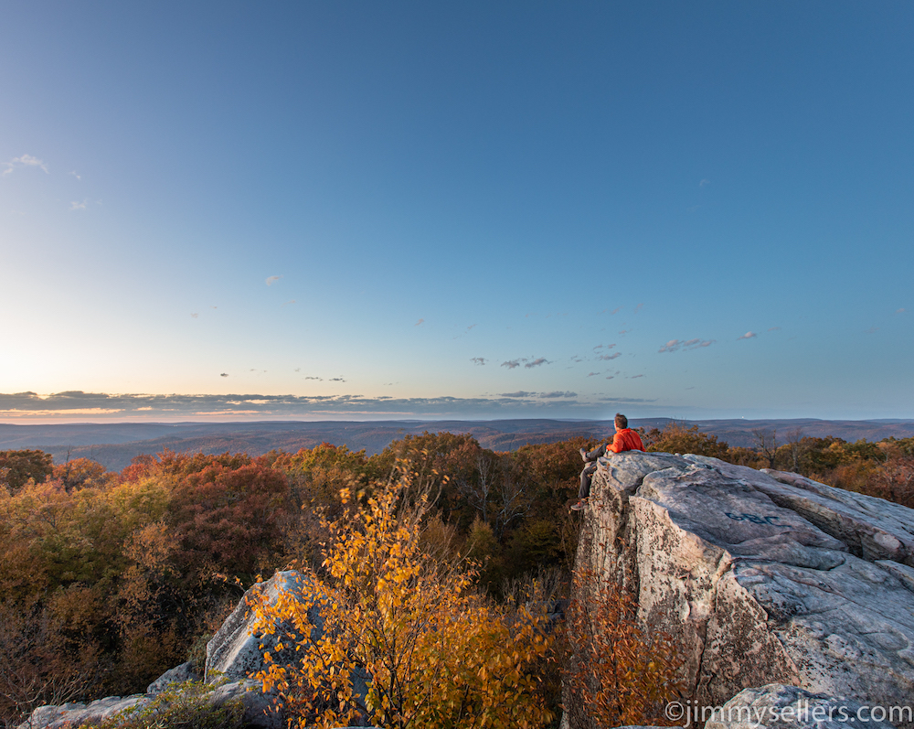 at doing something awesome like this.