90 day, 21k mile road trip culminates in this sunset
Reply
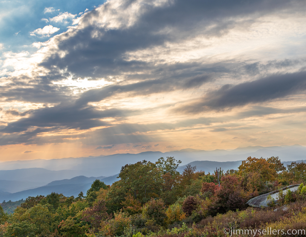
When I take these type of pictures of myself, I have always been able to say I was completely safe. My wife would see these pictures and get anxious, even though it was long since over. I have had people call me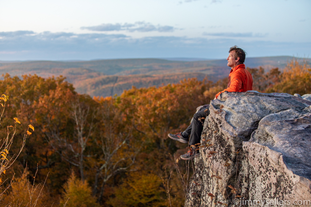 “brave”, because I was willing to make pictures like this. I was not trying to be brave, I have no friends. I WISH someone would get up in the dark and walk uphill with a headlamp alongside me. But alas, people don’t get along with me, and I am usually flying solo. I have always been able to claim safety, and play down how dumb I am, because I was acting very safe. I always use a shutter release. It is a button I can hold in my hand, and
 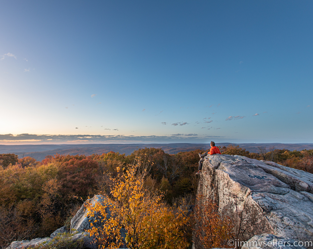 make my camera take a picture whenever I want. Possibly the most innovative piece of technology we have seen since the Supersonic Concorde. This evening I forgot my remote in the van. The van was a mile away, straight downhill. For these pics I used the built in, 10-second camera timer. I had to sprint into this position. I almost tumbled to my death each and every time. I said each and every time was the last time, but then the light kept getting better. I can not turn down the opportunity to get a better shot. Thankfully I did not die this time, but I will have to die sometime soon. Hopefully while failing at doing something awesome like this.
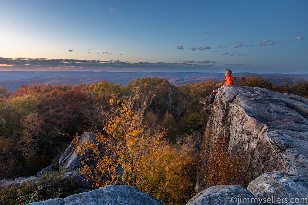
Day 87:
19,850 miles and counting
This morning I left cabin 9 at Table Rock State Park after an amazing couple of days. I’ve been on the road for over 80 days, living alone, eating alone, and mostly being alone, doing everything alone. It’s been the most amazing adventure of my life and I couldn’t be more grateful for it. The last two days have been spent with some of my closest friends at a celebration of a wedding for two beautiful people. I could not be happier for them. I also could not be more thrilled to have been included in their beautiful day. They brought me somewhere I may have never come on my own,
 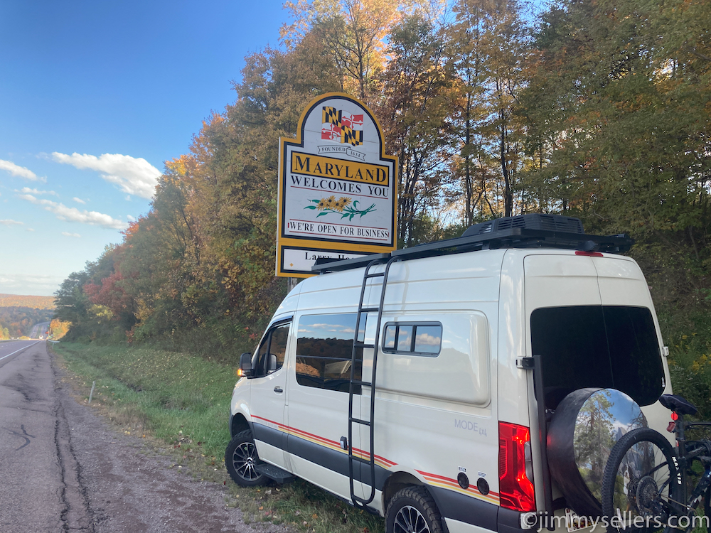 Table Rock State Park and the Pretty Place. I got on the road just before sunrise, and I believe I’m just heading to Western Maryland for the day. I should be able to get there before sunset and find somewhere to take some pictures and camp out for the night. But the day is early and my plans typically change 100 times before I get where I’m going.
I turned over the 20,000th mile of this road trip just after crossing into Virginia on I-81, heading towards home over the next couple days.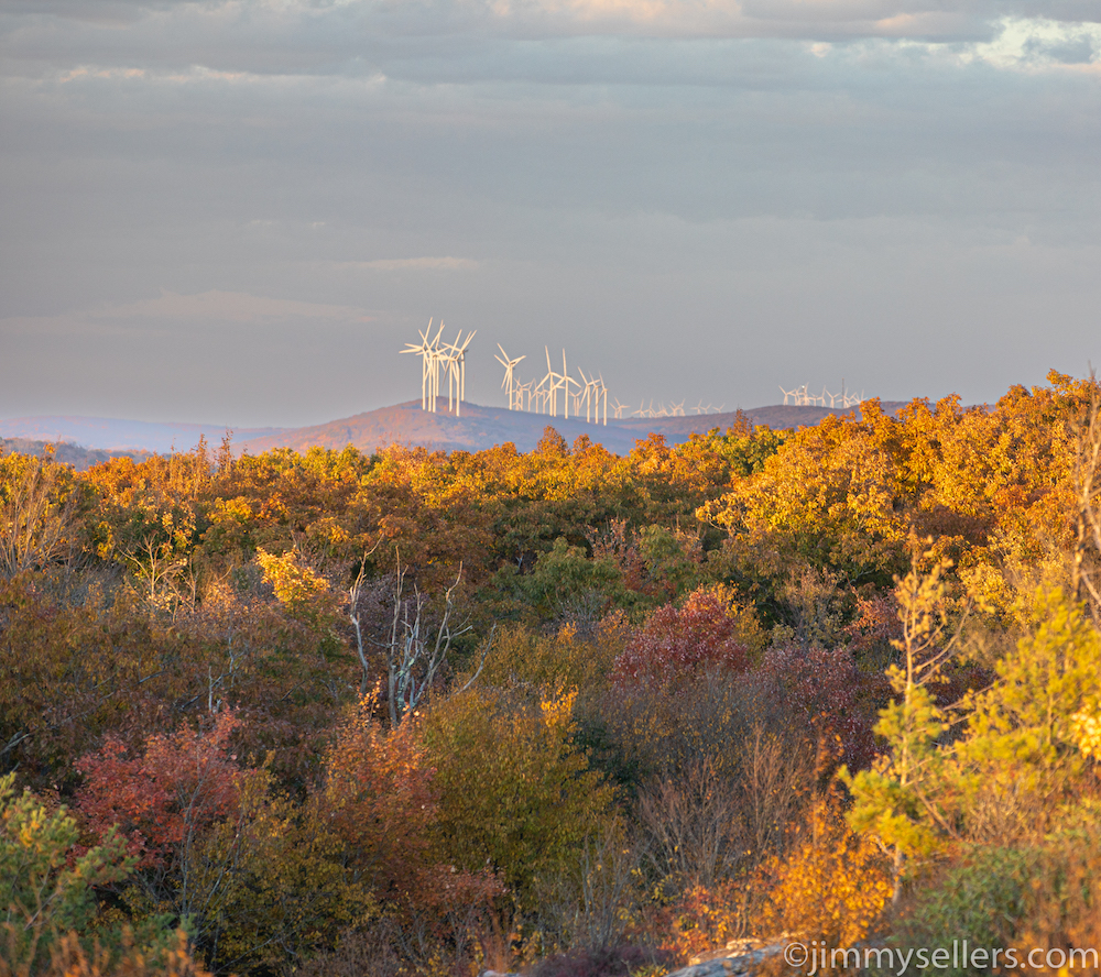 I spent most of the day speeding north, back to my home turf of Maryland. In a surprising plot twist, my wife asked me not to get home until Sunday, a full 48 hours from now. Either there’s a live-in boyfriend situation that needs to be cleaned out before I get home, or she has something to surprise me with when I get home, and wants to be there because it’s my birthday as well. Truth be told, I want her to be there when I get home too. The best way to ensure that is schedule my arrival around her busy life. I did not stop forward momentum today too much. Mainly for feeding Pervvie her
 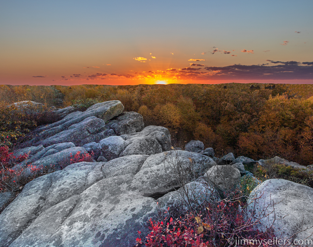 delicious liquids, and a few pictures and tinkle stops. I made it to the firetower trailhead in western Maryland that leads to High Rocks. I was a bit later than anticipated, and I had to jog most of the way up. I made it in plenty of time to see an amazing sunset, get some great pics, and find the really old geocache from 2001. This trailhead is the perfect spot to call home for the night. After a headlamp hike back down the mountain in the pitch black, I made some dinner and settled in for the night with some music and junk food. Tomorrow I will kill a day hiking around western Maryland, and then hopefully head toward Arlington for 1 piece of unfinished business. After that, I will have successfully completed the most unrealistic, impossible, satisfying checklist of my life.
When I take these type of pictures of myself, I have always been able to say I was completely safe. I always use a shutter release. I forgot my remote in the van. The van was a mile away, straight downhill. For these pics I used the built in, 10-second camera timer. I had to sprint into this position. I almost tumbled to my death each and every time. I said each and every time was the last time, but then the light kept getting better. Thankfully I did not die this time, but I will have to die sometime soon. Hopefully while failing at doing something awesome like this.
And you can drive right to it.
Day 84:
19,500 miles and counting.
I woke up at the Holiday Inn Express in Logan, WV. Shortly after waking up I was called to perform an emergency surgery. Thanks, HIE!
I rented a UTV from Bobby yesterday. After that I spent the day at the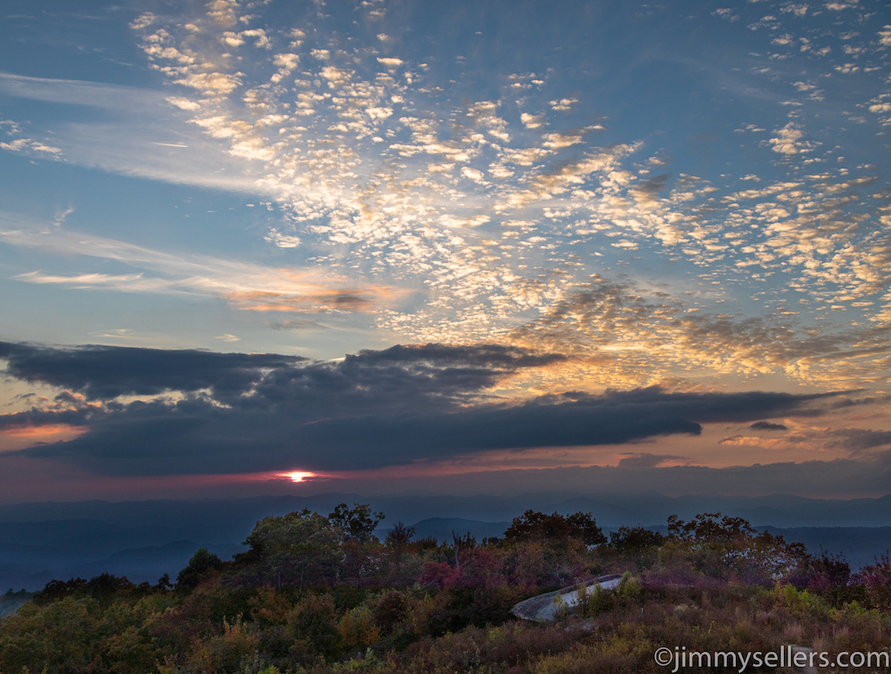 hotel catching up on real life stuff. I also spent most of this morning chipping away with that kind of nonsense. Today I will leave and head back south to South Carolina, for a wedding in Table Rock park.
I left the Holiday Inn express with a couple of quick detours. I had about a 5 hour drive to get back to table rock State Park in South Carolina. I should have plenty of daylight, even factoring in all the needless and random stops I will probably make.
 There’s a possibility that I may see some of my closest friends tonight, for the first time in over 3 months. I’m going back to South Carolina for a wedding on Thursday, and a bunch of my friends from home in Maryland are traveling to it as well. I am excited for this time, to see some friends and people I love for the first time in months. And to see them in such an amazing place like the mountains of South Carolina! That’s just a bonus.
I spent the day getting to South Carolina’s highest point, Sassafras Mountain, as fast as I could, hopefully before sunset. I had hoped to meet some friends there, but they did not make it here until very late. I made it in plenty of time and watched an amazing sunset with a bunch of fun strangers, now new friends. I got to talking to a local retired couple. Turns out they lived in the town I grew up in for a long time. What a small world this actually is. Either that or nothing is actually real. After the sun was gone, and the conversation dwindled, it was time to retire to my van. I made that my home for the night in hopes of catching the sunrise in the morning. Sadly it rained all night, overnight, and into the morning. There was no sunrise to speak of.
I have added a lot lately to the photo album HERE.
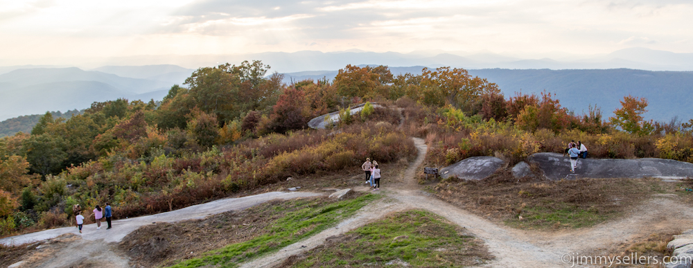
I love when I run into pro photographers in the wild. I take pride capturing as many groups in a single photo as possible. This is 3 groups in 1 shot, my record is 4 wedding parties in 1 photo in Glacier.
Day 83:
Today I met Bobby from BAC Rentals in WV, hands down the coolest geocaching ally I have met this trip. I have met a lot of our allies during 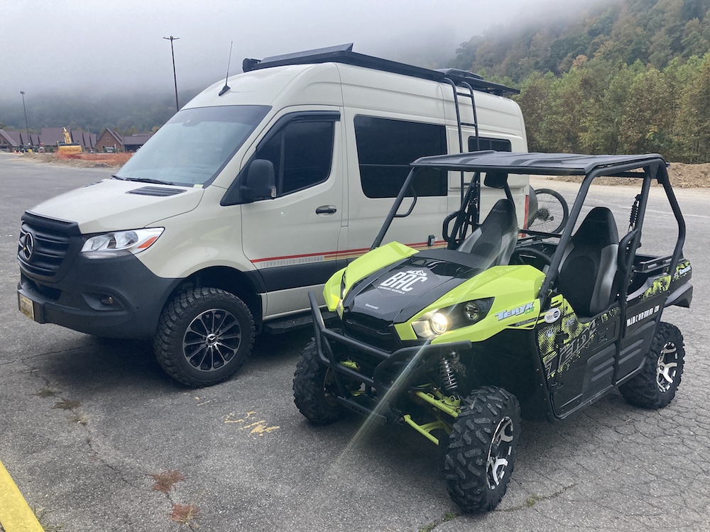 this trip. There are people all over willing to help me out with my stupid hobby, and obsession to complete nonsensical tasks.
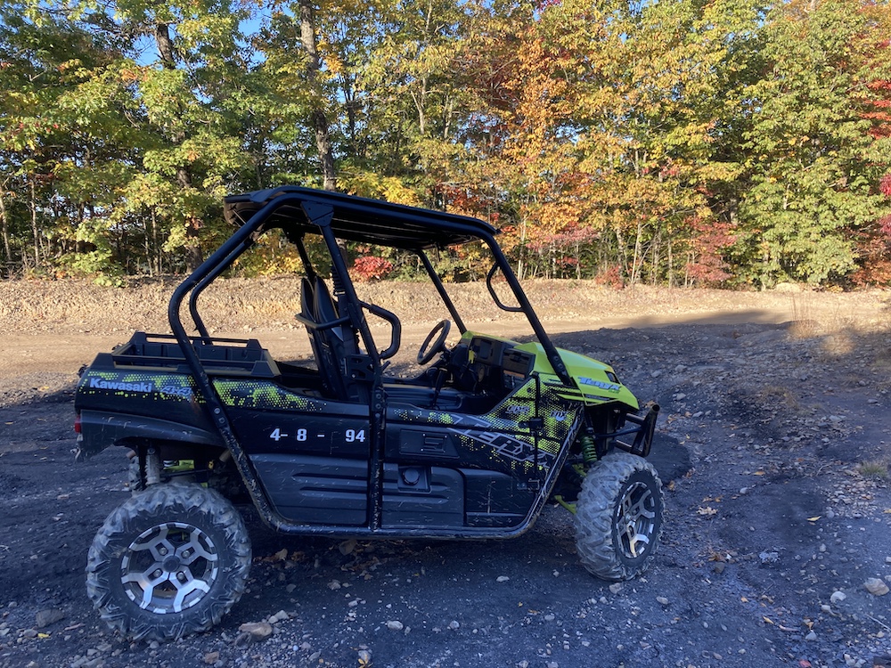
I woke up this morning already at the place I wanted to be. That place was meeting Bobby with BAC UTV rentals in WV. I was renting a UTV for the day, and part of the plan was to find WV’s oldest geocache. That was a very small part of an amazing day driving like an idiot. 80 miles, 5 hours, 3 geocaches, and only 1 close call/near death. The time flew by! Another thing I did during this road trip that I had the entire place to myself. I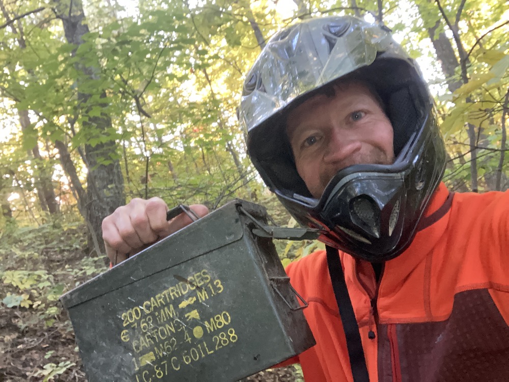 only saw about 10 other people all day using the Hatfield & McCoy trails. I was on a UTV just a few weeks ago near Phoenix. That is how fast I forgot how much fun they are. I had a blast today. The terrain was very mild compared to Arizona, but still so exciting! All day I was driving these trails, I felt like the fat guy from Lost, 21-10-33-31-45-42-26-14-18. When I was in my 20’s a bunch of my gearhead, knucklehead friends bought ATVs
 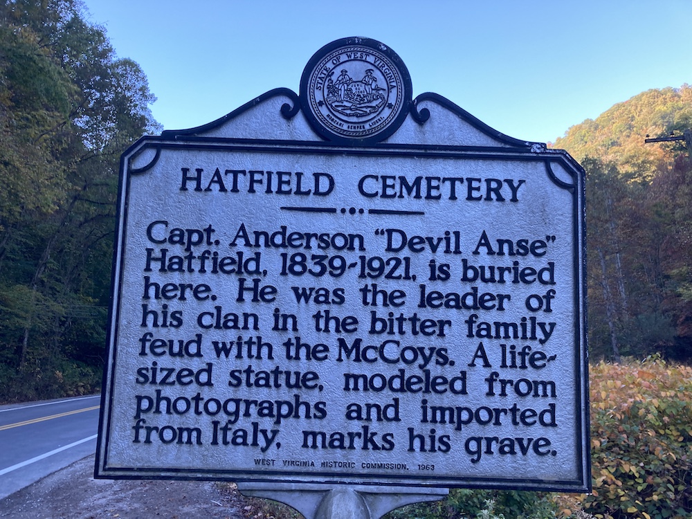 and came down here all the time. Somehow, I did not fall in line with them that time. I grew up with dirt bikes and guns, so they were not a novelty to me. Bobby said it might take me about 2 hours to get to my first stop. I was there in just over an hour. I drove like a maniac, because that is the fun way to drive off road. I spoke to Bobby later, and told him what I did. He said the next fastest anyone
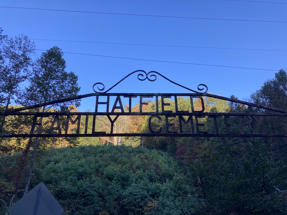 has done what I did, is 10 hours. That is twice as long. I told Bobby I am fast, I always have been fast, I used to race big wheels. I think Bobby and I are going to be pals for a long time. I hope to come visit him again soon.
After an amazing day playing, on the 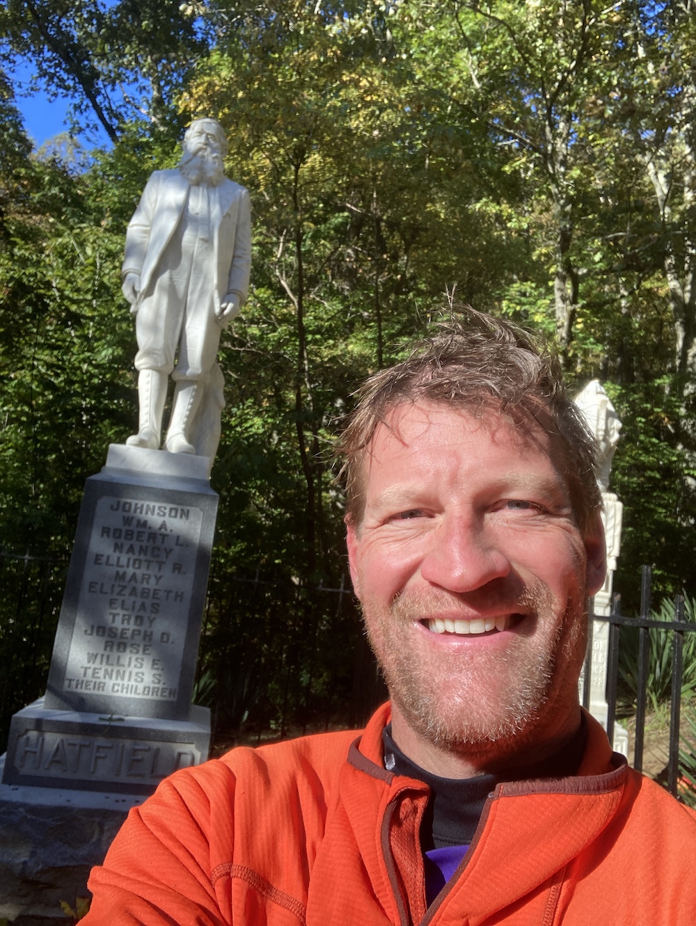 edge of death, I had a hotel nearby to catch up on some real life, and I had to do a zooming meeting this evening. A shower, internets, and proper lighting are required. Tomorrow I will head back south a few hours for a wedding in SC in a couple days.
I regularly update the photo album HERE.
Day 74:
17,170 miles and counting.
 Today I met Hippie, hands-down the coolest dog of my trip.
I slept at a Loves truckstop off interstate 20 somewhere heading east out of Texas into Louisiana. I slept for a long time, got up and then did a bunch of “house” things. Did a few minor repairs and some cleanup. Nothing was calling me and I’m on no time schedule or pressures, so I took this opportunity to tie up some loose ends.
I made my way through Shreveport with a few stops for some old and fun geocaches. I also spent some time catching up on some phone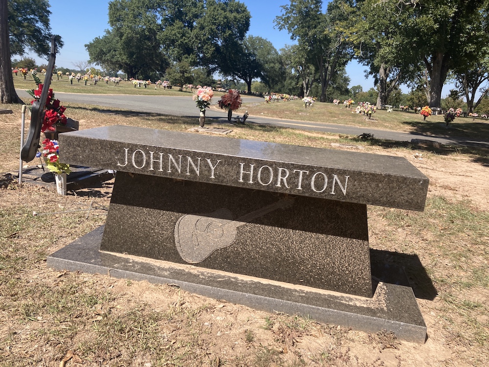 calls. I had hoped that I was going to be heading to Fort Myers Florida to visit my favorite person in the world. But it turns out they just had a storm go through there, pretty bad unfortunately, and she is not there. That’s a bit of a bummer for me. Selfish, I know. I mostly meandered aimlessly east. Contemplating whether I wanted to go to New Orleans proper. I have been there, but only as a drunken teen. Not sure if that’s a place that holds anything interesting for me or not. I guess I’ll decide.
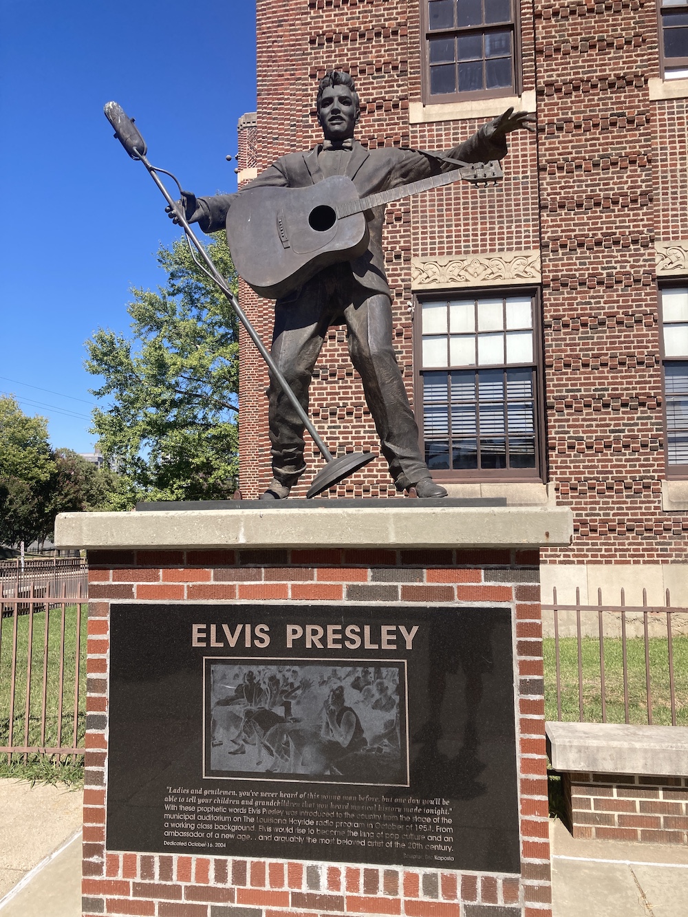
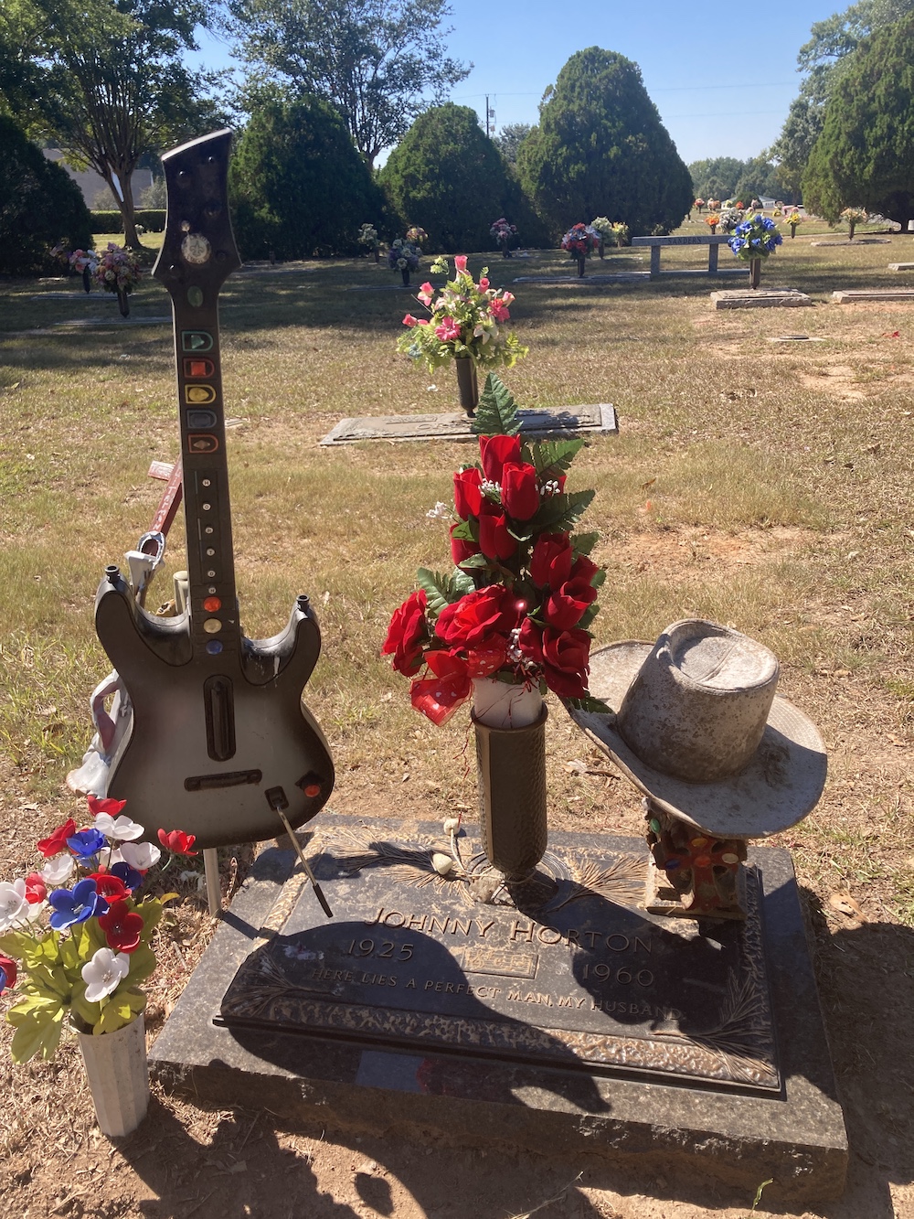 I did a Music related virtual geocache in Lousiana, and I had no idea what I was in store for. I assume that I visited a grave/memorial, I would at least recognize the name. For some reason I thought it might have something to do with Elvis or one of the people of that era, and because of this area. Turns out it was the gravesite of Johnny Horton, one of my pop’s favorite musicians. That caught me completely off guard, to the point where I actually sat down for a few minutes and squirted out a few tears. But that didn’t last long, because I got things to do, shut those emotions back off. Unfortunately, that project sent me 10 miles back to where I just came from, but dems da brakes.
From there I decided to see exactly how high Louisiana’s highest point is. Looks to be about 4 or 5 feet above sea level? I think the elevation gain was in the double digits.
After the almost impossible trek to 500-and-some-odd feet of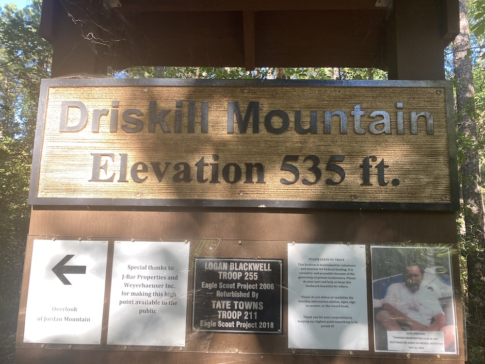 elevation, I had to start heading south. I needed to get to the wild azalea trail where Louisiana’s oldest geocache is located. I made a few stops along the way at different places for fun things or travel necessities.
I made it safely to an alternate parking spot for the azalea trail. I jogged out and back to make that find of Louisiana’s oldest geocache. I then decided to make that parking spot my home for the night. It was as quiet and dark of a spot as I have ever picked. Lucky me.
Day 75:
Today I met Maggie, hands-down the coolest dog of my life, she is probably going to change someones life forever.
I woke at the trailhead for the wild azalea trail, Louisiana’s oldest 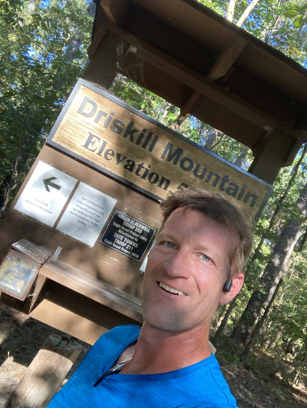 geocache. I found the oldest just at sunset, then decided to spend the night there. I got a great night’s sleep. It was dark, and I was not disturbed once by anything or anyone. Very peaceful and quiet back there, no sign of life for 12 hours.
My goal was to continue heading south and east, Baton Rouge and then New Orleans. I had a nice drive, it is a Sunday, so there was no one anywhere. I was all around LSU, I rode a bike around Baton Rouge, and I saw a wonderful group filming a music video. That last thing really got me excited. I also found another old geocache from 2001 in a horsie related park. All the streets were named after horse stuff, palomino, paint, applesauce, etc… I did a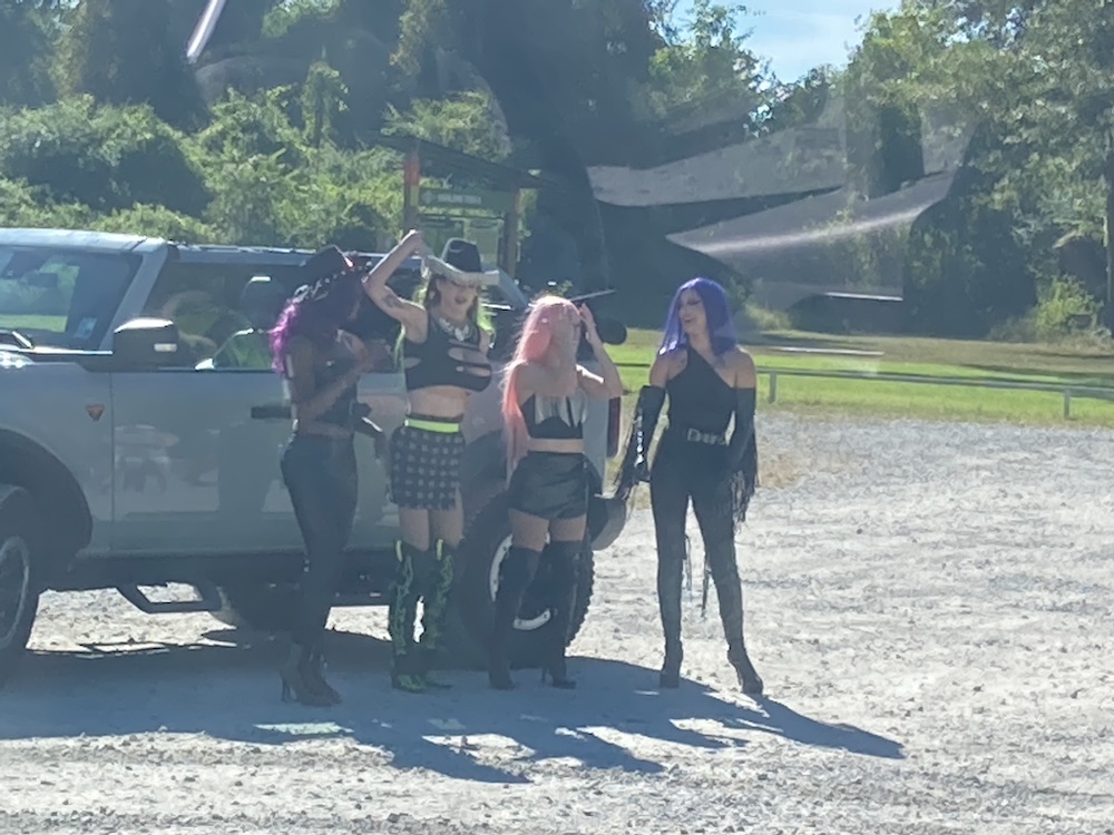 really fun where I go while riding my bike. The description said bike trail and I thought to myself, I have not ridden my bike in quite a few days. Sounds like a great idea. I mean I have been lugging it around for 18k miles. It doesn’t just make my van’s ass look great.
Finally, I made it to the town of Mandeville. I found something nice to eat for take away. I found a nice spot to park my house, ate, cleaned myself up, and got ready to settle in for the night. Before that, and after dinner I did a nice big walking loop to settle supper. A very slow day for me, at least in comparison. I didn’t go far. I didn’t get much done. Oh well. I found out today that I probably won’t be able to go to Florida next like I had planned. I had no idea they had such terrible storms until this morning. Oh bother, mother nature.