Day 48:
Today I met Roald, hands-down the coolest dog of my trip.
11,850 miles in counting.
I woke up at the Golden Gate Bridge rest area this morning. That’s two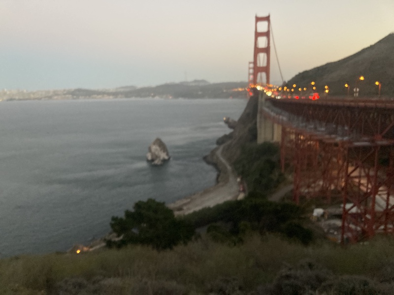 mornings in a row I woke up at the Golden Gate Bridge, nothing to complain about, I guess. Yesterday was such a fun and successful day, and completely unexpected for the things that I have planned, that I slept better, as long as my body would allow me. I woke up to the sun high in the sky, got cleaned up and got moving. The only thing certain is I have a campground reservation in Yosemite starting today, through the next few days until my van repairs on Thursday.
 I toil with what to do and where to go and what route to take to get to Yosemite. Like every other day of this trip, I have changed my mind 100 times in 20 minutes. Originally, I wanted to go back and visit Jeremiahs Gold again. That final is going to haunt me forever, unless I find it. But I think I decided to head out towards Bodie and then work my way into Yosemite from the other side.
I drove East all day. The most beautiful area being Lake Tahoe, obviously. The weather was perfect, and the skies cooperated for me to get some of the most amazing views from above, down onto the lake.
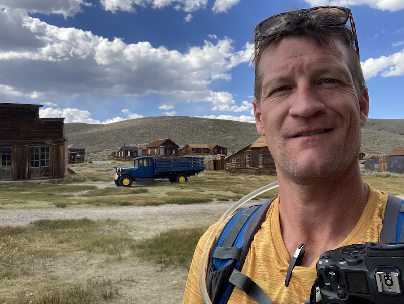
My first real stop of the day was Bodie California. Bodie is an abandoned mining town, that CA maintains as a park. I made it out there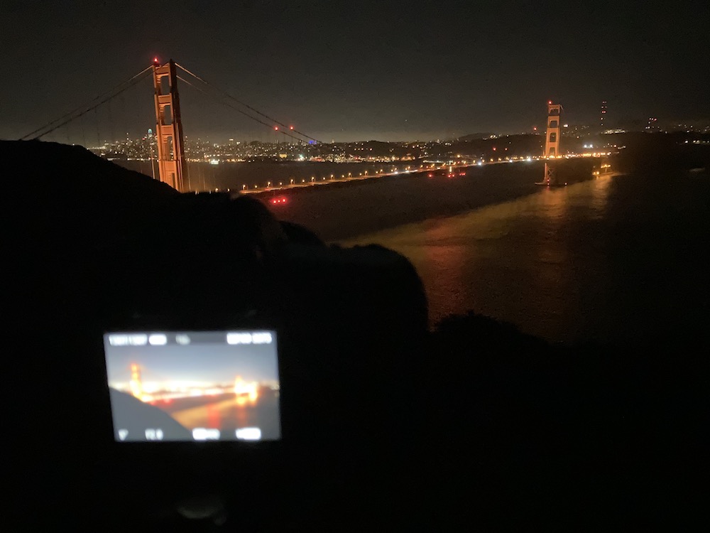 about mid-day. I spent a couple hours wandering around, taking pictures, being unbelievably fascinated about this time period. This kind of stuff has always fascinated me. I know I say if I had one I wish, I’d lived back then, I’m wrong. But I wish I could travel back in time for a vacation. you know, kind of like a dude ranch? West World style. If anyone has connections with robots and AI, get in touch.
Since I was driving right past, I had to make a stop at Mono Lake on the way from Bodie to Yosemite. I first heard a mono lake in 2013, the first time I visited Yosemite. But I’ve never been here. Glad I made a 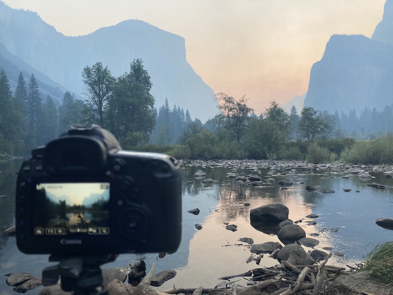 little pitstop, it was the perfect time of day. The sun was behind everything and casting that beautiful “sun is setting” light.
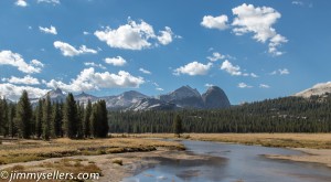
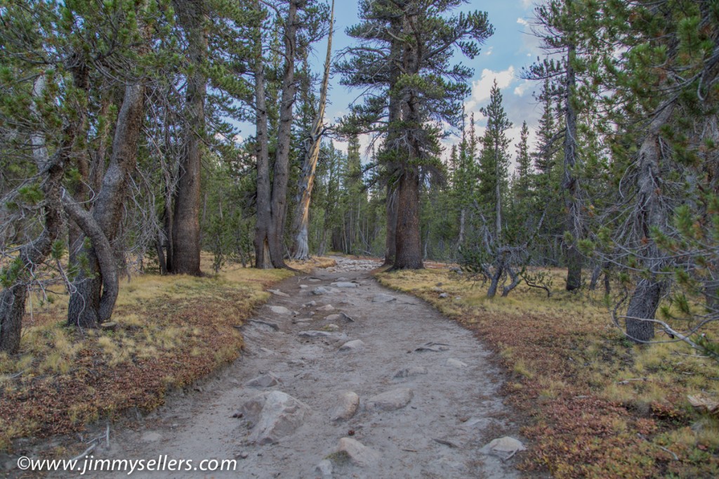
Now into Yosemite where I will make my home for the next few days. I’m killing time, and giving my van a rest, before hopeful repairs on Thursday in Sacramento. I guess I just called 3 days in Yosemite “killing time”. More examples I’m the luckiest person alive. I’ve never driven over Tioga Pass before, I don’t believe. I’ve been to Yosemite a few times, but don’t think I ever left the park on the eastern side. That’s one of the more unbelievable passes I’ve ever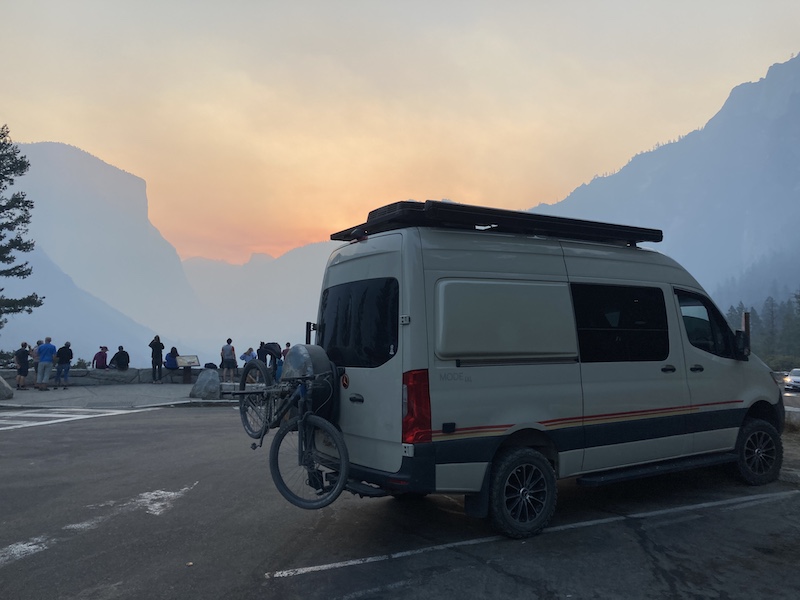 passed through. I pulled over so many times to look and take pictures I lost count.
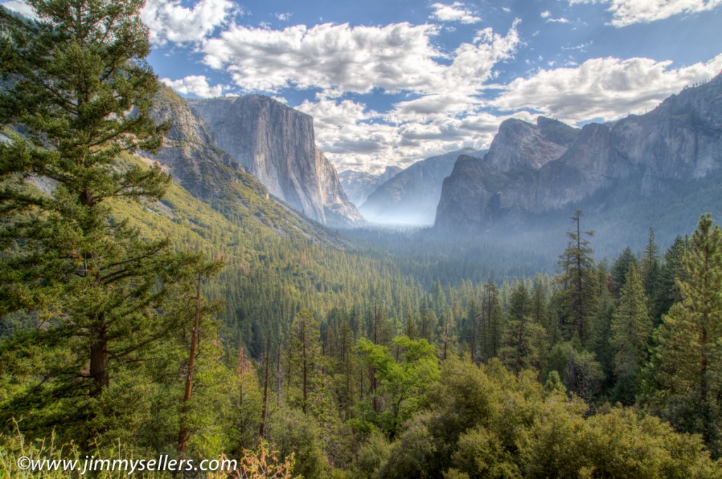
I love Yosemite so much. I saw a big brown bear wandering around shortly after I entered the park. Also, it’s the only place where I can enter the gates and think to myself
“Yay I’m in Yosemite!” And then I still have a 2 Hour drive to get to where I’m going in the valley.
What a great place.
Day 49:
Today I met Pierre or PeePee as he is affectionately known, hands-down the coolest dog of my trip.
12,270 and counting.
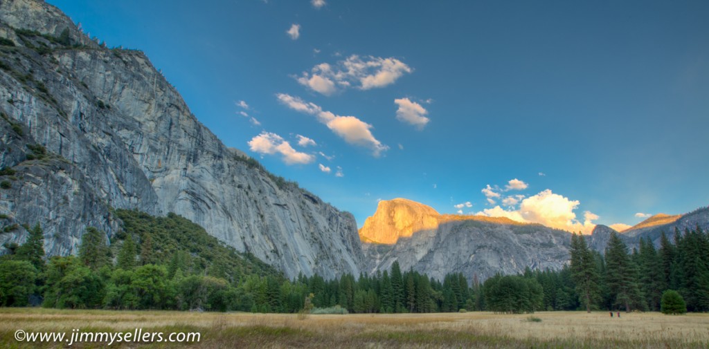
I woke up in a Yosemite valley campsite this morning. There won’t be a lot of miles today, because I’m in Yosemite and may not even move my 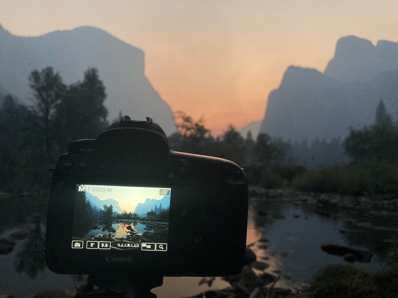 little girl. I got up at about five and drove out to Valley View for sunrise pictures. It was a bit hazy, understandably. But beautiful for all the right reasons. Then up to Tunnel View. I watched the sun come up over the mountain and took some pictures. What an unbelievable life I have. I made conversation with lots of other traveling strangers. It was an amazing way to start my day. Then back to camp where I made myself a wonderful bacon and eggs and fruit breakfast. I think that’s the first time I’ve actually “cooked” a meal in my van. I’ve made a lot of boil in bags, sandwiches, dry foods. But I broke out the cooktop and whipped up some e
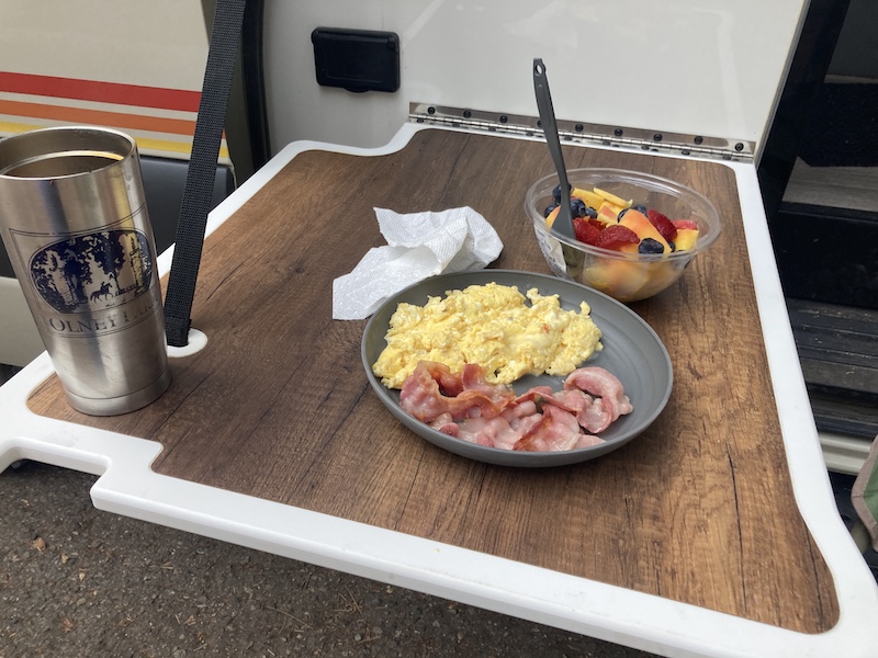 ggs and bacon.
My possible plan for today is to at least make a big walking loop around the valley. I can’t believe there’s still so many geocaches I haven’t found in Yosemite? I’ve been here twice before, both times since I started Geocaching. But there are just a whole lot of unfound geocaches. Lots of them found, but way more than should be unfound.
The way I had to get campsites in here is strange, but I’m just grateful to have them at all. I was in one spot for one night and then the next morning I had to move a quarter-mile to another site for the next two nights.
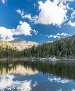
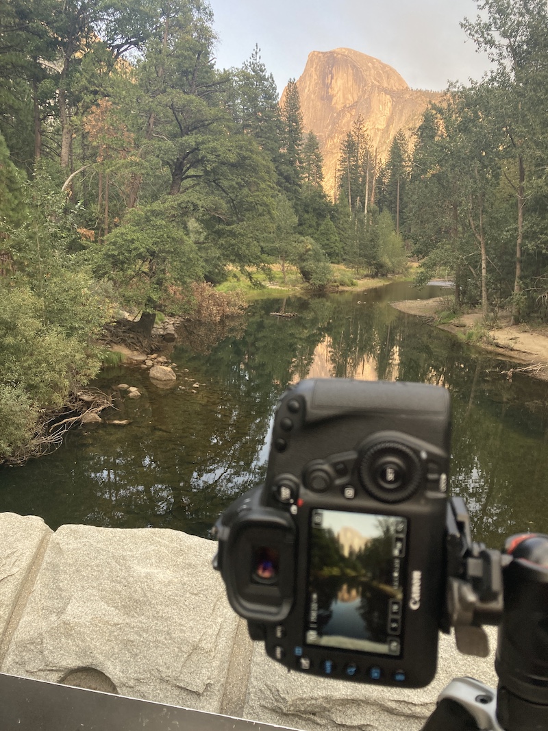
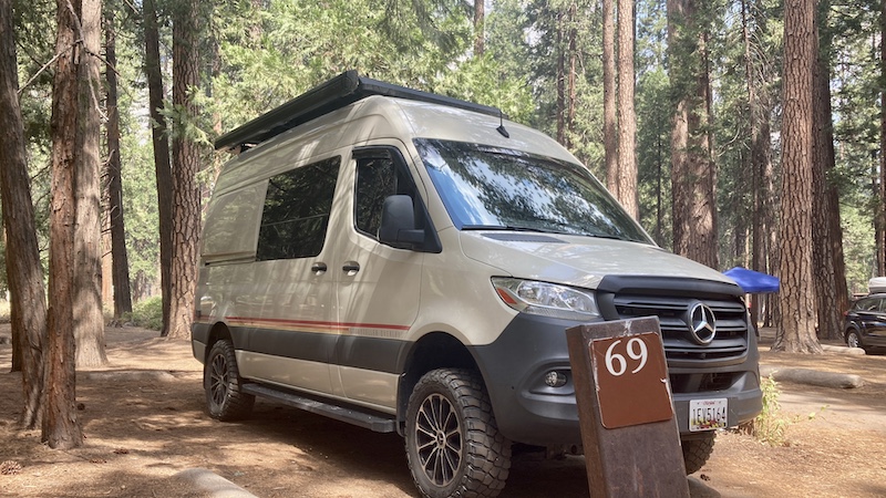
I did about an 8-mile walking loop around the valley. I got back in the perfect time to move my van from one site to the other. I still cannot believe there are so many geocaches that I had not found in two prior visits here. I walked a big loop. It was about 8 miles, a couple virtuals, whereIgo, very unique question mark in the middle of a national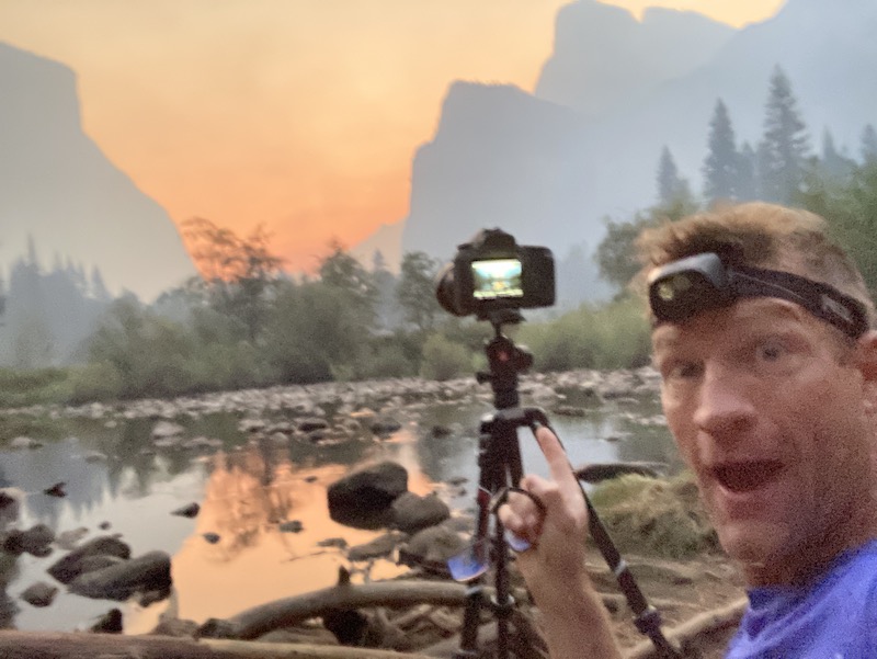 park, and earth caches of course. I had to move my mobile home from one campsite over to campsite number 69 in upper Pines. Hee hee.
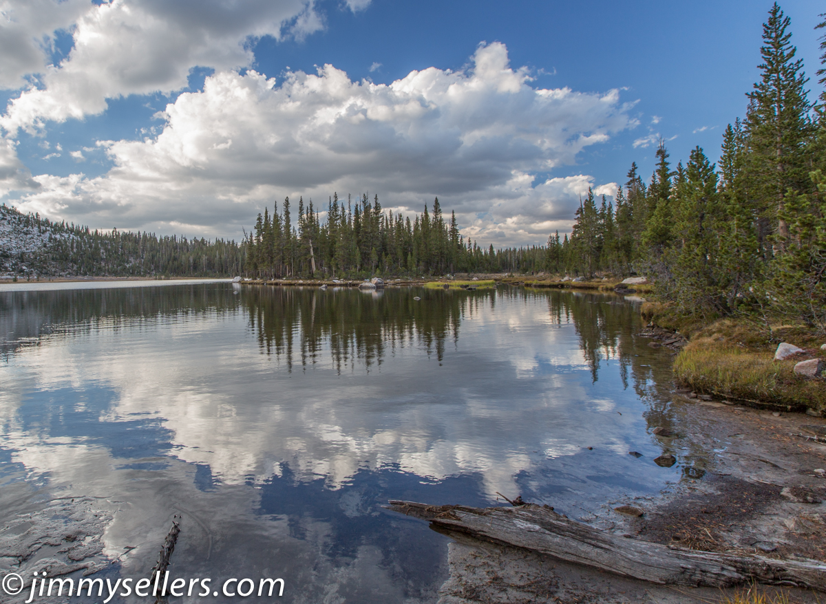
I slung up my hammock and rested for a while, just taking in the sky. At the time of day when the sun was highest in the sky, a sunshower came through. Bright blue in one direction, and terrifying gray in the other. The drops were as big as quarters, they felt great in the blazing sun, and that smell of the ozone in a thunderstorm in the trees is delightful.
 I finished the night with pictures on the famous bridge that looks into the valley. I set up there a good two hours before I needed to. That gave me the opportunity to have at least a dozen wonderful and meaningful conversations. Most notably I met the most fascinating person so far of the trip. A young fellow from New Jersey named CJ. He’s an inspiration to what we can be.
Then it was back to the campsite. I made a steak and mashed potatoes, and went to bed for the night.
Day 50:
Today I met Ozzy, hands-down the coolest dog of my trip.
12300 miles and counting.
I woke up in Yosemite Valley, campsite #69. Coolest part of the trip so far.
 I had nothing planned. I had to drop my van off for service in Sacramento in 24 hours, so I had that long to play. I made myself a lovely breakfast at the campsite, eggs and bacon. I turned my back for 5 seconds to get my water and walk it to the picnic table, and a crow stole all 4 pieces of my bacon. That left me very depressed. Thankfully the delicious cheesy eggs fixed everything. I spent a while wandering around the campground, enjoying the sounds and smells, and chatting with tons of strangers. About mid-morning, I wrapped up everything, packed up nothing, and got on the road. I had a hike I wanted to do in Yosemite before I left. I parked at Tunnel View, and hiked straight up
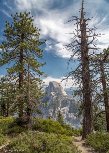
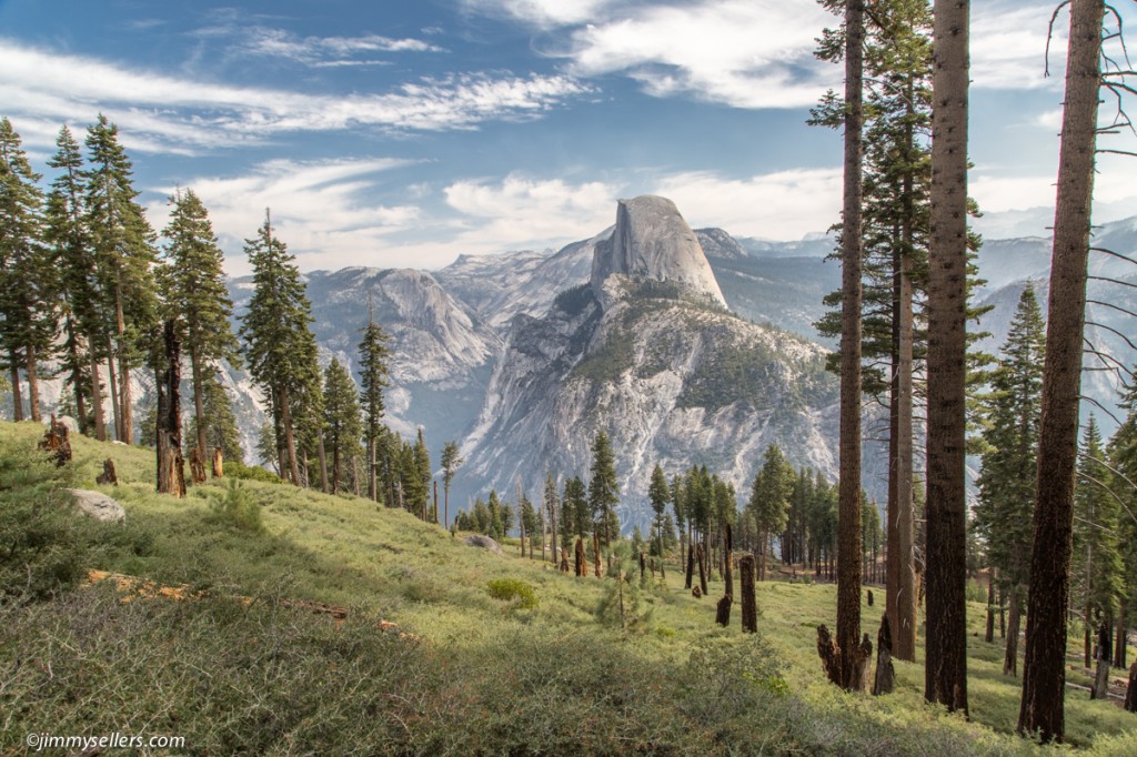
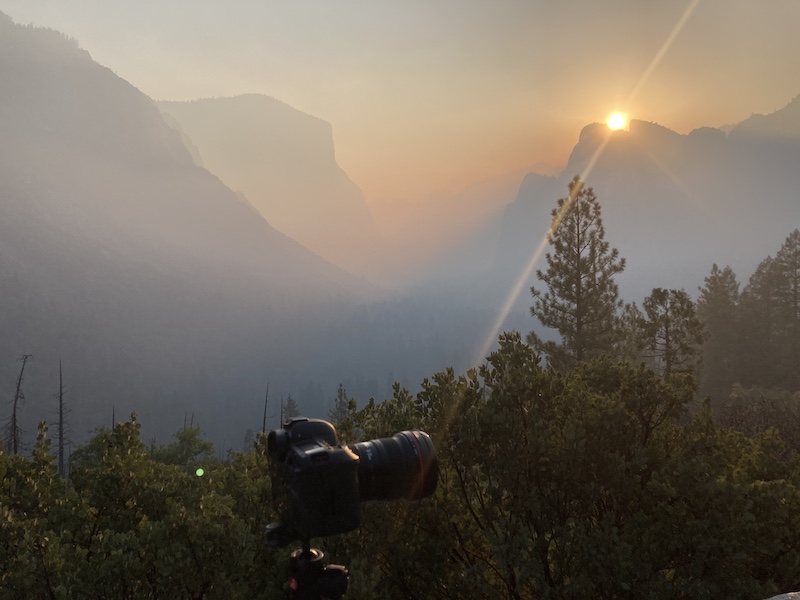 the side of the mountain, toward Glacier Point. Glacier Point is about 13 miles straight up. I only went about 2 up, almost 4 miles round trip. I found this awesome and old virtual geocache there. Thanks for brining me to this hike. Sadly, the haze was really bad today, and the views were all silhouetted outlines. Still amazing in its own, but different way.
From the park, it was time to get to Sacramento, I had a bed in a hotel waiting for me there. I took my time driving, enjoying the scenery along the Merced River. No picture opportunities today, sadly. I made it into the city, got Pervvie to a nearby truck wash, picked up some stuff at an amazon locker at a 7-11, stopped at the auto depot for more Pervvie liquids (she loves the green stuff), and finally checked into my hotel. Tomorrow morning I take my baby to the infirmary to hopefully find out what ails her.
I did start an album of this trip that I am updating as I process. HERE.