This is a time lapse video I made from the last new moon. I spent the night in the middle of nowhere New Mexico. It is a new trend, people are calling it #Barteau’ing
Time Lapse from Barteau New Mexico During the New Moon
Reply
This is a time lapse video I made from the last new moon. I spent the night in the middle of nowhere New Mexico. It is a new trend, people are calling it #Barteau’ing
I got a phone call from my one friend back home who does the best pretending not to hate me. He wanted to make sure I knew it was the new moon,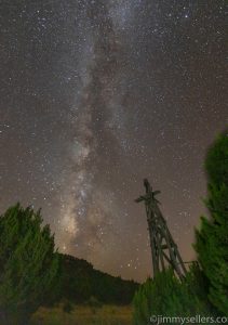 and had planned accordingly. He also told me some other nonsense about Saturn or Jupiter or Youranus, something about being close and visible. I was planning to get a hotel this particular evening. I knew it was the new moon, but I had not prepared or planned anything. I was planning to be in the middle of nowhere Texas the following night. Something about that phone call changed my entire attitude and mentality. I felt like one of those challenged kids that the entire school was rooting
 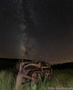 for suddenly. Rudy comes to mind, and Carrie.
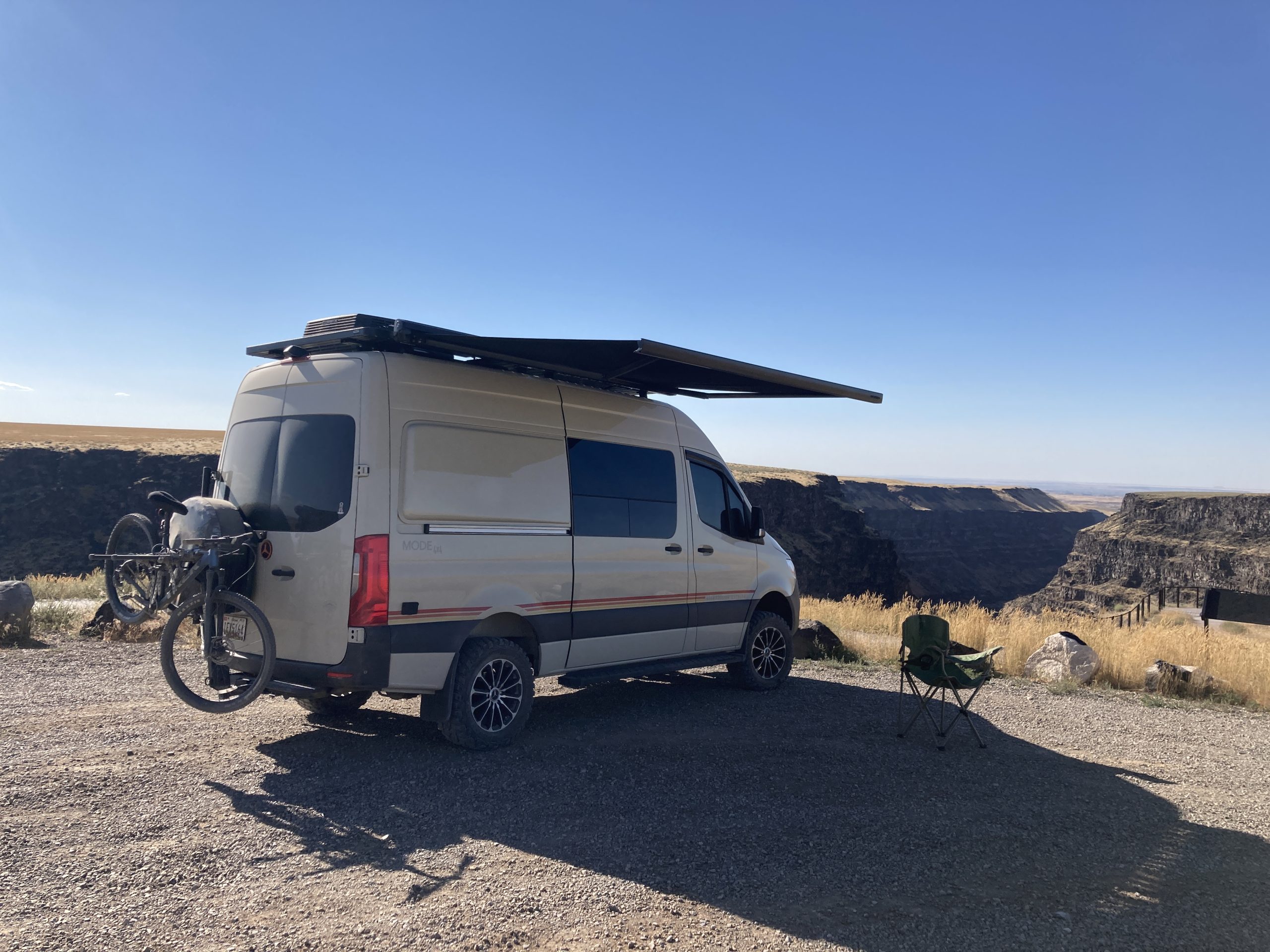
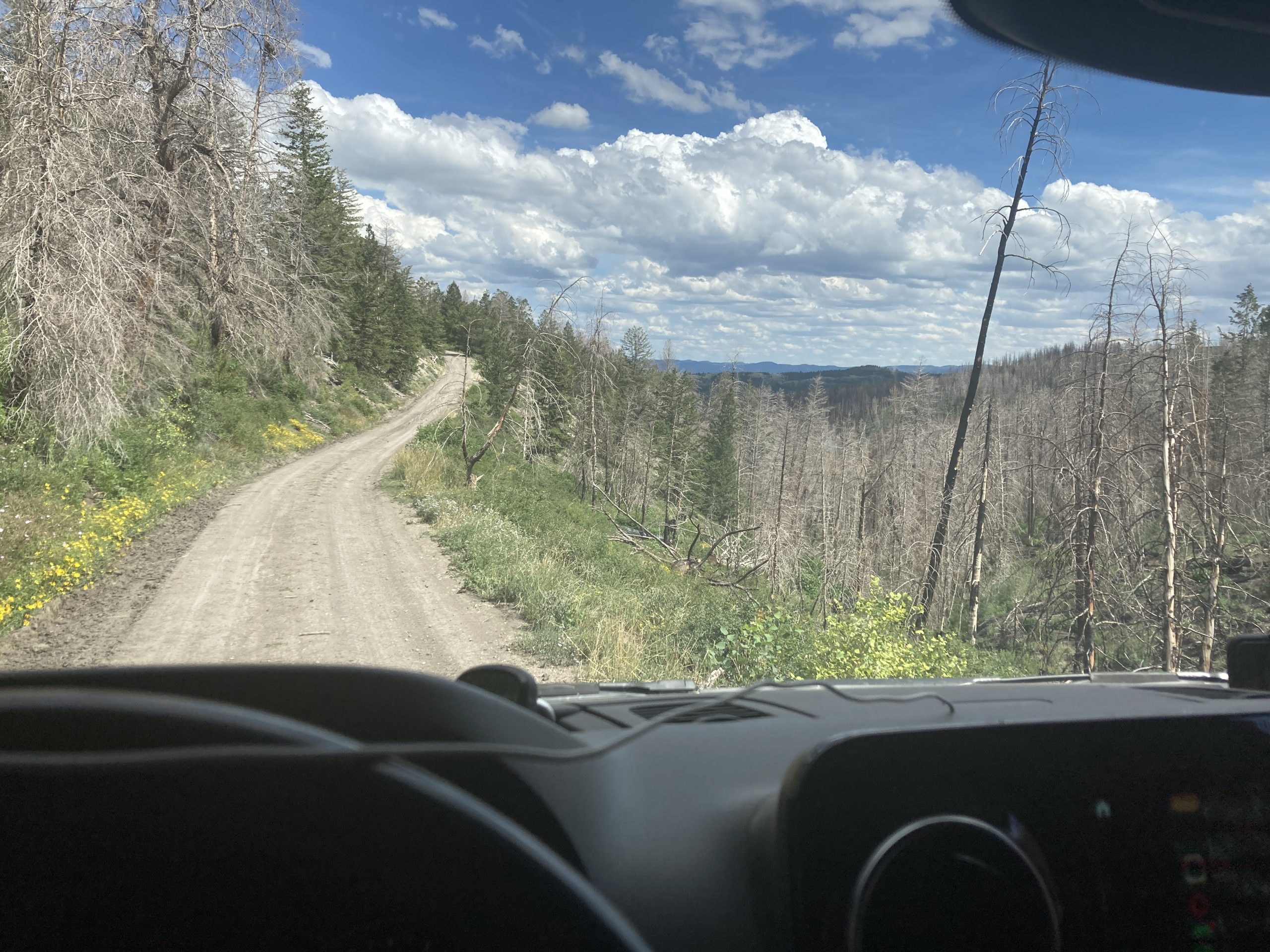
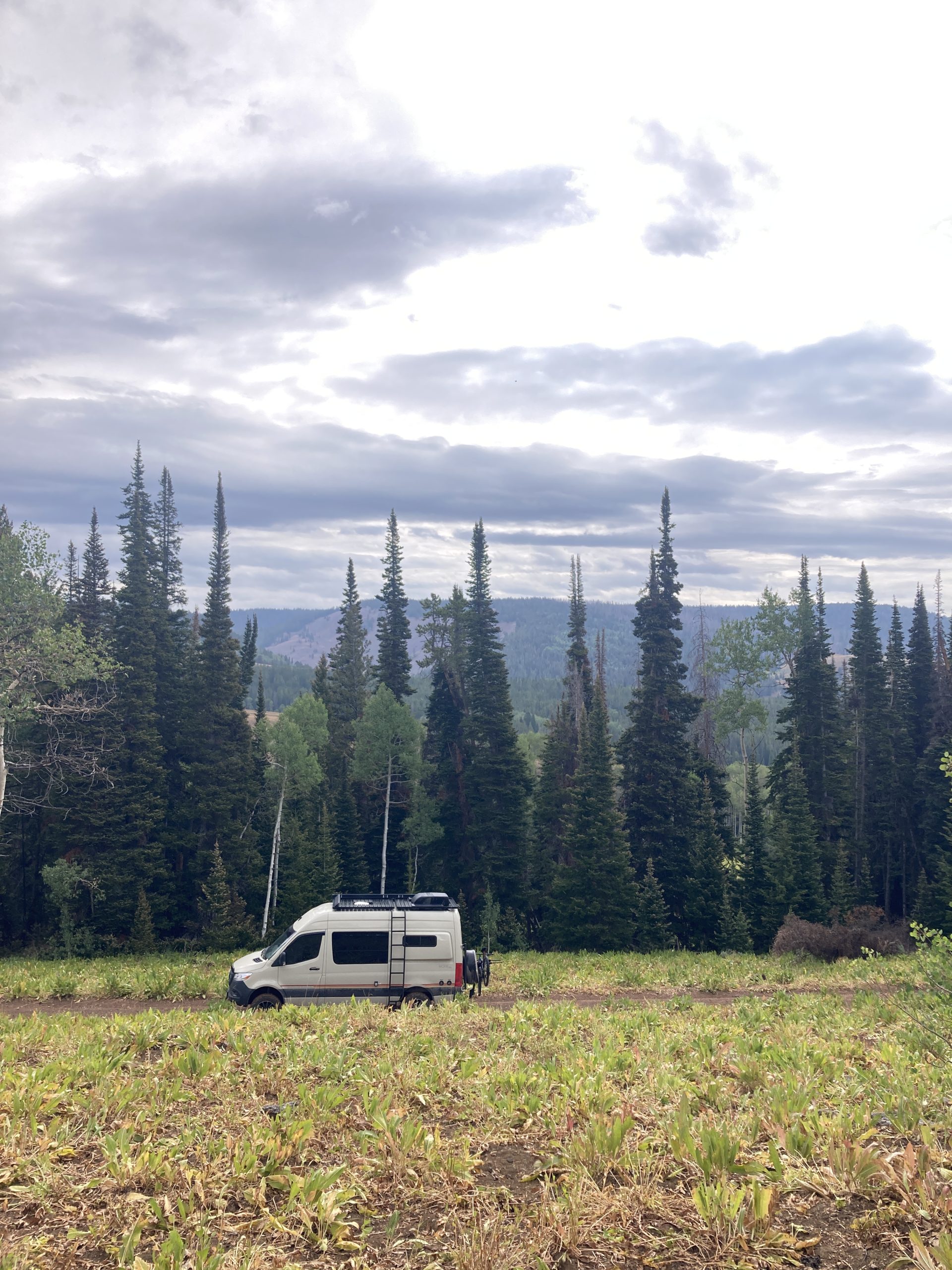
I immediately pulled over for a fuel and research break. I found some dark skies in places I could get to before sunset. That is where Geocaching came to the rescue. I did not know anything about the area, and there was nothing on the satellite map except rugged terrain. There were a few geocaches spread out over a giant section of map. This is unusual. But seeing those green icons let me know that a human got there, and most likely without too much difficulty. I was able to navigate to the middle of nowhere northwest New Mexico, on drivable roads. I drive an adventure van named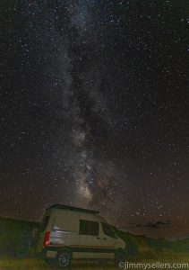 Pervvie, so almost anything is drivable these days. There was not another thing or soul around. Not only did I navigate to the middle of nowhere, very dark spot, it took me to a gold mine of beauty. I saw an amazing sunset. Crystal clear sky and I found these “ruins” nearby. It is just too much. Too too too too much.
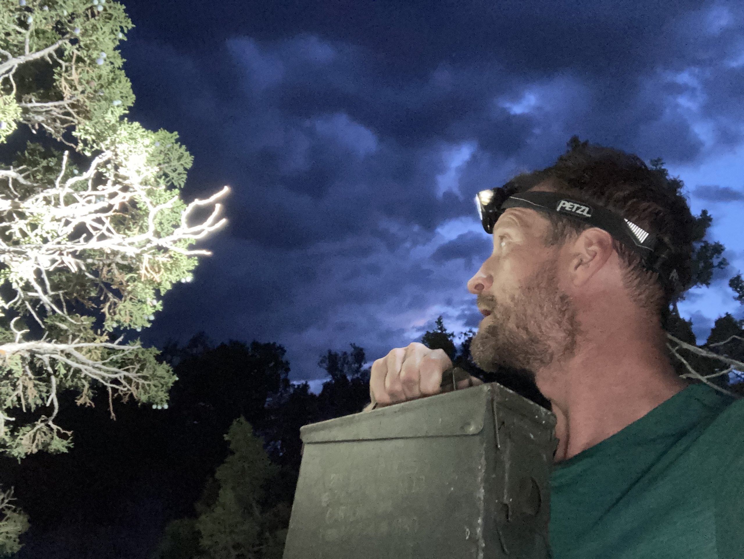
The night pictures went perfectly. I can’t even believe this spot I accidentally stumbled on. I watched day turn to night with a beautiful sunset. Then I watched night turn to utter blackness. It does not get this kind of dark where I live. There was a moment I thought I was going to have to scratch the whole night. I stepped out of my van into the pitch black, walked a few feet away, set up my tripod, turned on my 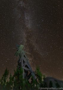 headlamp and the first thing I saw, a snake, in the middle of the night, in the middle of the desert, in the middle of nowhere New Mexico, I’m sure it wants to kill me. It was about 2 feet long as big around as a pencil, but it might as well been a dragon.
I stayed up all night with two cameras taking pictures of all different angles with several different foregrounds. I also spent several hours just sitting outside in my chair staring up at the night sky. It was mesmerizing and amazing. Last night was a night that I really wish I could’ve slept outside under the stars. Everything about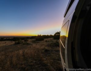 it was perfect, the scenery, the smell, the sound, the temperature, the cool breeze. But, you know, the snake from 2 paragraphs ago.
Because of inspiration from the youth in my life, and a passion for finding hidden treasure, I was able to spend a perfect night alone, in the pitch black, world at my fingertips, and make some really fun pictures.
To make everything even more fun, today was day 69 of my road trip.
A bunch of my favorite pics from my road trip album HERE.
Fun playing with exposure as I process these night sky pictures:
Day 70:
16,010 miles and counting.
Today I met Jingles, hands-down the coolest dog of my trip.
I woke up next to an abandoned tractor and some buildings in northeastern New Mexico where I took pictures of the night sky all last night, during the new moon.
Boy am I sure glad I changed my plans yesterday. I stayed up all night with two cameras taking pictures of all different angles with several different foregrounds. I also spent several hours just sitting outside in my camp chair staring up at the night sky. It was mesmerizing and amazing. Last night was a night that I really wish I could’ve slept outside under the stars. Everything about it was perfect, the scenery, the smell, the sound, the temperature, the cool breeze. The only thing that wasn’t perfect about sleeping outside under the stars was that within 30 seconds of being outside taking pictures in the dark last night, I saw a snake. If there was a place to sling my hammock up, I would’ve slept outside, but I wasn’t sleeping on the ground after that 🙂
 This morning I’ll make my way back toward civilization, and then Amarillo area. Tonight, I will definitely be getting a hotel somewhere to catch up on real life responsibilities. My route includes a whole string of really high favorited geocaches along the route 66 corridor that I stopped for. I have done this drive in the past, but there is a lot I did not take time to stop and see.
After a quick stop for breakfast, refueling, and postcard purchases, I continued along the 40/66 corridor, all the way across the panhandle. My breakfast spot also provided me an awesome little route 66 old car museum tour. I may be a 71-year-old man, but walking around in there really made me nostalgic for being a little kid with my pop. This is the kind of crap that he absolutely adored more than anything in life, except professional wrestling.
I sure am glad I am not Don Quixote, I would have never gotten through that mine field. I made a few random stops here and there for fun stuff. My goal for this afternoon was to get to Oklahoma City. This is where I plan to get a hotel and settle down for the night.
Through my travels I learned a lot about history, businesses that opened and closed, Route 66, old gas stations, and helium.
I would imagine based on the part of the world I’m in, and the time of year, my picture taking opportunities are about over. I got the new moon in the middle of nowhere darkness New Mexico last night. Between here and home, it’ll probably mostly be just working my way back towards 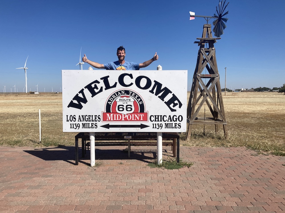 Maryland. For 2 1/2 months I have based where I was going to be on the sunrise and sunset and where I can take the best pictures. Somehow that time of the trip feels like it might be over? It really feels like this is a book end to my trip. I have lost two time zones in the past day. Suddenly it went from 3 to 1 hour difference from home.
I got into OKCITY, Yukon to be exact, and got set up for the night at a HIE. I hardly made a dent in the things I need to accomplish. I think tomorrow will probably be a working day too.
Day 71:
16,450 miles and counting. Yep, mostly worked all day at the hotel. But, today I met Kletus, hands-down the coolest dog of my trip.
I left a Holiday Inn express in Yukon Oklahoma about 3 PM. I got into a hotel last night and got a few hours of responsible stuff done, but I hardly made a dent. I needed to spend the majority of today catching up. When I finally got back on the road, I went straight into OKC proper, and wandered around for a bit. I had to stop by a post office,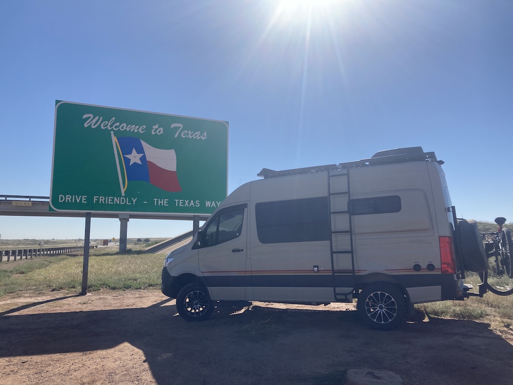 and the one I chose was right by the memorial park. I had a lovely time wandering around there, reflecting, and learning a lot of things that I knew nothing about. In the end, humans, we are all just the same.
After I finished my business in OKC proper, it was time to head a little east towards Tulsa. I was hoping to get a few things done before I ran out of daylight today.
I made it to my main objective today. I wanted to find Oklahoma’s oldest geocache. It was not difficult like many of the others so far this road trip. And a quick 2 mile jog over the course of less than an hour I found it, and several other challenge geocaches nearby.
I made it back to my van just as I was running out of daylight. I sat and figured out what to do next. Being out of daylight, the only real thing I can do is drive. There’s other stuff around Tulsa I’d like to do, but I 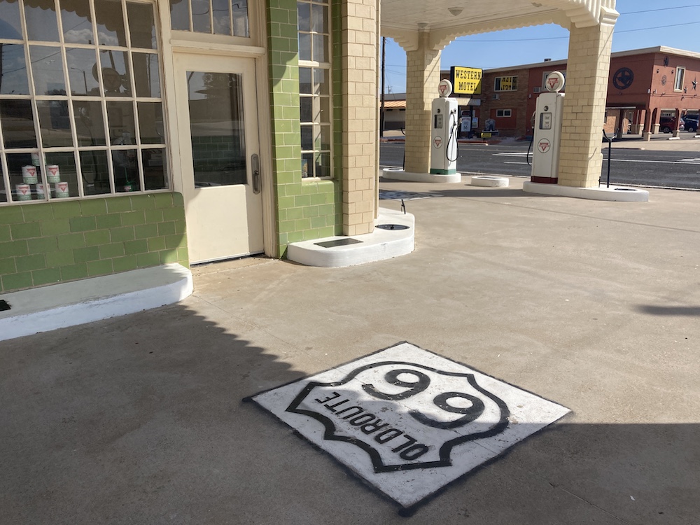 also need to get to Dallas. So, I decided to start making my way south toward Dallas. I have a handful of things surrounding Dallas that I’d like to accomplish, hopefully all tomorrow. I guess we’ll see about that. There’s an event for Geocaching in Dallas that happens tomorrow night. I might try to go to that, just for traveling fun.
On my way south I made one stop. It was to check out some baby rattlesnakes. That’s one of the funniest, cleverest, anxiety inducing geocaches I’ve ever done! So glad I made time for this one.
From here I drove I-35 south towards Dallas until I ran out of awake time. I found a truckstop and got prepared to start up again pre-sunrise.
Good chance there is new pictures at the album I created HERE.
If the idea of baby rattlesnakes in a geocache piqued your interest, then this video may scratch your itch:
Day 68:
15,200 miles and counting.
Today I met Ginger, hands-down the coolest dog of my trip.
I woke up this morning in Payson Arizona, and decided today was the day I finally make my way to Albuquerque. I meandered my way there. 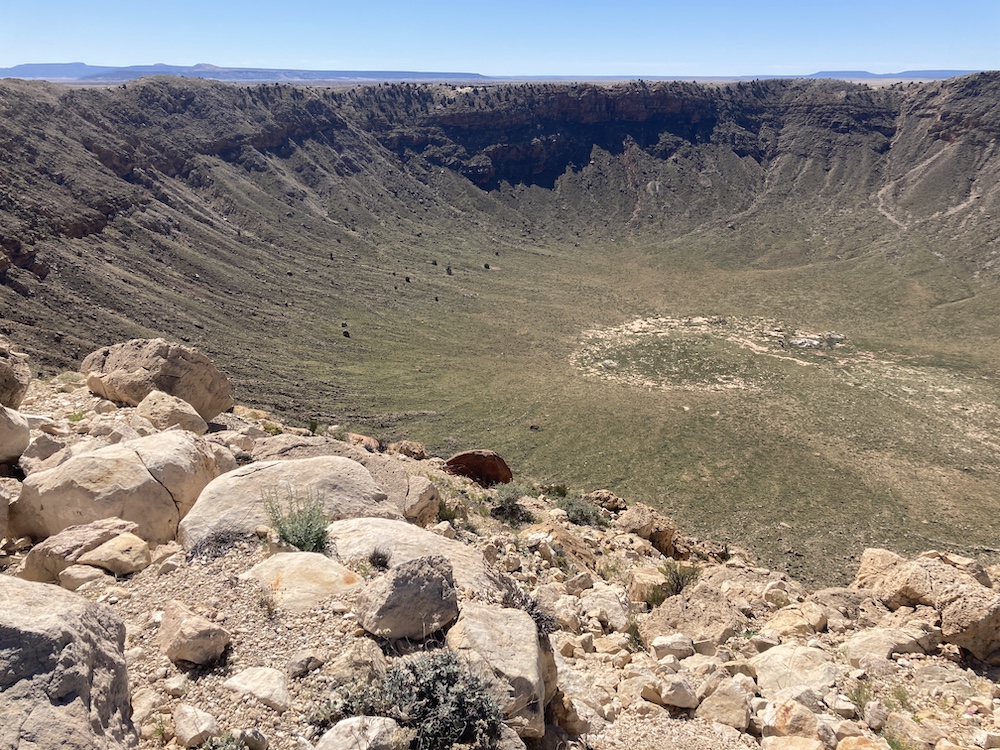 As I made my way east, I stopped by Meteor Crater, because I am a loyal junior astronaut. I am always fascinated by what is guaranteed to be true and factual, because science says so. Quite a fascinating place, and I am definitely glad I popped in there for a quick visit. Then it was on to Winslow Arizona where I stood on a corner, it was such a fine sight to see. Or whatever lyrics.com says. After that I visited the petrified forest. That place is beautiful the further north you go. Reminds me of the
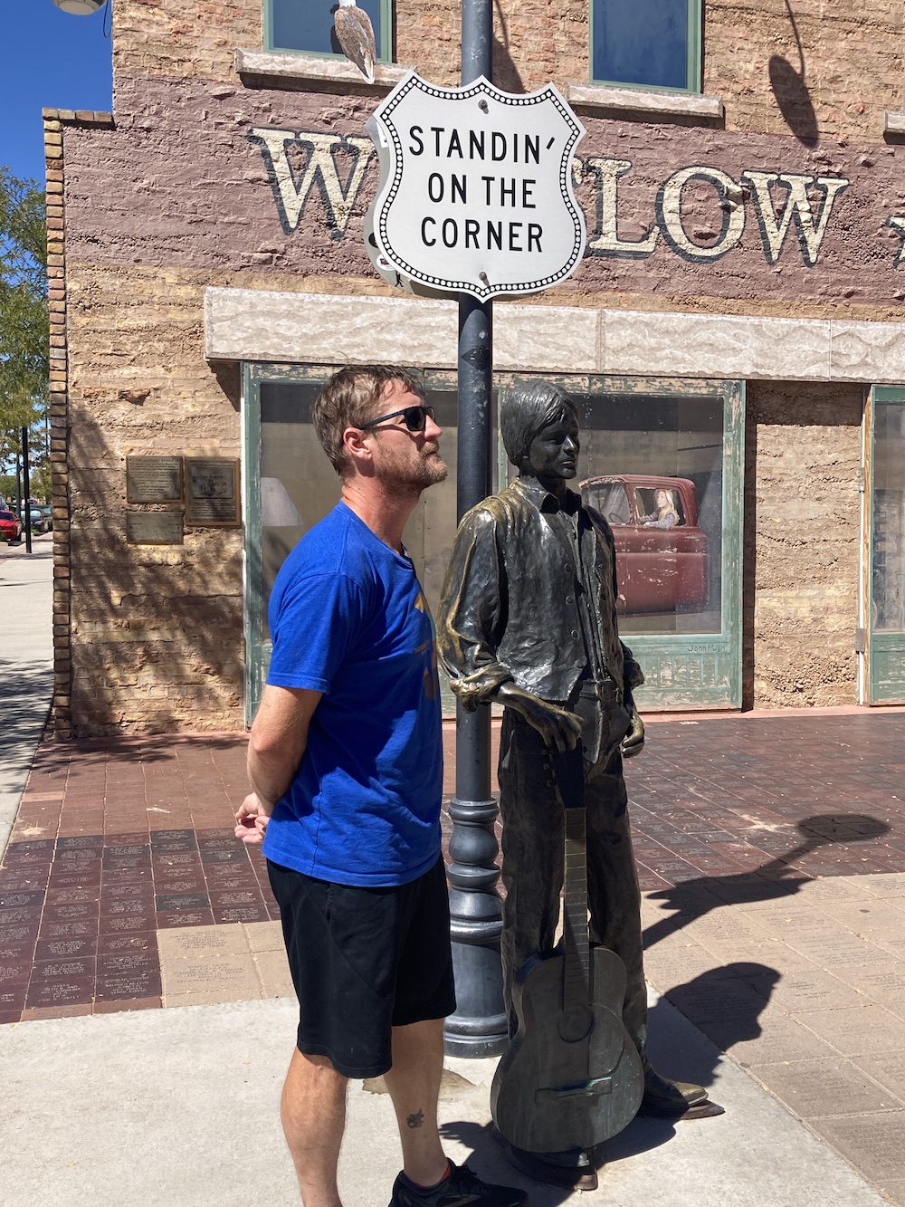 Badlands, except more fun and colorful. I drove through the petrified forest south to north. I made stops at all the required locations for learning, pictures, and a third thing I can’t think of right now.
Then I did some driving on historic Route 66. I saw an easy looking multicache on the route, and I wanted to stop for it. Turns out it is brand new and not been found yet, so a first to find, thousands of miles from home. The only thing better I can think of is the accidental FTF we got in Iceland years ago. I visited 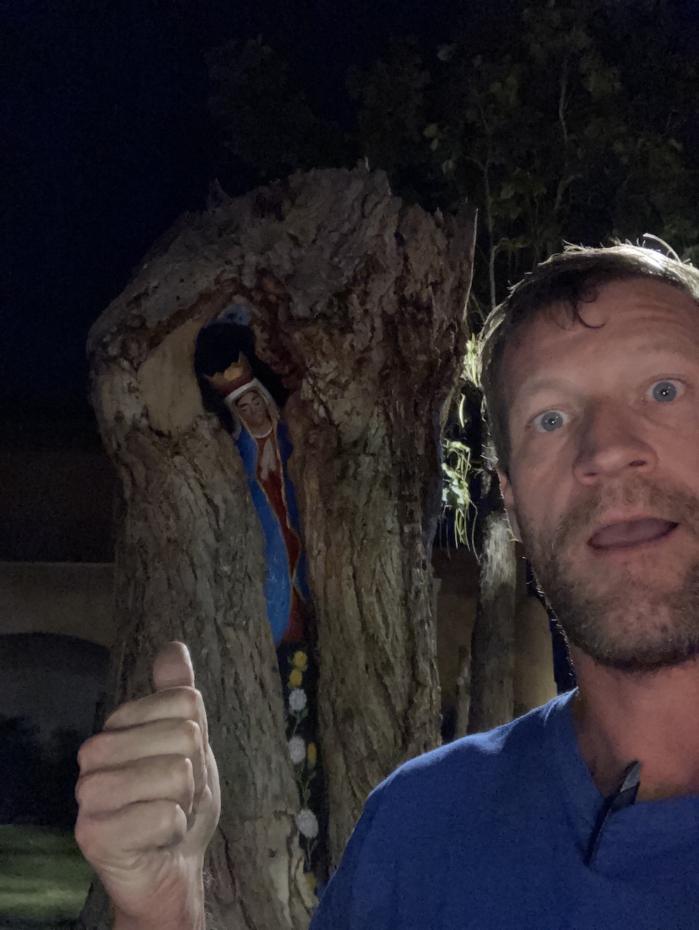 Albuquerque proper for just a few minutes. Long enough to see a really awesome religious lady in a tree! So beautiful. I traveled a bit further north, in preparation for a desert hike as early as possible tomorrow morning. I parked, ate and slept. That is it. Stop reading now.
Day 69 (hehe):
15,650 miles and counting
Today I met Izzy, hands-down the coolest dog of my trip.
Well, today is the day of this trip I have been waiting for, just for 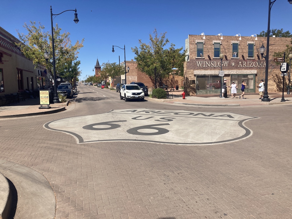 the jokes. Who am I kidding, I never imagined getting past 20 days. I believe I slept in the town of Sandia, which is a very fun memory for my wife and me. I woke up early this morning before the sunrise. My plan for the day was to start with a hike around the desert, so I wanted to get started as early as possible. I grossly overestimated how long that hike was going to take me, and I was back at my van after finding the oldest geocache in New Mexico just about the time the sun peeked over the mountain ridge. I don’t think it got above 60° before I was done that hike. After that hike I had to head back down to town to pick up something from an Amazon locker. Not sure what I’m going to accomplish today. I think today might be get a hotel day and catch up on work and real-life responsibilities.
After my Amazon pick up, I had a delicious breakfast at Jimmy’s café. I 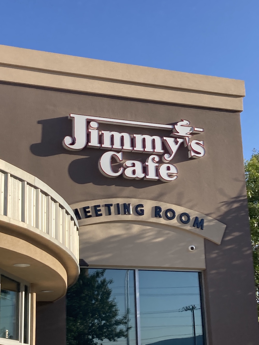 couldn’t resist stopping by a place called Jimmy‘s. I loved it, the walls were lined with Jim, Jimmy’s and James’s of all levels of fame and notoriety. I think I even saw my picture in a corner. So they also honor zilches. After breakfast I looked at which direction I wanted to head and what was in my way. Hot air balloons, one of my all-time favorite things. I love riding in them, and I’m fascinated by them. So, I went to the museum. Unfortunately, it was closed. But I found out that the balloon fiesta is this coming weekend. I am one week early for the balloon fiesta that they have every year. I’m a little bit bummed that it didn’t work out better with timing. Maybe next year. While I was near the fairgrounds, I saw a field full of travel, RV, and adventure vans. Turns out they were all Winnebago’s, and they were having some kind of meet up. I stopped in, chatted with some
 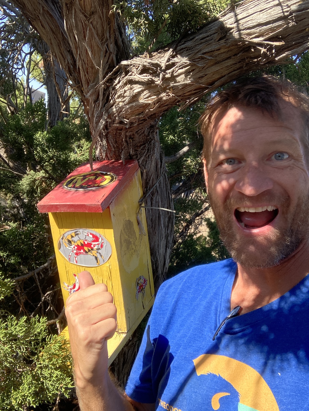 strangers for a while (1 guy from Delaware), and then made my back to the blacktop. After that, while looking at the map of New Mexico, the word Maryland jumped out at me. Hey, I’m from Maryland. What is this. It’s a geocache that was put out for my neighbor back in Maryland? OK I guess I gotta go there now! I reached out to said geocacher in Maryland, thinking they might be excited. All I got back as a response was a cartoon picture of a single finger. I’m so excited that I found a cache that was put out because of someone I know in my home state of Maryland!
After that I found a cool multicache at a frisbee park. I pulled in and saw frisbee baskets. I am not on any kind of a time schedule, but somehow, I just don’t have time for a round of frisbees. I hope my friends back home never hear me say that.
I spent some time doing a wonderful walking tour of Santa Fe. I visited some shops, bought a few trinkets, found a few geocaches, spoke to a lotta strangers, and all around had an amazing time. I thought about opening up a restaurant, but that would be too much.
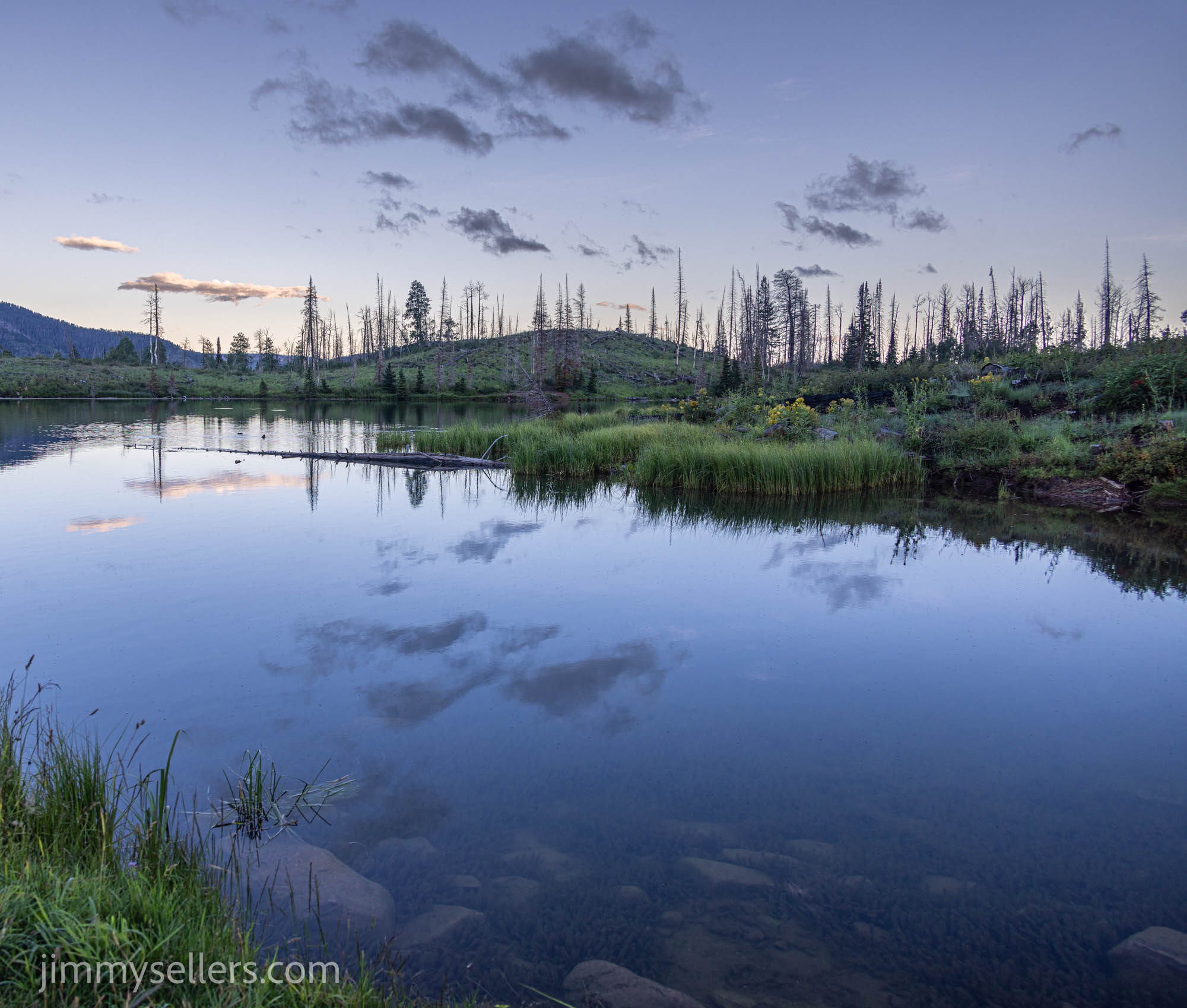
I had planned on tonight being a hotel and work night. I knew it was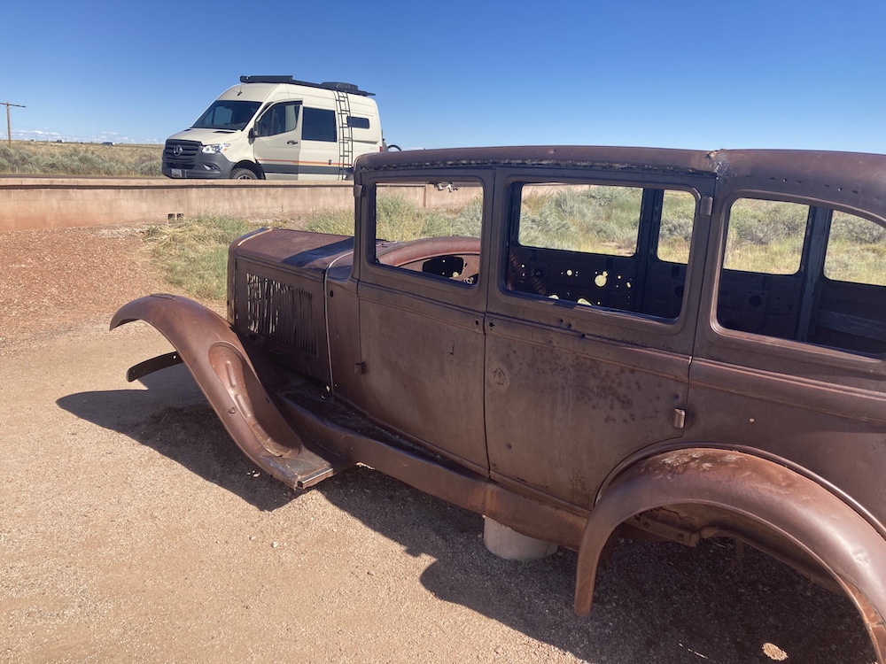 the new moon. But a phone call from my only friend back home reminding me that it was the new moon, and filling me in on some other Saturn information has me reconsidering flip-flopping my schedule. Instead of a hotel maybe I can find somewhere dark in the middle of the desert. I stopped for fuel and a research break. I looked at where I was and where the closest darkest skies were. Today being a new moon, it should be pitch black. Geocaching to the rescue again. I go to the Geocaching map and find a couple of caches in this general giant middle-of-nowhere area. There are not many, because there isn’t anything there. But I found a couple and I’m using them to navigate to somewhere in northeast New Mexico where the skies will
 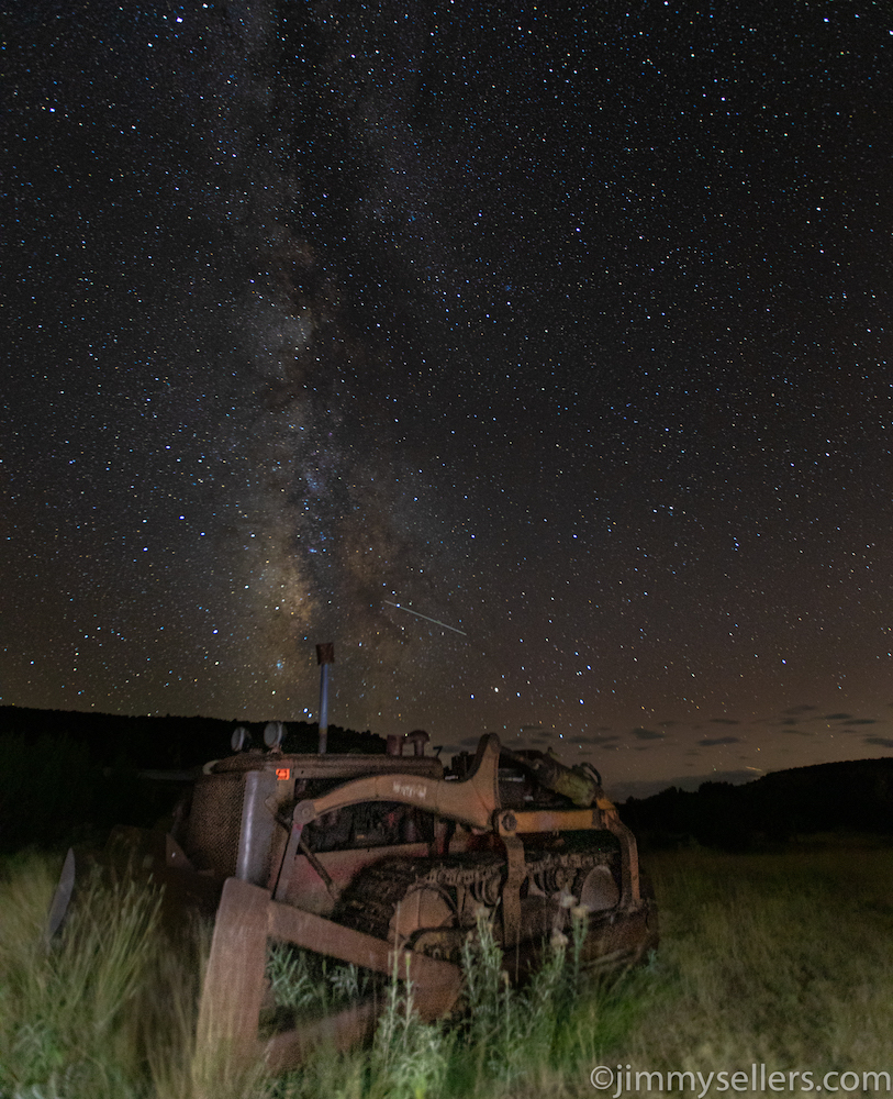 hopefully be as dark as possible.
The night pictures went perfectly. I can’t even believe this spot I accidentally stumbled on. I watched day turn to night with a beautiful sunset. Then I watched night turn to utter blackness. It does not get this kind of dark where I live. For a second I thought I was going to have to scratch the whole night. I stepped out of my van into the pitch black, walked a few feet away, set up my tripod, turned on my headlamp and the first thing I saw, a snake, in the middle of the night, in the middle of New Mexico, I’m sure it wants to kill me. It was about 2 feet long as big around as a pencil, but it might as well have been a dragon.
I would think there’s a pretty good chance I might have been the only human being within 10 miles. I am done being amazed, I guess this is just who I am.
At least I got these pictures!
I’m going to do the best I can to paint this story and mental picture as if it was an animated cartoon. Because I lived my life for about 15 minutes feeling like I had to be in some sort of fantasy fever dream. Either that or Bugs Bunny had chased me deep into the desert because I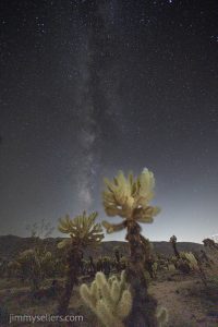 forgot to make a left turn at Albuquerque. Either way, cartoonish.
I wasn’t pooping. It was the middle of the night in Joshua Tree. I was taking pictures in the amazing Cholo cactus fields. The sky was crystal clear, and the milky way was shining in all her glory. I was taking pictures from the ground looking up, through the cactus. I was being very careful. I was doing a lot of sitting and laying in the desert to get the right angles. I was being very diligent, checking everything before I moved. It was pitch black, only light was my headlamp. I knew I had to be careful, so I was. One time I was not quite careful enough. I squatted down to check a setting on my 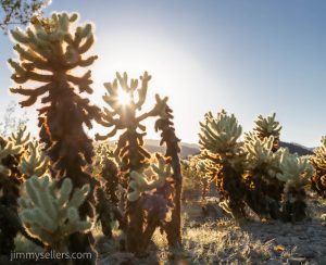 camera. I sprung up, like I was shot out of a canon. Within a few seconds I noticed that I had a softball sized hunk of cactus attached to my left ass cheek. It went all the way through my shorts, underpants, and deep into my skin. Countless cactus needles were puncturing my cheek. I immediately knew I had a problem. I did not know what to do. I knew NOT to panic, and I knew that I was not mortally wounded, just a flesh wound. It was pitch black. I grabbed my underpants to try and pull everything away from my body. I could not, so many cactus needles
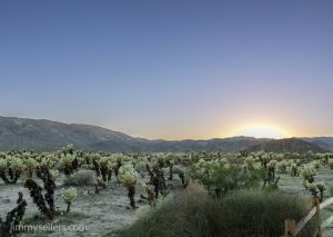 had my clothes stapled to my body. As I started to pull a little harder, I realize this was not gonna be easy. All my playing in the woods and outside I have had a lot of stickers, bushes, thorns, spurs, briars, every imaginable natural thing stuck to and penetrating my body. I grabbed ahold of my clothes on both side of where the cactus bulb was glued. I started pulling and realized exactly how much cactus was stuck in me.
 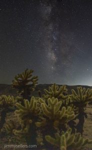 It was painful. I would love to say that it was just like ripping a Band-Aid off, get it quick get it done get it over with. It took a lot of strength to pull that thing away from my body and that was only the beginning.
I’m standing there with two handfuls of my clothes and a giant cactus bulb wrapped in them, holding it out and away from my body once I finally got it out of my cheek meat. The elastic bands of my underpants and shorts were currently my biggest enemies. I then slowly started to take my shorts and pants down. There was no other way than to take everything all the way off. I was careful as I could be but somehow, I still panicked at one point and lost my grip on the elastic of my clothes. This caused the cactus ball to shoot straight in my knee and then ankle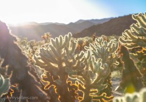 as I got close to being done. After I pried it away from my body for a second and third time, I finally get my shorts and underpants all the way off. Remember, this is happening in the middle of the desert, in the middle of the night. So now I am rocking nothing but a Donald Duck. Top only. I must walk about 10 minutes through this cactus field back to where I parked my van. I only saw one other person the whole time, and it was dark, so (hopefully) she had no idea I was Donald Ducking. I ended up with at least a handful of cactus spikes that I had to yank out with a pair of tweezers. They were stuck in such a way that even though I can get a hold of them with my fingers, I didn’t have enough strength to yank them out of my body.
All in all, I would definitely say worth it. A very valuable life experience. I now know the next time I photograph in a cactus field, in the dark, I do it naked. That way I will avoid getting cactus bulbs stuck in my cloths. Lesson learned, thank you Universe for the message. Most importantly I had a great time, a great memory, and hopefully made some fun pictures!
I started an album of this trip that I am updating regularly HERE.
Day 40:
Today I met Sandy, hands-down the coolest dog of my trip.
I woke up in the most perfect location after sleeping along the PCH. I got up, rub my eyes, stretched, brush my teeth and got ready for another day. I wasn’t sure where I was heading yet, but once I started looking and thinking about it my brain was racked with decisions and choices. I think I changed my plan 100 times over the course of 30 minutes. I even turned around from where I was heading , and then re-turned back around around. I know I have to land in the northeast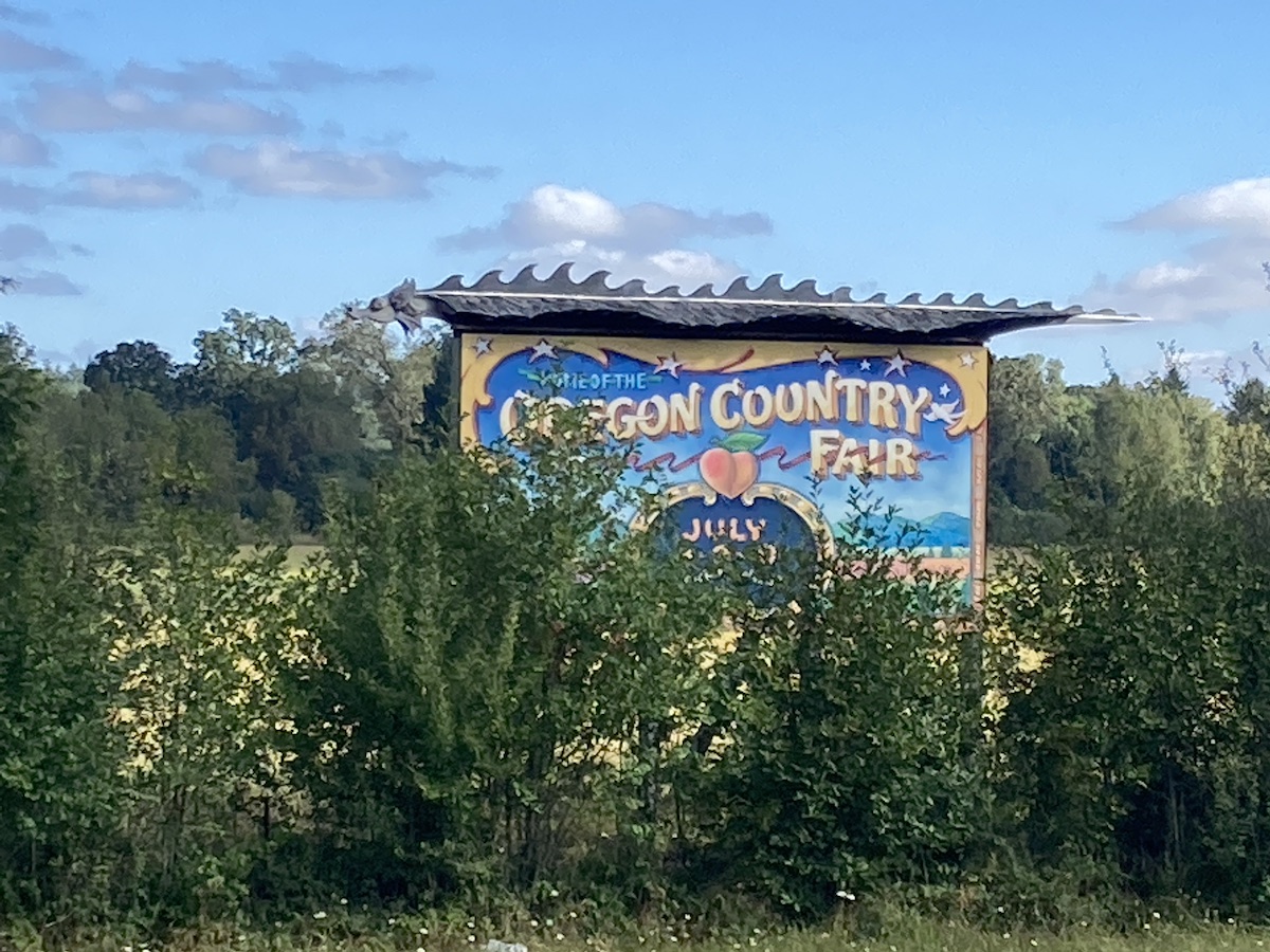 corner of California at some point. That’s about six hours from where I was. So, I think right now my plan is to head there, backtrack, hopefully for the night at Crater Lake, and then back out to the coastline immediately after that.
Everything turned out as planned, even better actually. I left the coast and head inland. I passed through Veneta Oregon. Home of the Oregon country fair. I’m an East  Coast person, but that fair holds a lot of amazing memories of my adolescence. I used to spend two weeks each year out here with friends in Eugene, around the country fair. I did that for four or five of my most formative life years. I had to stop in. Luckily there were a couple of geocaches that brought me exactly where I wanted to be. I think the best memory I now have of the Oregon country fair is driving my van all over the empty fairgrounds, at the end of August, a month after the fair. Seeing all the permanent hippie dippy structures and signs, with nothing else around or nobody else around, that’s a memory I’ll have forever. It put a giant smile on my face and still has me giggling.
Vitreous here I come. Most of the morning I drove through the forest of southern Oregon making my way to Northeastern California. Vitreous falls into the category of things I’m looking for on this trip. Only by one single day, but it made the list.
I pulled up to the diesel pump and parked next to this guy with unbelievable log cabin on a pick-up style RV. We got to chatting and he said “I guess we’re heading to the same place?”
I thought quickly. I’m driving about 14 hours out of the way to find one geocache from the year 2000, so I doubt it. But I simply answered, “Doubt it, where are you heading?”
Burning Man he said. OK now maybe I’m going to burning man for a day. I found out later, the guy I met buying diesel is a bit of an internet celebrity: Truck House Life https://www.youtube.com/c/TruckHouseLife
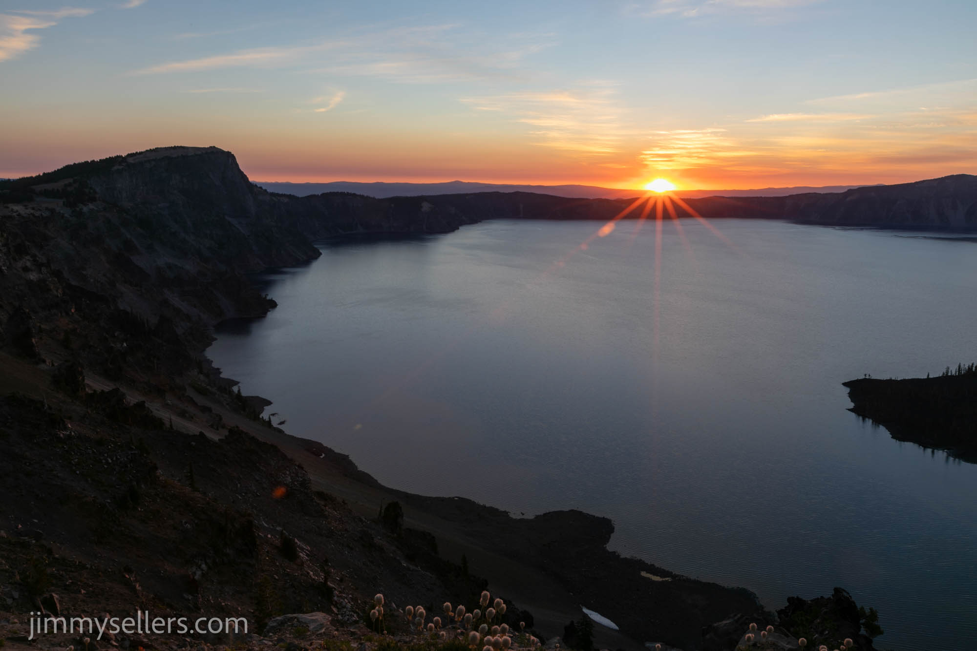
I made great time and found Vitreous and one of it’s neighbors. I chatted with some ladies that were finding obsidian ‘needles’. I got an interesting education about that. Then it was time to boogie toward 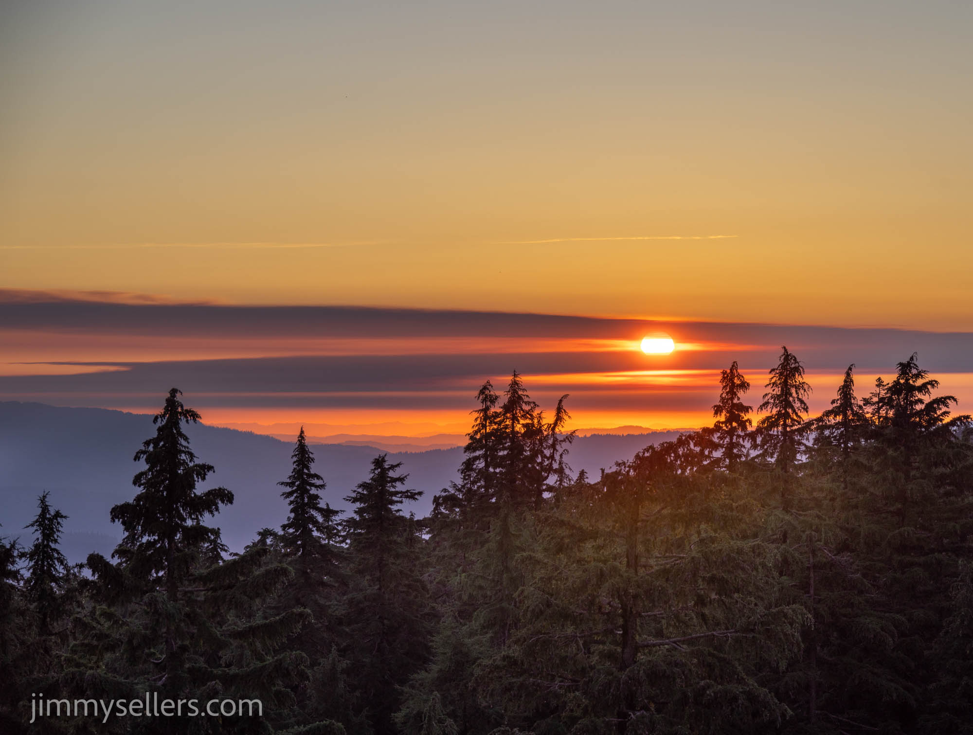 Crater Lake. I made everything in perfect timing somehow. As I got into the park and did the ring road, the sun was setting. Every corner presented a new sunset view. It might be the most epic sunset I have ever seen. I shot it from many angles. Then I found a pull off to call home. The sky is crystal clear. I parked, ate, and got my camera set up in perfect time to catch the galactic band passing by. So unbelievably
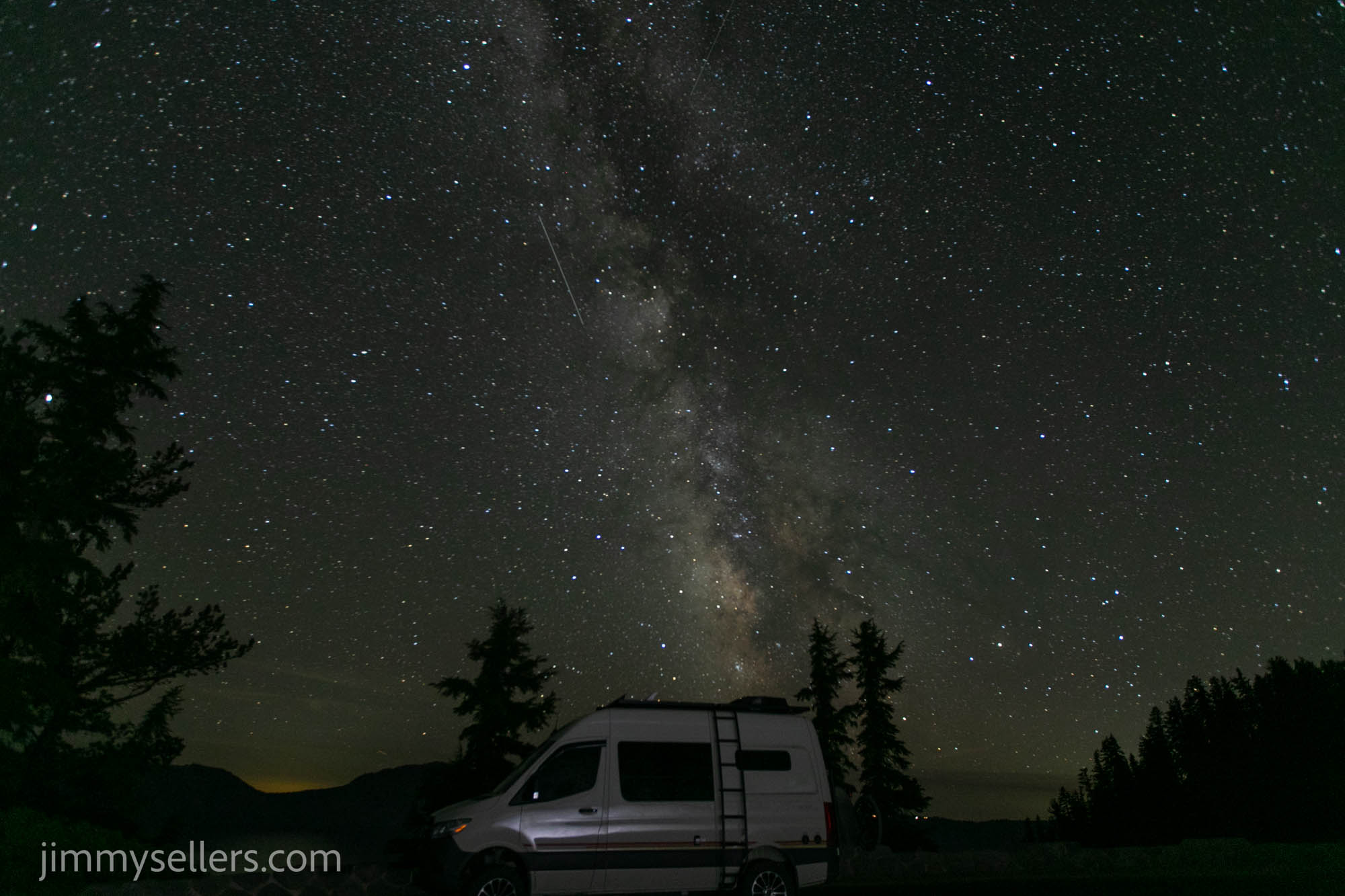 amazing.
I set up camp and had a giant pull off all to myself all night. It was a perfect southwest facing view. I was able to photograph the stars in the Milky Way and the galactic band all night with crater Lake as the foreground. It was hypnotic and mesmerizing.
Day 41:
10,700 miles and counting
I woke up in crater Lake this morning. I have no idea how I got here, but I’m sure glad I was here. I got here just before sunset last night. So, I had to race around and take photographs from different angles before I lost the good light. Then I set up camp and had a giant pull off all to myself all night. It was a perfect southwest facing view. I was able to photograph the stars in the Milky Way and the galactic band all night with crater Lake as the foreground. It was absolutely hypnotic and mesmerizing.
 When I say I woke up in crater Lake, I was awake most of the night taking pictures. But I had to be ready for the sunrise. I was! I made it around to the other side of the lake around 6 AM to catch the sunrise pictures from there. After that was done, I then took the time to drive the rim Road and investigate each of the virtual and earth caches around the lake.
After all those tasks were complete it was time to clean up for the day and make my way back to the coast. I spent all day yesterday driving from the PCH, inland, to Northeastern California, just to turn around today and head back to the PCH to continue my journey south on that.
Crescent City is where I will pick up the PCH again. I will travel south from there, hopefully stopping around Eureka. I have a very old, dear friend that lives there. He used to be the front man of a very famous rock and roll band back in the 90s. I don’t want to say much more and give away this persons location.
I continued south, keeping the ocean on my right for the entire afternoon. I had to be in Arcata around six. I leisurely drove and stopped for random tourist options, and mostly non-traditional geocaches.
Boy those redwoods sure are impressive.
I caught up with an old friend for a few hours, had a blast, more fun than I deserve. It almost makes me wish I could live a normal life. Then it was to a nearby community center and tuck myself in for the night.
Here is my longest and probably best time lapse so far. Around 400 images:
I did start an album of this trip that I am updating as I process. HERE.
Amazing Sign!
Day 33:
8900 miles and counting.
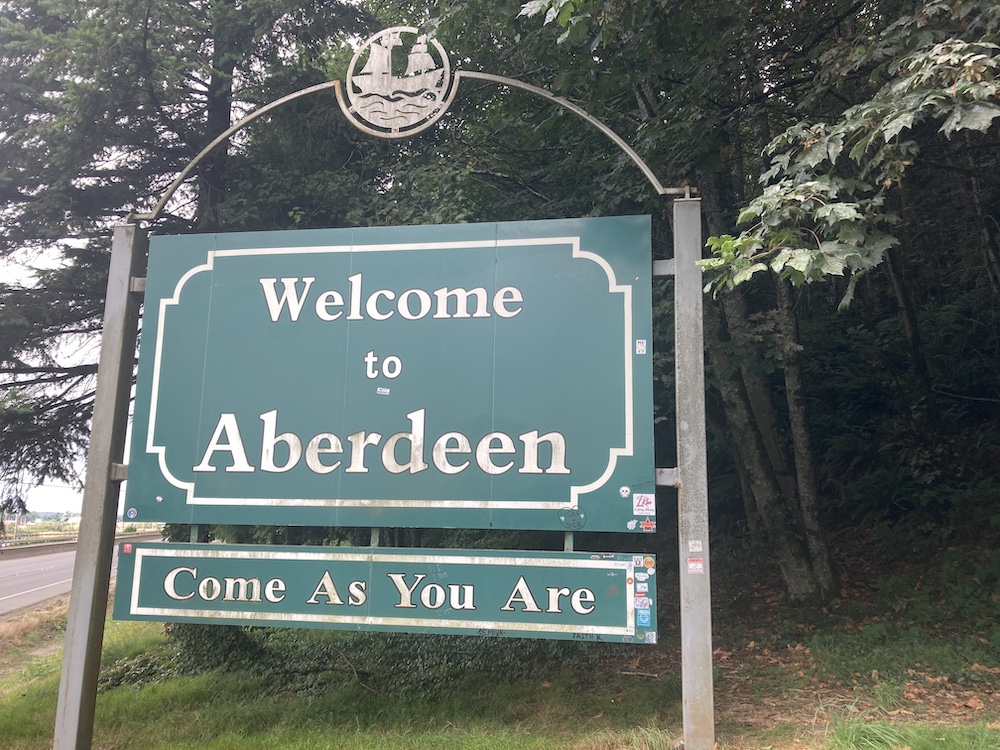
I slept in Elam Washington, and got my start this morning by heading to Aberdeen. I spent quite a while walking around town and taking in the history. I am the perfect age for Aberdeen Washington to mean way more to me than it actually should.
I also visited a giant graveyard on a hill. Of course. You can always 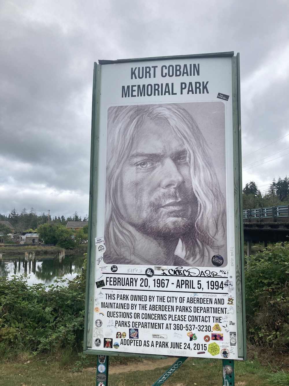 count on me, visiting graveyards. If I am not finding a geocache there, I am stealing water. Probably both, and a third thing, that you know what.
After that I head straight to the coast. My intentions were to find the cache across America, Washington state version. Then from there I wanted to get all the way to the north and west while going through Forks. My wife made me promise that if I did this trip, I would make it to Forks. She apparently thinks that I can bring back the ability for her to be a vampire? Not sure what that means, but it means something to her.
Currently I am having to kill a weeks worth of time around Seattle. I have a window repair on my van scheduled in Bellingham next week. So, I can’t get too far away, or I’ll just have to backtrack. I’m hoping to make it all the way to the top left of Washington. Spend some time in Olympic national Park. And at some point, I still must make it east of Seattle to Monte Cristo. That is the hike I was looking forward to most, when I left home with a loose itinerary.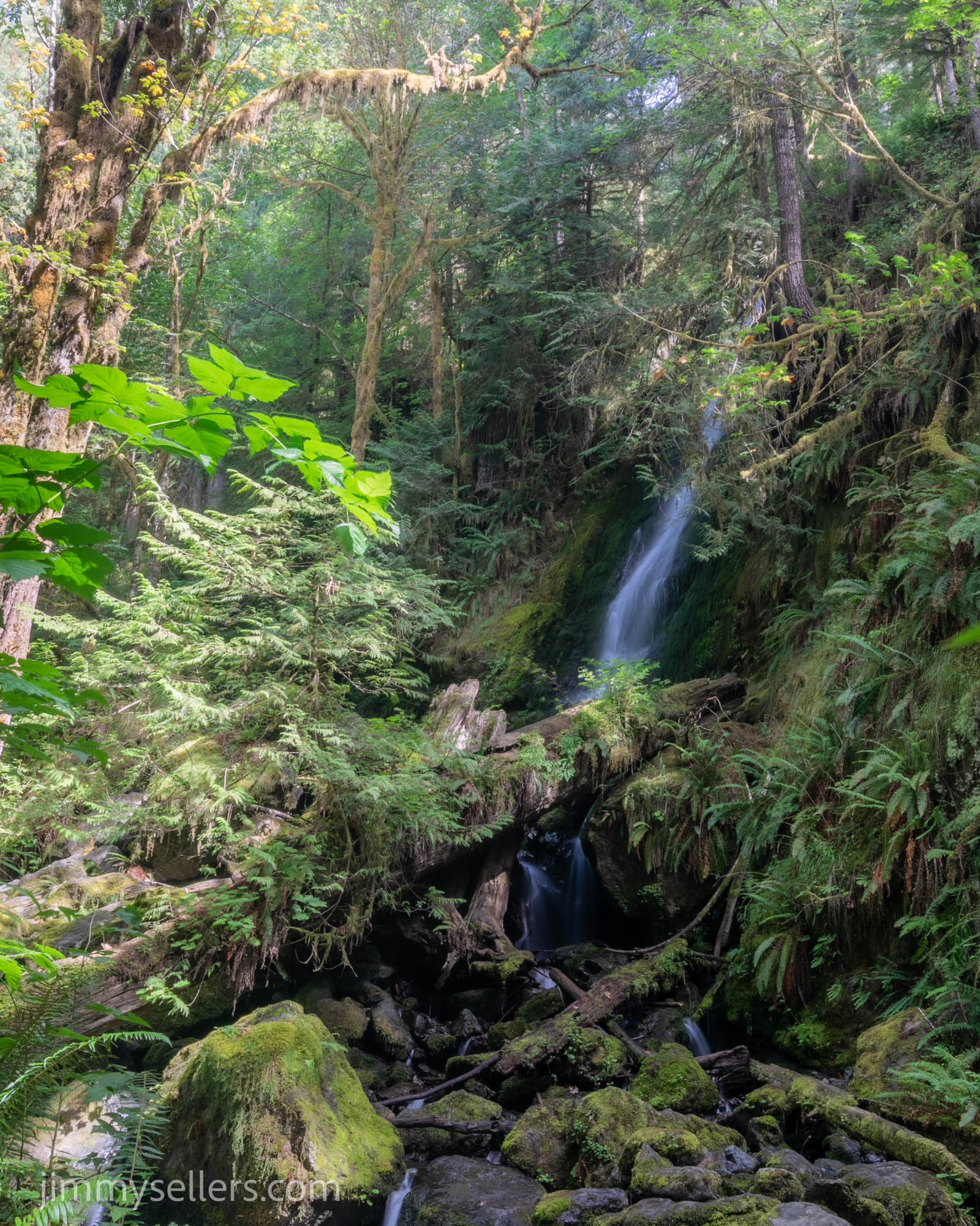
I drove the full loop around the lake in South Olympic National Park. I drove out on the South Shore and then back on the North Shore. I stopped for pictures a few times, including about an hour of climbing up and down rocks taking pictures of a waterfall at the geocache. I guess that’s not inside the park if there is a physical container? I stopped for a couple virtuals as well.
Once I left on the South Shore road I was finally attempting to get to Forks.
I never did make it to Forks today. I was driving along the 101 and saw a sign that said HOH Rainforest: make a right. I couldn’t turn down the offer to see a rain forest. I didn’t know anything about it. I called a buddy back home who is a big nerd. He said that if I have the opportunity to go, I needed to go. So, I made my way down that road, 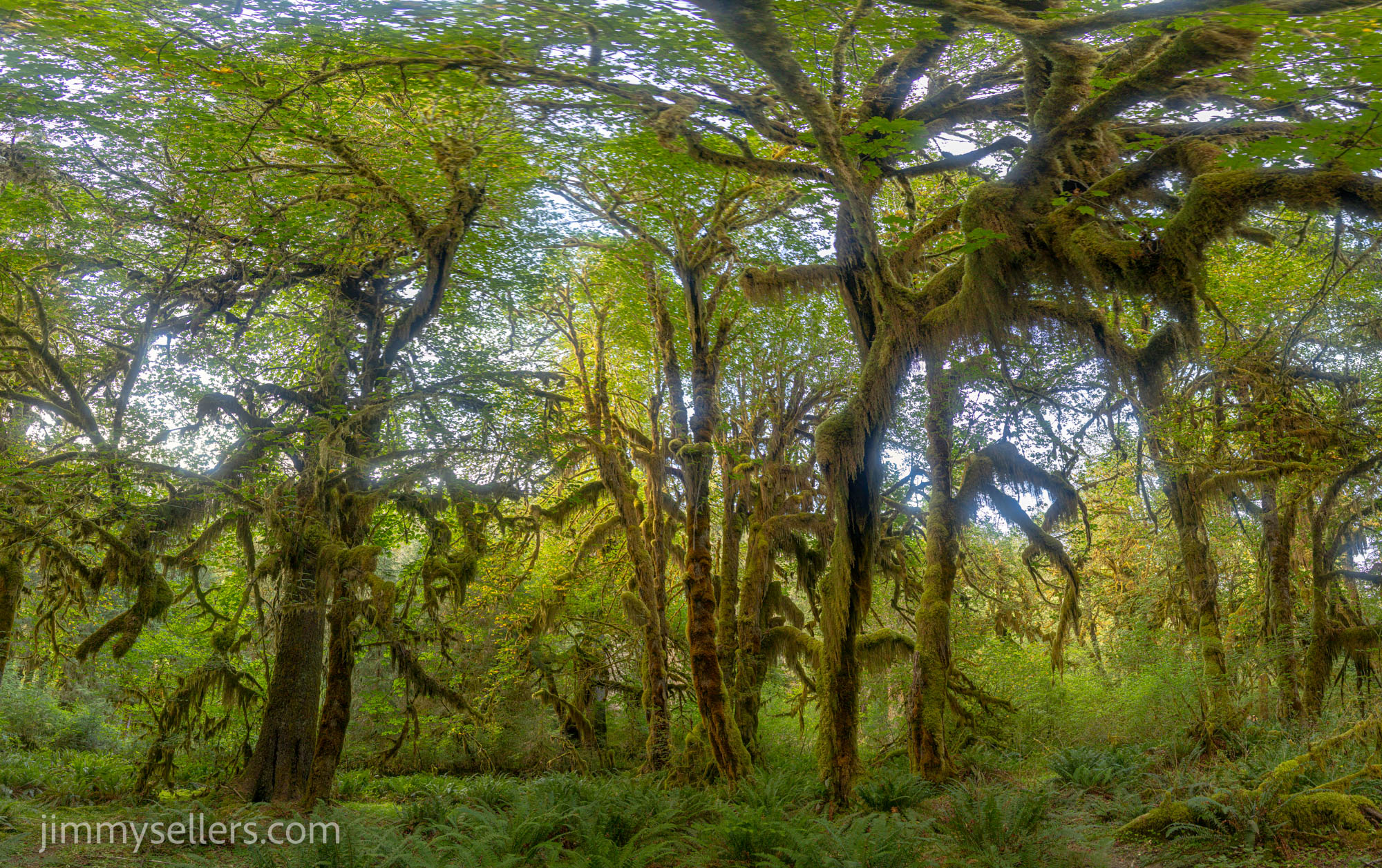 through the entrance gate, and I went into HOH rainforest. I didn’t see but maybe 10 other people the whole time.
I got into the rainforest, I parked and did some hiking. Very little of the rainforest is actually traversable, which I am sure is a good thing. Reminded me of the Galapagos Islands… you are really only allowed to see about a millionth of a percent. I did the two loops by the campground and checked out both of those earth caches. I’m so excited about the spot where the rainforest meets the lake. I plan to go back there in the middle of the night to photograph the sky. It faces the perfect direction south southwest. Fingers crossed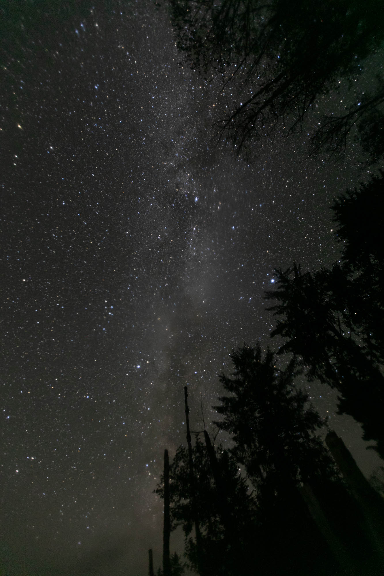 for great results there. After the hikes just enough time for a shower and a quick bite before hopefully I’m heading back into the pitch-black woods.
I hiked back to the forest/river intersection about 10pm and spent 3 hours there taking pictures. I watched the stars, listened to music, and maintained an overall gratitude for this unbelievable life I get to live. What a day. Cool towns, rainforest experience, watch the milky way dance. That sounds like a well balanced diet.
I did start an album of this trip that I am updating as I process. HERE.
Day 25:
6400 miles and counting. Woohoo! Today is the day I get to scram out of Las Vegas. My pretty girl is all fixed up, and ready to get back on the road. She just needed a rest, like every beautiful lady, she needed time at the spa. After a fresh bath a bunch of new bolts, some new sway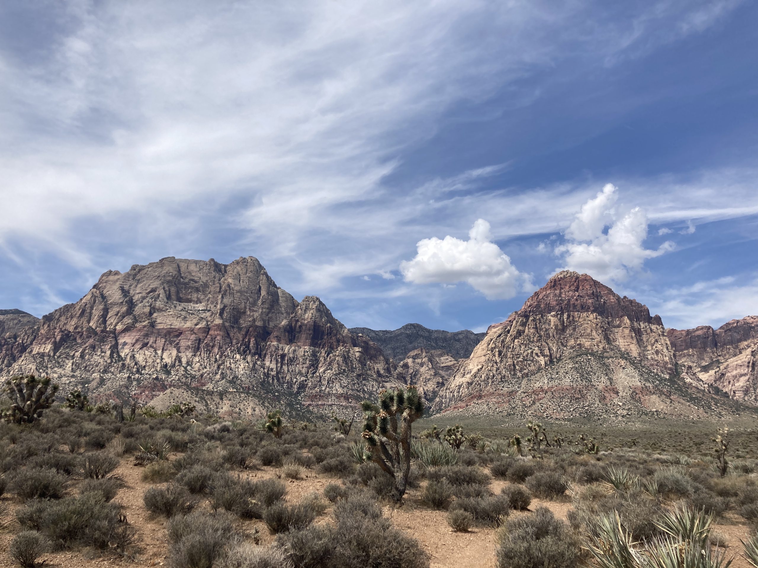 bars, and a whole lot of TLC, Pervvie is back on the road and ready for adventure. It felt so good getting into her after a few days absence.
On the way out of town I did a few miscellaneous Geocaching things, and a trip to the food market to get restocked up. I was hoping to steal some water from somewhere too, but I have plenty for now. I am heading directly north, into the desert. I plan to drive for a couple of oldest hides in Nevada, and some other highly favorited geocaches along the way. I believe my next destination is going to be rattling 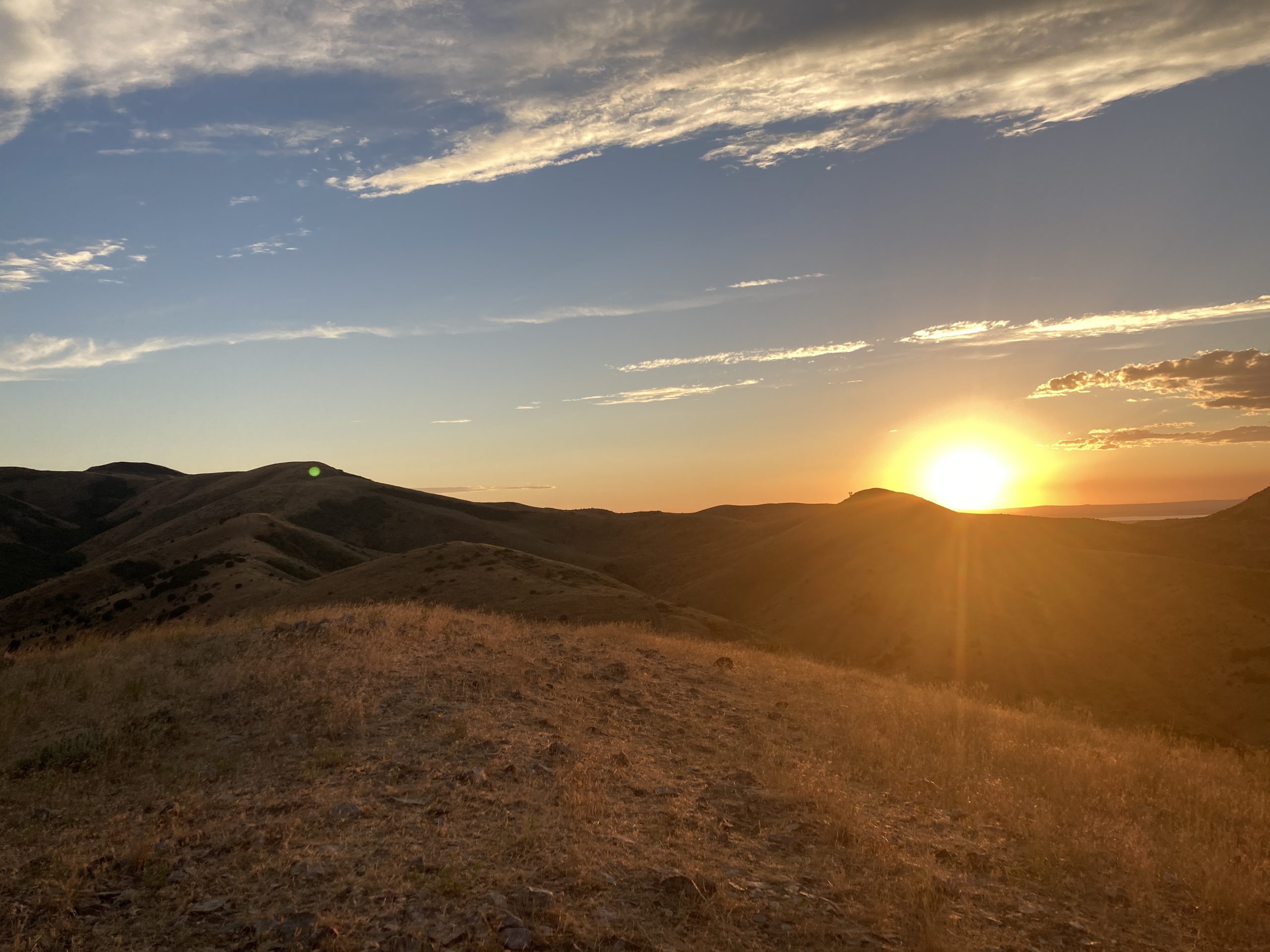 around Idaho. But so far, my plans only work out 50% of the time. The other 50% of the time I end up doing something way better than I ever planned or imagined.
I drove all over, all through, and all around all of these power trails out here in the middle of nowhere. I stopped for more than I thought I would. But still very little. Just the high favorite ones, and the older ones. If I had the willingness, I could’ve had a find count of 20,000 higher than I do now. But that just doesn’t seem like having a fun. The fun for me is just driving around in the desert, getting lost in my own thoughts…not pretending I’m a mailman.
I found all the main ones that I wanted, and some others. Basically, where I stopped to pee, take pictures, sometimes both of those things.
Time to head north for the oldest one. I was in a big conundrum. The van said it has 90 miles left of fuel. I was 30 miles one way from the main road, and 30 miles from the town of Tonopah. I had to drive all the way from Golden Arrow, to Tonopah, turn around come all the way back, go to the old one north, turn around and back through Tonopah. Poor fuel planning.
As I turned left off of the main road to go north on a dirt road, I noticed “I want to kill you” weather, in the distance. Behind me was the most beautiful bluebird skies you could ever imagine. However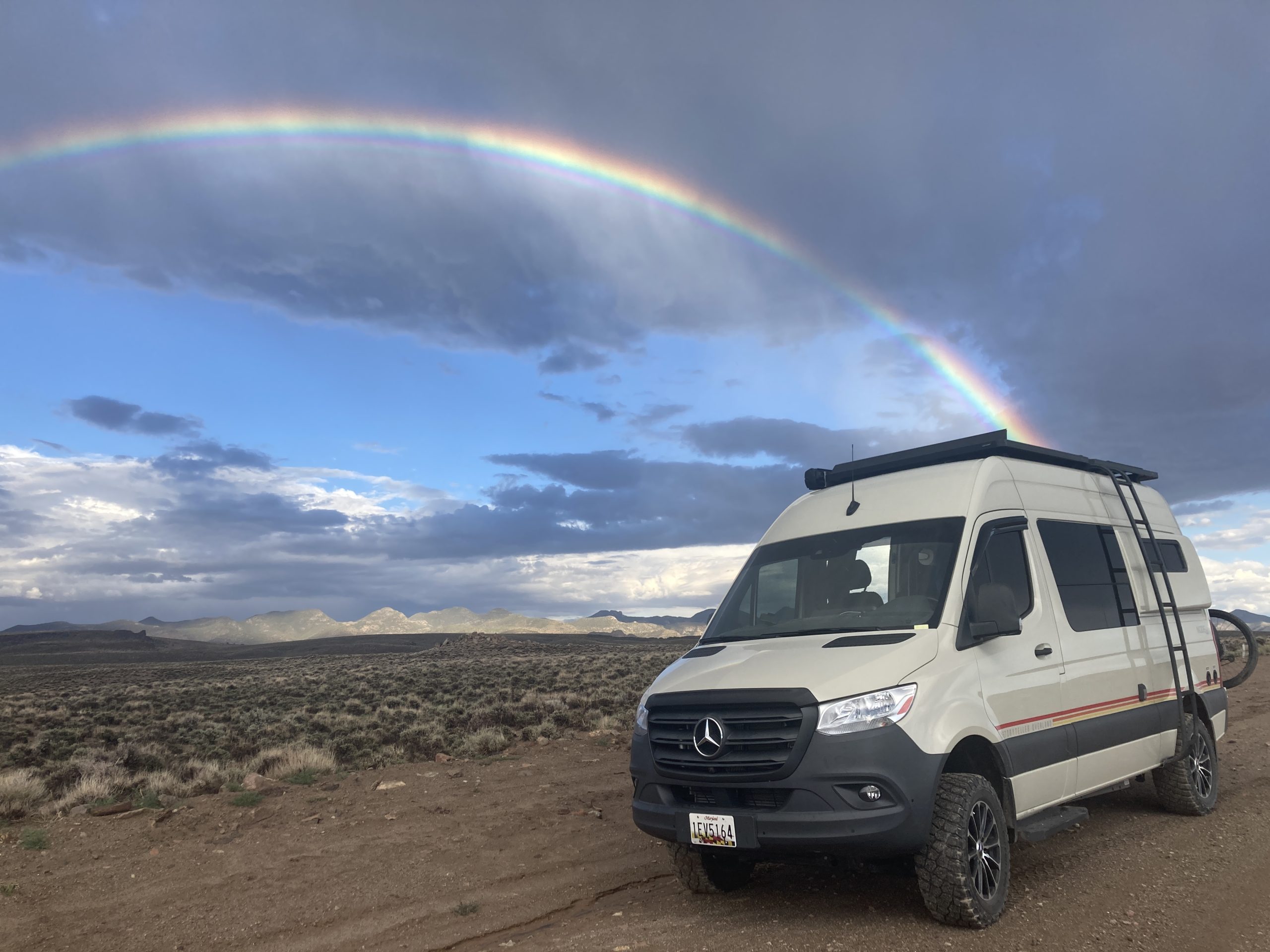 directly in front of me was the most terrifying, menacing sky I’ve seen yet on this trip. Oh well, that’s the way I must go.
Thank you so much for bringing me to the location of Nevada’s oldest geocache. I was treated to a spectacular show of storms and skies and clouds and then ultimately rainbows. That’s right rainbows with an ‘S’ at the end.
From there I made my way to Ely, found a nice place to rest for the night. Tomorrow is hopefully north to Idaho.
Day 26:
I woke up in Ely, Nevada at a Love’s. 6900 miles and counting.
I am planning to head into Idaho. I got moving this morning not quite as early as I would’ve hoped, but after a few nights absence, I was extra cozy in my mobile home’s bed.
I changed my plans for the 10th time today and a millionth time this trip. I made a detour back through Salt Lake City. I couldn’t spend  much time there, because it was during a time when I thought I needed van repairs and was anxious to get that done. I drove and wandered around an empty Salt Lake City on a Sunday. The weather was beautiful, and it was a perfect time to be Geocaching as there was no one else around to see me acting weird.
Having grown up on the East Coast, I will never understand how I am able to drive 3 hours or more, at 80 miles an hour, and not see another human being. Did they build these roads just for me to use?
From there I was going to head to the Golden Spike. It occurred to me I had a few errands, and I was in a major suburban area. So, I stopped off at the Home Depot, the Office Depot, the Auto Depot, and luckily picked a town with some really highly favorited caches and a WebCam.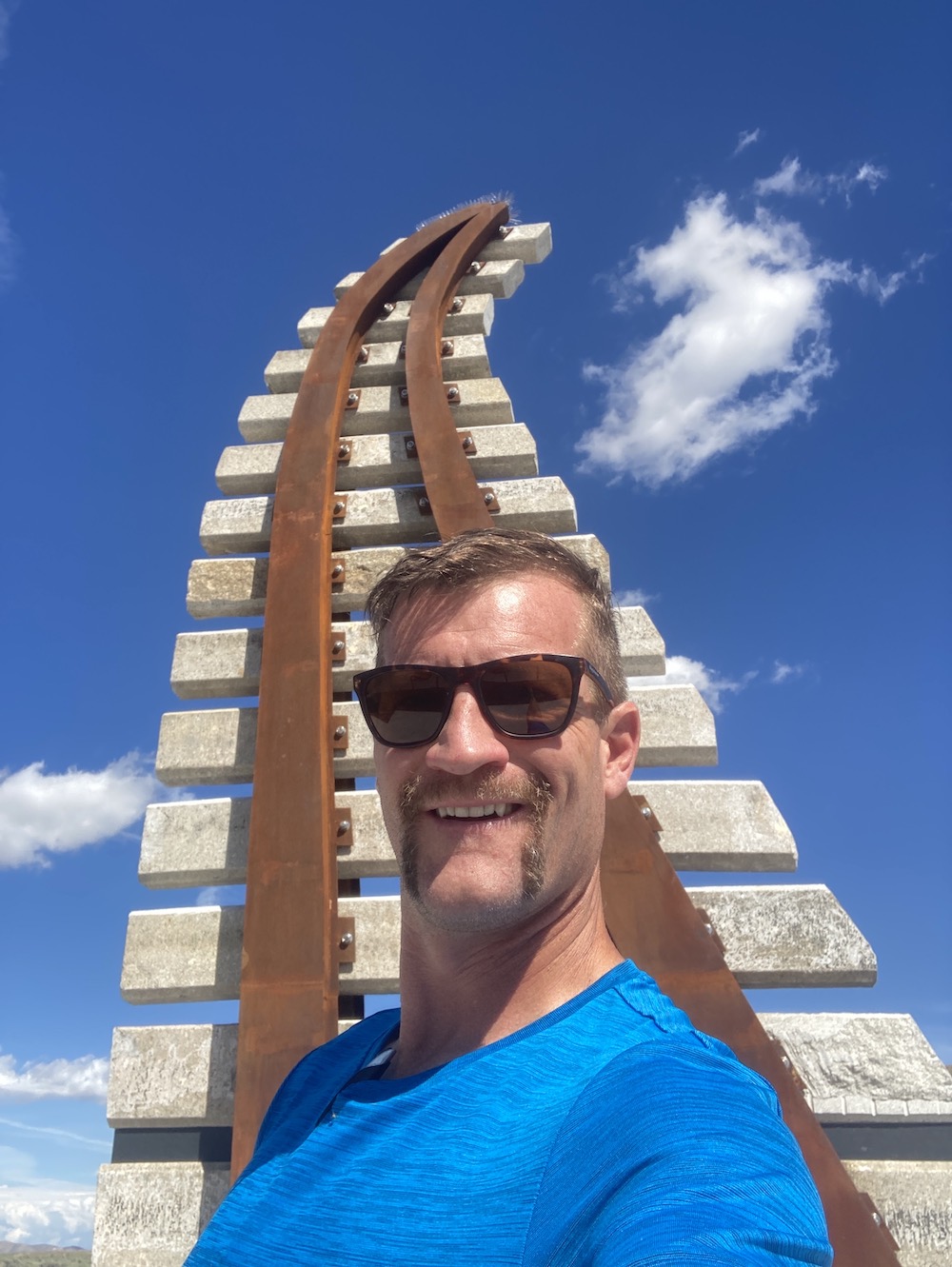 This detour was a lot longer than I had planned on.
After visiting a choo-choo train history spot, I backtracked to the missile exhibit. That was so much more fascinating than I ever expected. I went there for the old virtual and the letter box. I spent about 40 minutes on that letterbox. First, I couldn’t find a sign. So, I did some alternate research and narrowed it down to a couple of options. But then I was messing 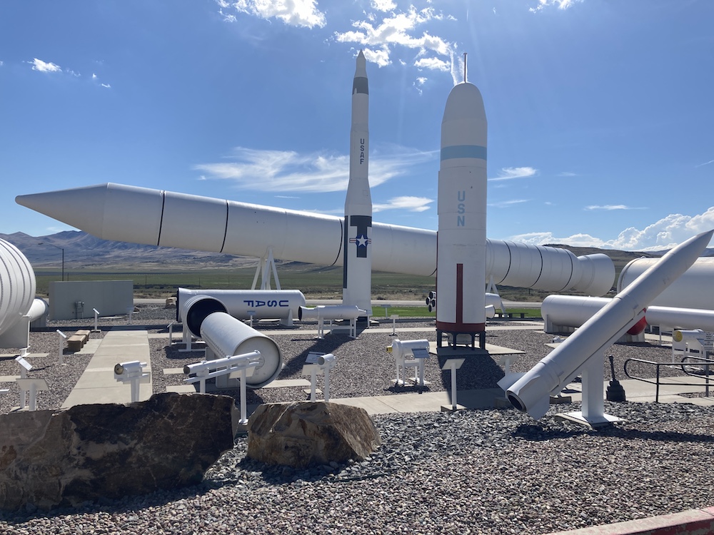 up on first letter second letter third letter first words 2nd word third word. There was a nice big hint in the combo description by the owner. And I still thought I knew what I was doing. I got about 10 minutes away driving, and it clicked. Turned around went back, got my name on that letterbox too.
So glad something routed me to that spot. I never would’ve made it here on my own.
Now it’s time to finally try and get in Idaho.
I made it to southeastern Idaho before I ran out of day. I was able to find the old one in Southeastern Idaho, but not without issues. For some reason I had notes that said I could drive pretty close to this one. I guess 2 miles round-trip walking is close, but it was probably also a half of a mile uphill. I was running out of daylight. Poor time management, so I had to jog the whole time up the hill and then back down to where I left my van. After that I was officially out of daylight. I found a nearby spot to park and sleep for the night.
Day 27:
7500 miles and counting.
I woke up in Idaho and made my way to the waterfall earthcache. I spent much more time at the waterfall area than I ever imagined. I did a couple of short hikes, and found a bunch of geocaches. I took some pictures and I chatted with some other nice travelers. I met some motorcycle enthusiasts from Australia. They told me they drove their bikes all the way to Idaho. What I thought would be a quick in and out ending up being several hours of my morning. Thank you for that.
 After a few miles of jogging and climbing around all these awesome rocks, the park filled up. People were swimming in a little lake/pond/pool area. I was hot and sweaty, and that look like an awesome thing to do. So, I did it. After a refreshing dip in the lake, I went and utilized my indoor shower. It’s a real special occasion when I use that thing.
On the way out of town I had a final of the Wherigo. I realized how I had to get there and said, damn, I just took a shower. So, I walk extra slow and tried to stay nice and zestfully clean.
My second stop for the day was out at Bruneau Canyon. Even thought it was early in the day, I knew it was where I wanted to stay the night.  The possibility of amazing night skies were high at this location. If they skies stayed clear. I have my sights set on the Cache Across America Utah version, and I believe there is also a virtual there. I had a couple hour drive. I had hoped to get there, long before sunset, and set up camp. Everything worked out perfectly. I had hours to kill before photographing the sunset and night sky. There was telephone service, and I was shocked. I was able to use that and catch up on work. I put Pervvie into Work MODE!
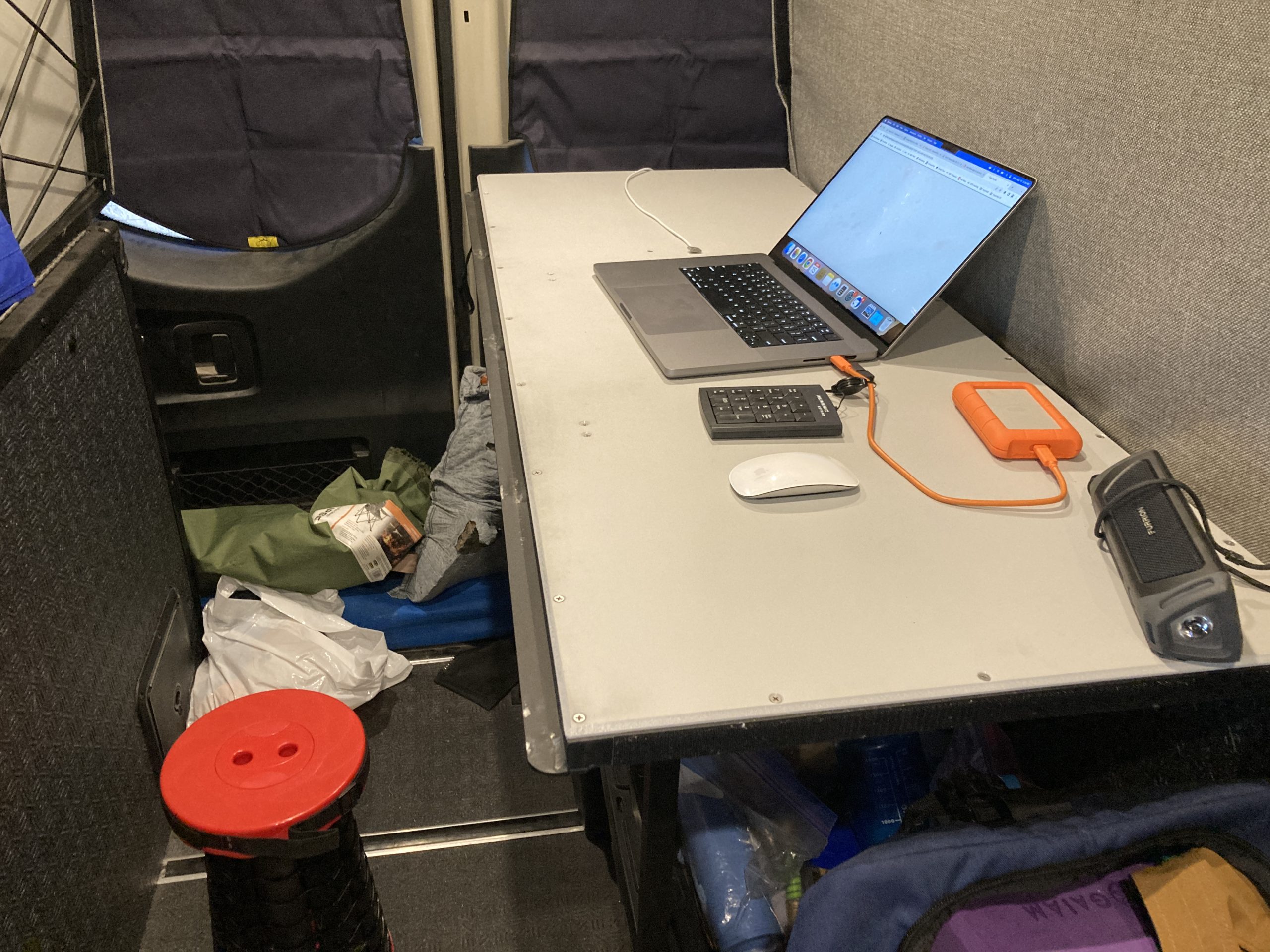
Day 28:
7700 miles and counting.
Last night I simply stayed where I landed around mid-day, at Bruneau Canyon. I had the entire place to myself from about 4PM on. I had some telephone service, so I spent a few hours catching up on real life work. I was basically just killing time waiting for the sun to scram. The skies were perfectly clear, and I was treated to a spectacular show of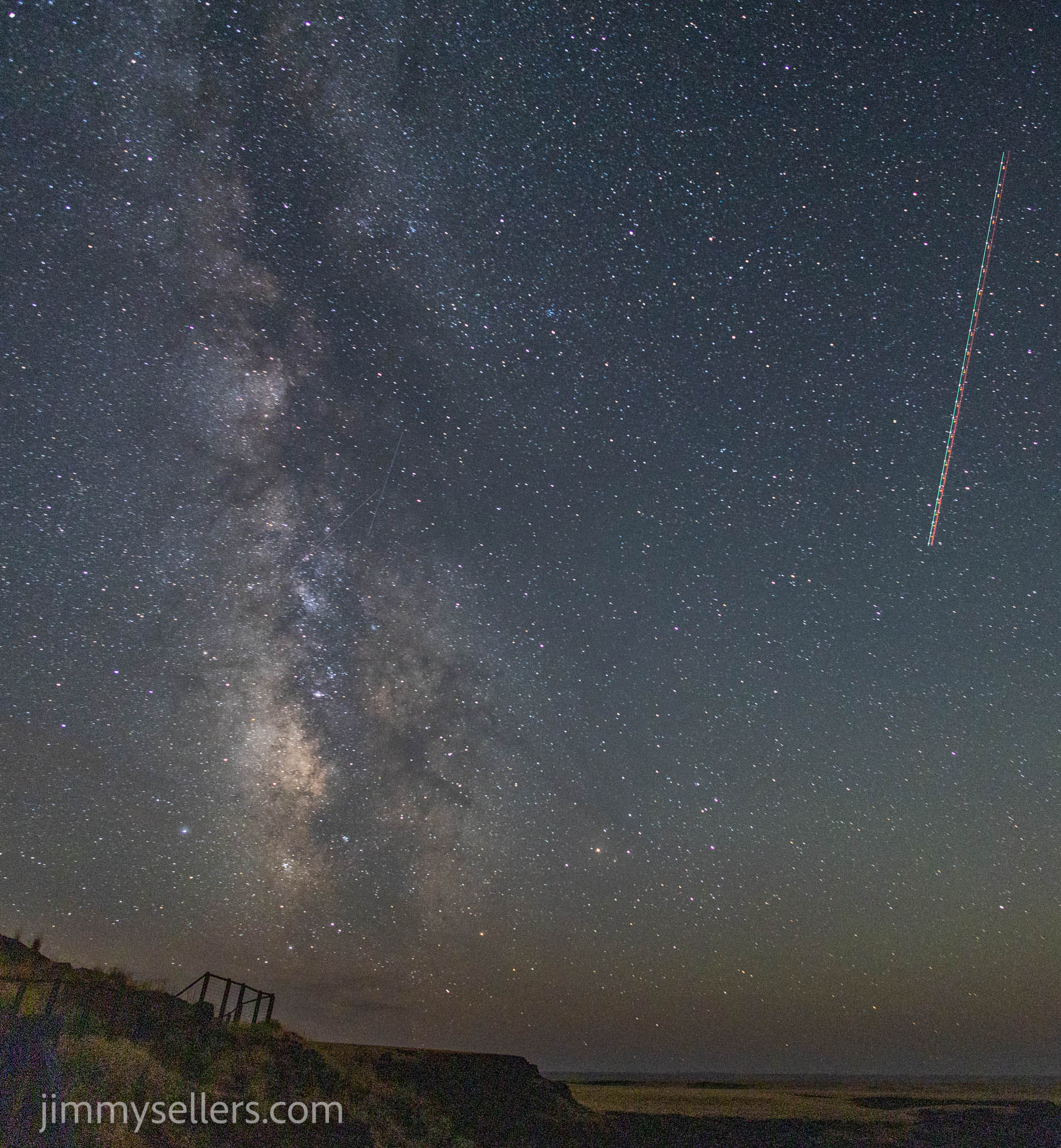 the moonlight rising and lighting up the canyon inch by inch. I got some great photographs of the Milky Way before the moon entered the show. And then some super fun shots of the canyon illuminated only by moonlight.
Now it’s time for me to head towards Boise, and then ultimately all the way north in Idaho. I have a few checklist items on my agenda, but I’m also open to getting into anything fun.
As I was driving away from the canyon on my way to Boise, I noticed a couple of power trails. Yikes, I don’t have time for that. But I noticed there was a whole bunch that were challenges. I made time for some of 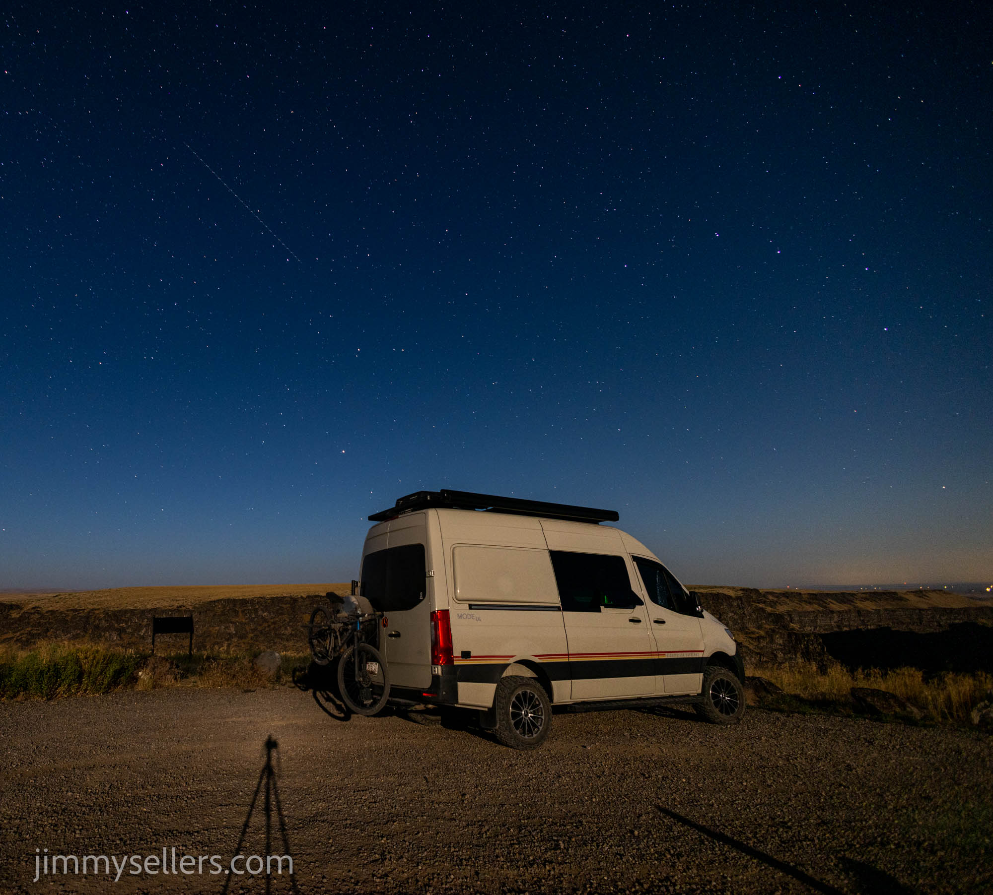 the more interesting ones that I knew I should qualify for.
I made it into Boise to check off a few specific tasks. While I was there a few other things distracted me. I also refueled Pervvie, and restocked the refrigerator. Yes, that does include a box of Cinnabon‘s. I wasn’t there long, but I knew I had plenty of city already. It was time to start heading north and get back away from people and things. My destination was GC 26 and 27. Two very old geocaches, as evidenced by their GC codes. It would be nightfall before I got there. So, my hope is to get all the way there, and have that be what I do first thing in the morning. An absolutely gorgeous drive to start out with. Meandering, twisting back-and-forth following the river that was rushing at me. I didn’t get all the way there, so I found a nice place to park and sleep along the river, during the homestretch of my drive to GC26 and 27.
I did start an album of this trip that I am updating as I process. HERE.
Day 18:
I slept near a pet Cemetery last night. I got moving plenty early in the morning, but it’s hard to get much done when the sun rise is like they are in Utah. One direction is the most beautiful pinks and oranges lighting up the mountains. 180° the other way the sun pokes it’s head up over another set of mountains. I’m trying to get things done,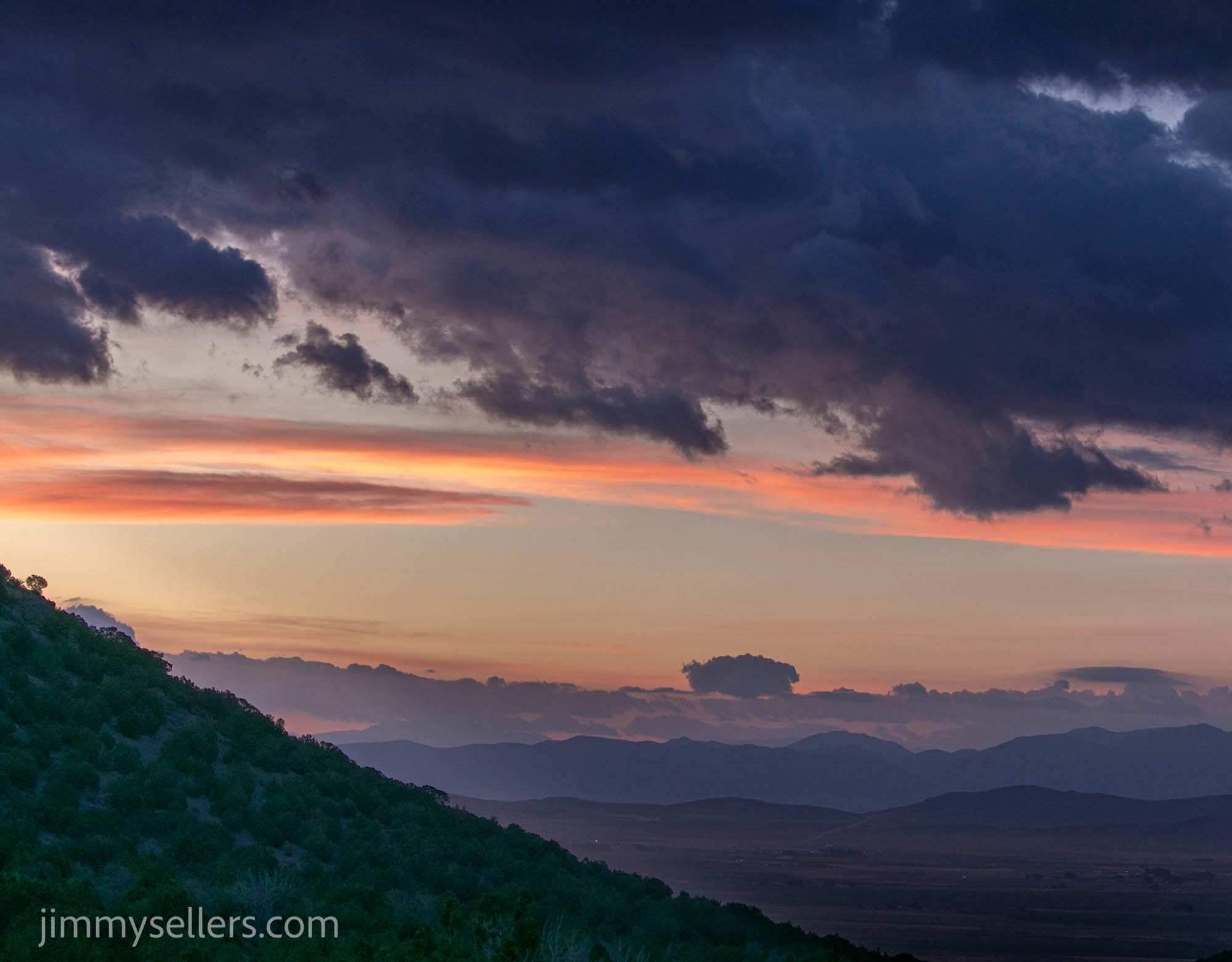 Mother Nature, and I keep having to stop and take pictures. Very inconsiderate.
I did a short trail of letter boxes. I got through them quick, no opposing traffic, perfect weather, and a van with a side door that I could just leave open, getting in and out like a mailman. I found all that I looked for, a couple of them were originals, a couple replacements, and I found a couple completely cracked and destroyed and left behind new film canisters. From here I have the half day trek to get to the Beaver hide.
During that drive I saw people living life the way I grew up. I passed a guy going the other way on a four-wheeler. He had his small daughter in front of him, holding her, letting her steer, and a beer in the other hand. Perfect.
 I wish I could have a do-over on today, or at least the 2nd half. I wasted at least five hours trying to get to Beaver. Or I wish I had done some more research ahead of time. I did a lot of due diligence planning for this trip, but I guess I slacked or failed on this one.
First, I ran up one road and hit an absolute dead end with a gate with a lock on it. After that I rerouted and ended up in places that I should not have been. I made it through, probably breaking everything about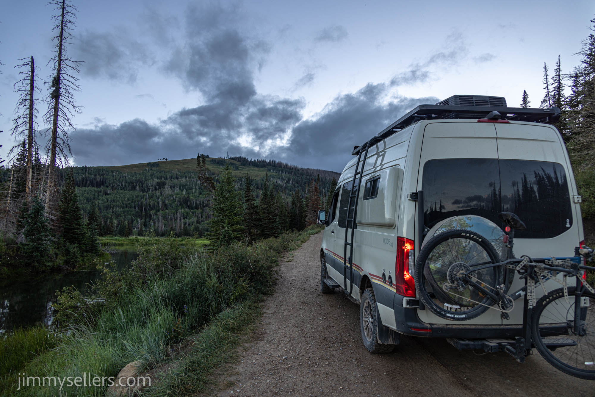 Pervvie, poor girl. And then I had to spend an hour just getting back to some sort of civilization to reroute. I read some old geocaching logs about route 6 and French Creek. I found that area on Gaia, and off I went. Another 4 hours, man, I really put on a lot of rough, off-road miles today. About 3 times more than required. But Beaver did turn out to be a park and grab. I did finally get to the top, the view was amazing. Truly unbelievable. I was so proud of my Pervvie. I gave her the honors of a photo with the ammunition can.
This is a memory I will never forget. Probably because my butt cheeks will never unclench from this experience.
 After I made it back to civilization, I drove to Potters. What a beautiful drive it was. I got there and got settled, planning to spend the night here. I decided to go do a headlamp hike as the sun was setting, take some pictures of the lake, and do the loop for the old hide.
I found everything I looked for except a trail. I’ve done a lot of dumb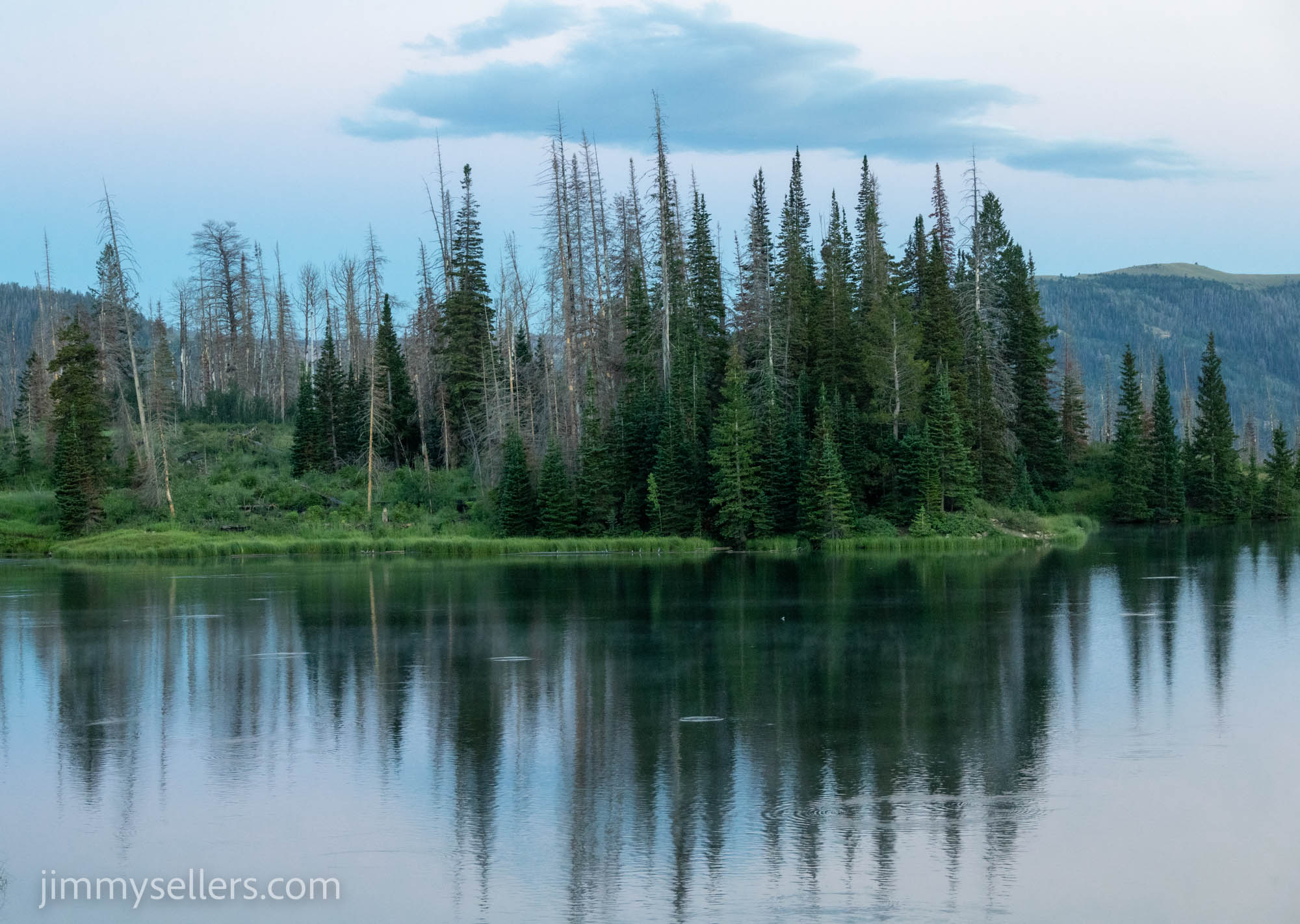 things on this trip but bushwhacking around in the pitch black for a couple of miles maybe now at the top of that list.
Day 19:
I slept at the old hide, Potter’s last night. I got on the road early, I would’ve liked earlier, but I was extra comfy in my mobile bed this morning. I had about a 2-hour drive where I was going next, a Little Creek Stash.
I came off the mountain, fueled up, got a sandwich, and headed where I was going. As always, I was distracted by other geocaches right in my path.
The first old one this morning was the least dramatic so far. No problem at all, parked close and made a short trek to the find. I didn’t break myself, my van, or anything on this one.
Next was to get the Cache Across America Utah version. I saw where it was and it would be easy, looks like it’s in the middle of a power trail. No time for that, but I did make time to find a bunch of the 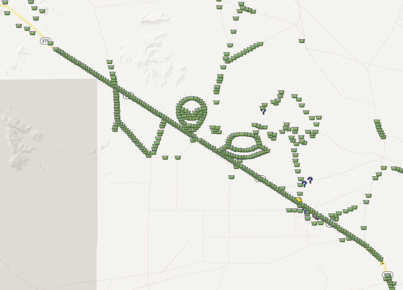 nontraditional‘s, letterboxes and multis. Geocaching power trails are very popular. They are endless amounts of geocaches along the roadside. People increase their find count by many thousands, even tens of thousands using these power trails. I do not think hell exists, but if it did, I would be forced to do power trails. The secret about hell is that you don’t even know you are there, that is how bad it is. Such an unappealing way to spend the time.
I visited the state house in Fillmore. It was perfect, I needed to re-up on water, and they had a spigot out front. It is as if I needed something, and the universe provided for me. Either that or I just stole water from a municipality. I found out later I could’ve waited and just stole some water from the graveyard I would have to visit.
Boy, do I love Beaver! Had an amazing run-in with an adorable family at the multi. I was struggling terribly, they noticed a geocacher in distress, and came to save the day! I was hoping they were going to invite me along with them camping, but we ended up parting ways.
Time for Wah Wah next. My notes said no problem. My notes were wrong. I started all wrong by entering from the east side. I spent about 4 hours getting nowhere, dead ends, and unpassable (by us) roads. I finally flagged down an ATV’er, and they set me straight. I ran the  main road all the way through the forest, then doubled back to where I was already within 3 miles of, but not good enough. Once here, I had probably 30 minutes wrapped up in the find. The coordinates do take you to a brand-new fence. At least mine did. I had no service, so no access to images. I scoured the obvious area 3 times before spotting it. I was going to be so bummed, but it is there, in the obvious place. And all the names before mine are on the log sheet, no matter where it was located.
I then chose here to spend the night. I wanted a shower, dinner, and to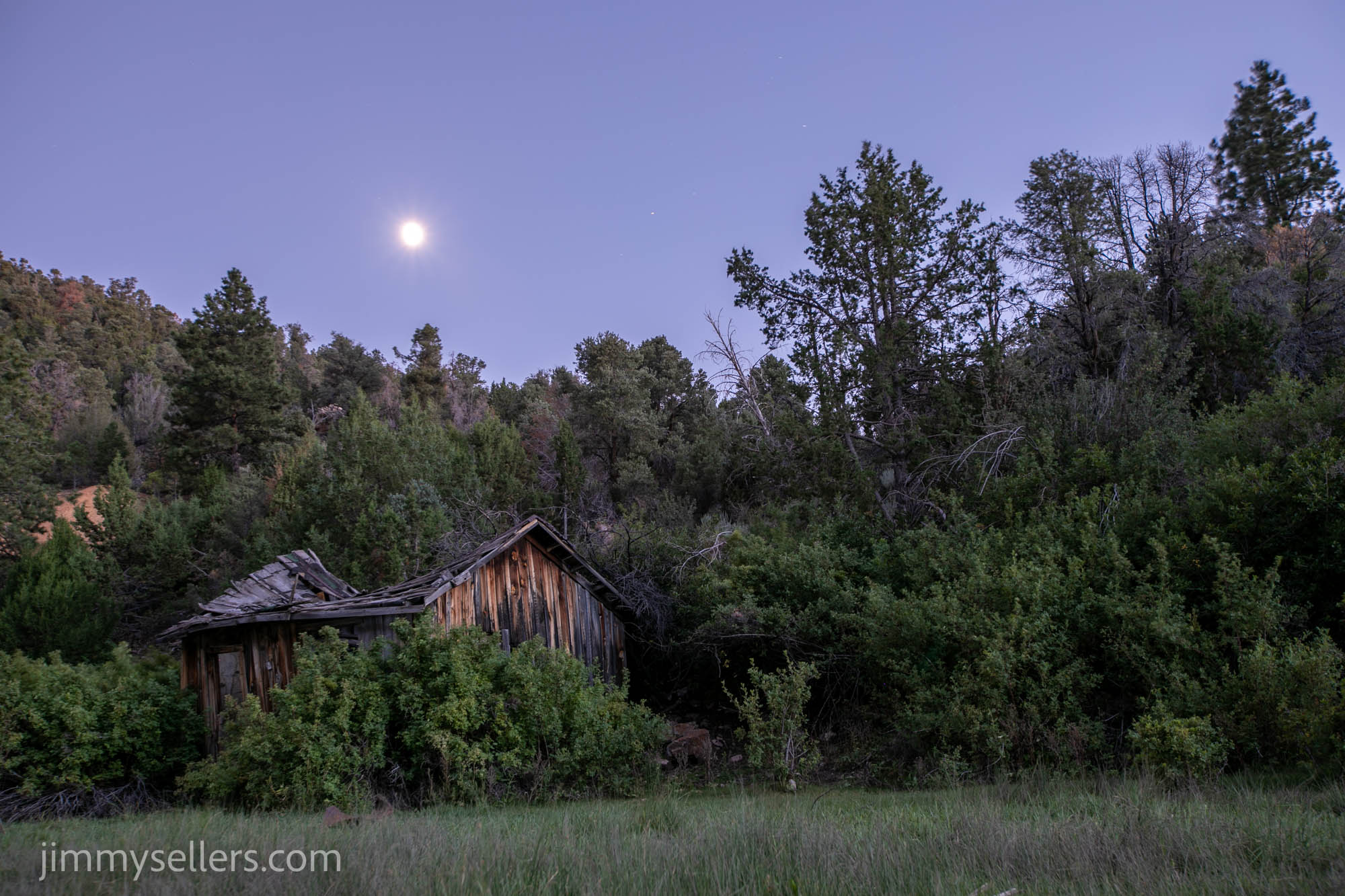 take pictures of the night sky, with the awesome foreground of those broke down shacks across the road from the ammunition can. Those photographs turned out amazing! Glad I stayed here. Did not see another human for over 12 hours at least.
Day 20:
I left where I slept, right at the Wawa Stash, not so early in the morning. My intent was to get somewhere near the Utah/Arizona border. I would spend the day and night there, as I have a bunch of personal and work things I need a hotel to catch up on.
I wasn’t originally going to go try for the old one at Lake Powell. My plan of what I was going to do has changed 20 times over the last two days. But as of right now the plan is to try to go to Lake 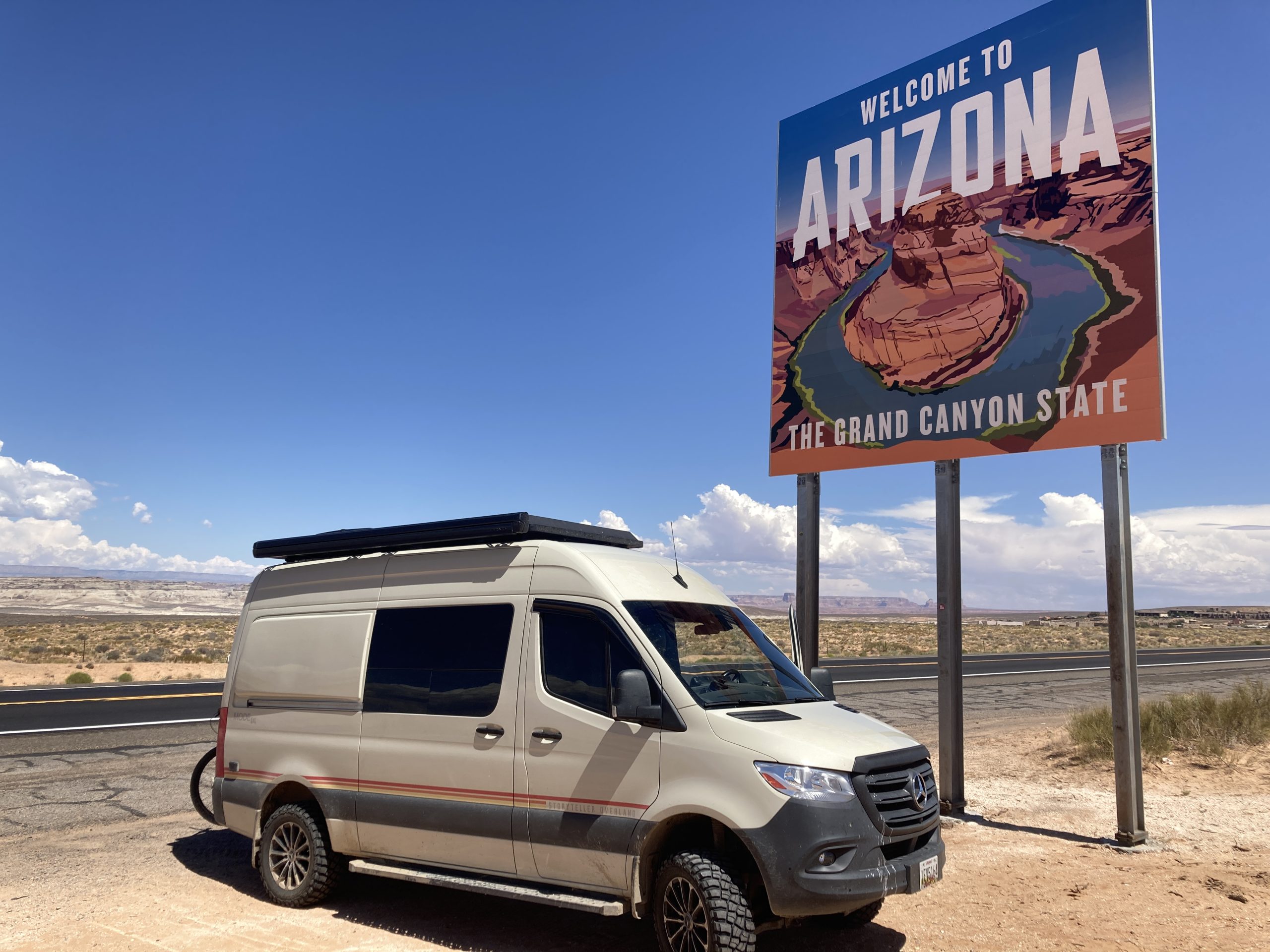 Powell. A lot of the morning was focused on just safely getting myself out of the forest. Some of those forest roads are deathly terrifying.
Nontraditionals catch my eye more than anything on this trip. I saw a multi not too far off my road route. So glad I decided to take the time for that one. Quite a lonely cache, had not been found in over 6 years. Awesome little side adventure. My favorite thing about road tripping is finding the weirdest things, like a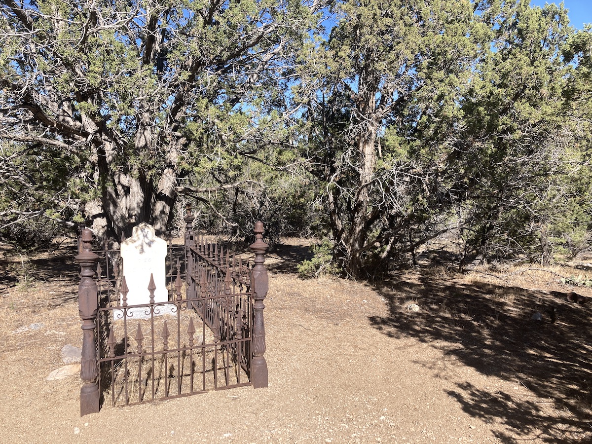 single site graveyard in the middle of nowhere. I can’t wait to sit down and figure out what that’s all about.
I passed through the town of prehistoric Parowan Utah. I spent time finding a few fun geocaches here. I wish I was passing through during this county fair, I bet it’s awesome. The signs everywhere said it was coming up soon, but not soon enough for me.
I took the scenic route. I passed through and over the town of Brians Head in Utah. I’ve never heard of it before, but it was beautiful.
Today was mostly about driving through southern Utah, the mesas and the views and the amazing colors and formations. I didn’t get much done today recreationally as I was doing my best to get into a hotel quickly, for a conference call, and then catch up on real life work and responsibilities.
I got checked into my hotel in Page, had a pizza, and partially caught up on the real world. Back to nonsense tomorrow. Jet ski nonsense!
I did start an album of this trip that I hope I will remember to update. HERE.
Day 15:
I was driving early before the sun, and it did not disappoint. The skies were beautiful as the sun came up over the South Dakota farmlands. Shades of pinks, blues and oranges that I rarely get to see.
I made my way toward Hot Springs with the expectation of finding out what that town was all about. I arrived in Hot Springs about an hour and a half before it opened. So, I spent that time cruising around the town, finding some geocaches and visiting some graveyards. Then I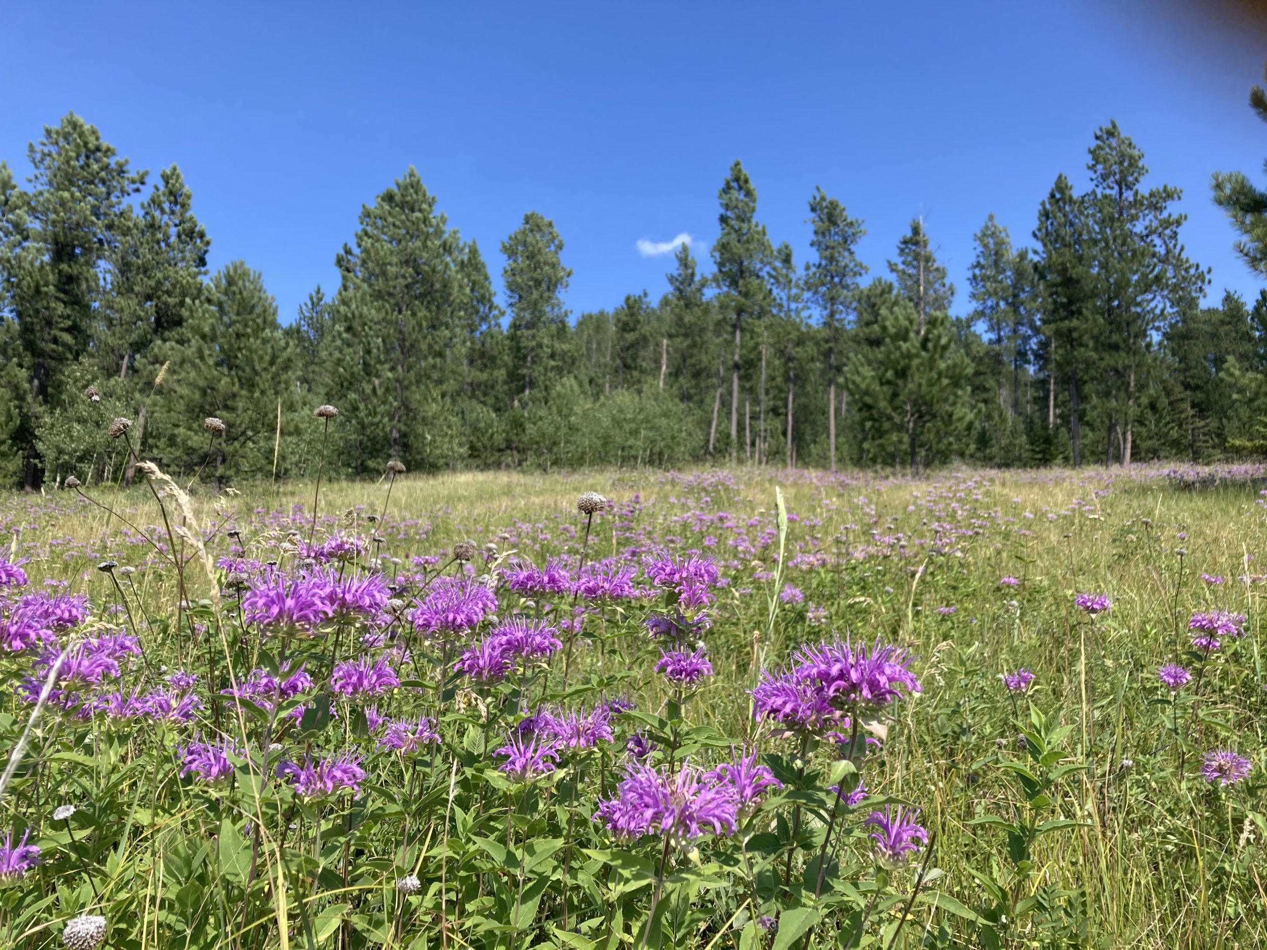 kept heading north and spent a little time in Custer. I found a couple of really fun geocaches in that town, and stocked up on food for both myself and Perrvie. Next stop, heading further north toward Campcache, the oldest geocache in South Dakota.
I spent the entire day and found the two oldest geocaches in South Dakota. I knew I was going to look for one, but didn’t realize the other one until I was nearby. Talk about an adventure that almost didn’t happen.
Holy cow. I think this has springboarded forward it to the greatest Geocaching adventure I have ever had, on all accounts.
 I finally got to do some of the off-roading I’ve been wanting to do. Forest roads of South Dakota are treacherous, terrifying and unbelievably fun. After about a two-hour delay by going the wrong way and only traversing about 10 total miles, I finally ended up at the proper location to look for this geocache.
I was kept navigated, safe and alive by my great rock climbing shoes, a new application, Gaia, I put on my telephone, and my amazing adventure van, Perrvie.
At first, I followed the GPS to a Boy Scout camp that was kind of close, but not as close as I could get in Perrvie. So, thanks to the brand new off-road GPS app, I was able to figure it out and route myself, rather than trusting the Apple Overlords.
Rewind, and erase the last hour of driving to get back to where I started, and go the other way. Then I drive about 4 miles in 30 to 40 minutes and arrive at parking. Thankfully parking is within about 300 feet. The last 100 feet is a doozy and straight down through rock crevices. I made my way down no problem I spent about 15 to 20 minutes searching and finally found the ammunition can in question! I sign in, take the obligatory pictures, and realize I must get myself out of here. That was no small feat, but a week’s worth of rock climbing for babies training, and these amazing shoes, and I was up and out of there lickety-split.
I can’t believe how lucky I am to have had that adventure, it is one I will never forget.
Campcache:
I love that this old one had parking coordinates listed. I was easily able to navigate there and realized I was only 3/10ths of a mile away. Maybe this wouldn’t take as long as I thought. Or maybe it will take as long as I thought. I just walked in a straight line from where I parked to Ground Zero. If there was a trail up, I never saw it. That last 500 feet was 500 feet that I’m not used to traversing in such a short distance. But I made it up, then realized I had to go all the way up. I thought I saw a nice way up on the right hand side, but am all the way to the left. I checked there before backtracking and ended up wall walking up one of the crevices. It was the perfect width for me to spider man up. I would be able to that easier way down on the other side. Once It was time to go down, I didn’t find that easier way down I thought I saw. So I went back the way I knew I could, and went down like a reverse-spiderman.
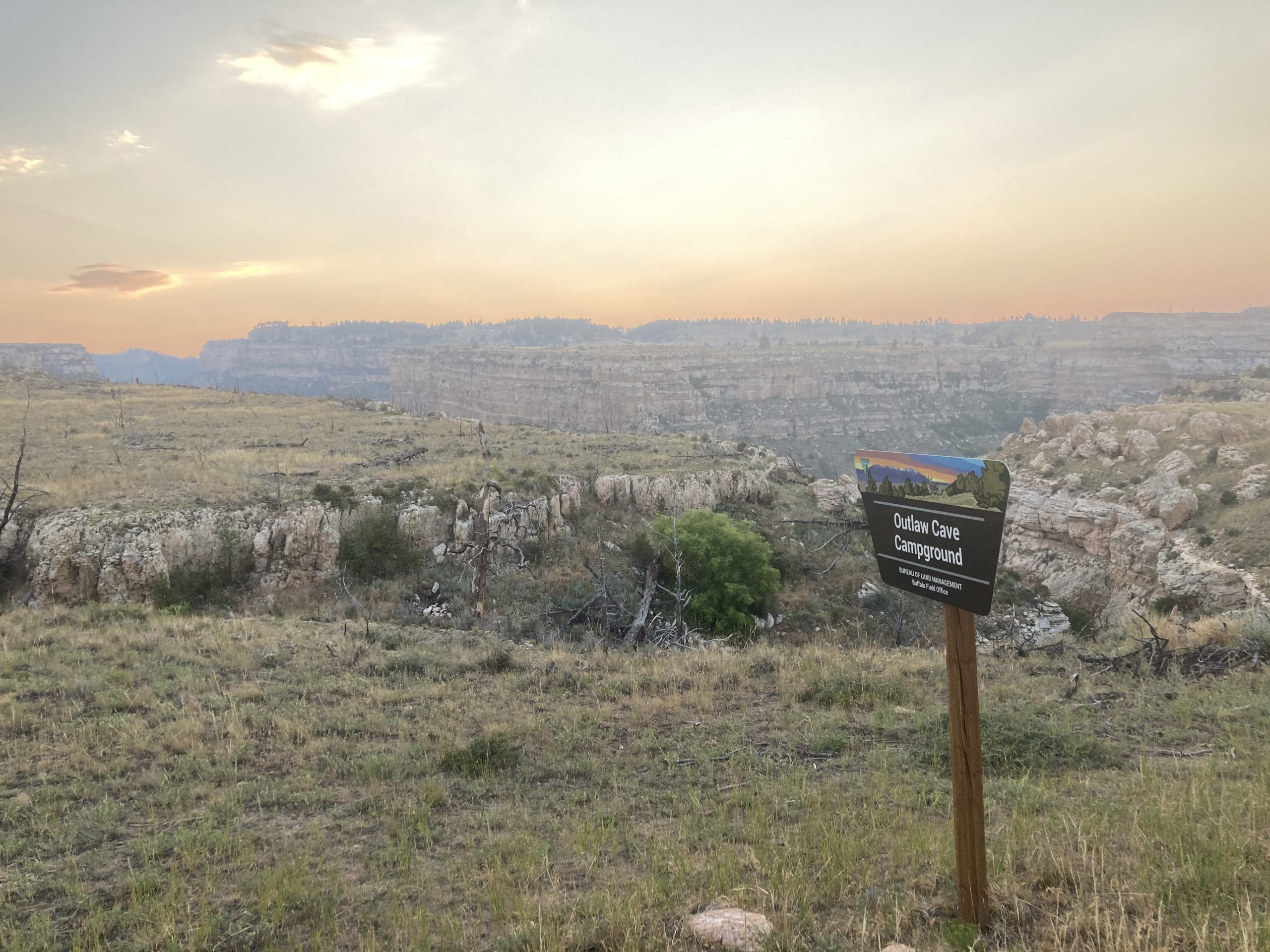 From here I wanted to get to the Outlaw Campround in Kaycee Wyoming before sundown. I wanted to camp and take pictures of the night sky there. I visited there last time I was through this area, and regret not spending the night. Now I am in this monster adventure van that can get me to these spots, no problem! I made it there at dusk, and stayed up until the sunrise, taking pictures of the night sky, and the sunrise. Now that I have gone through those
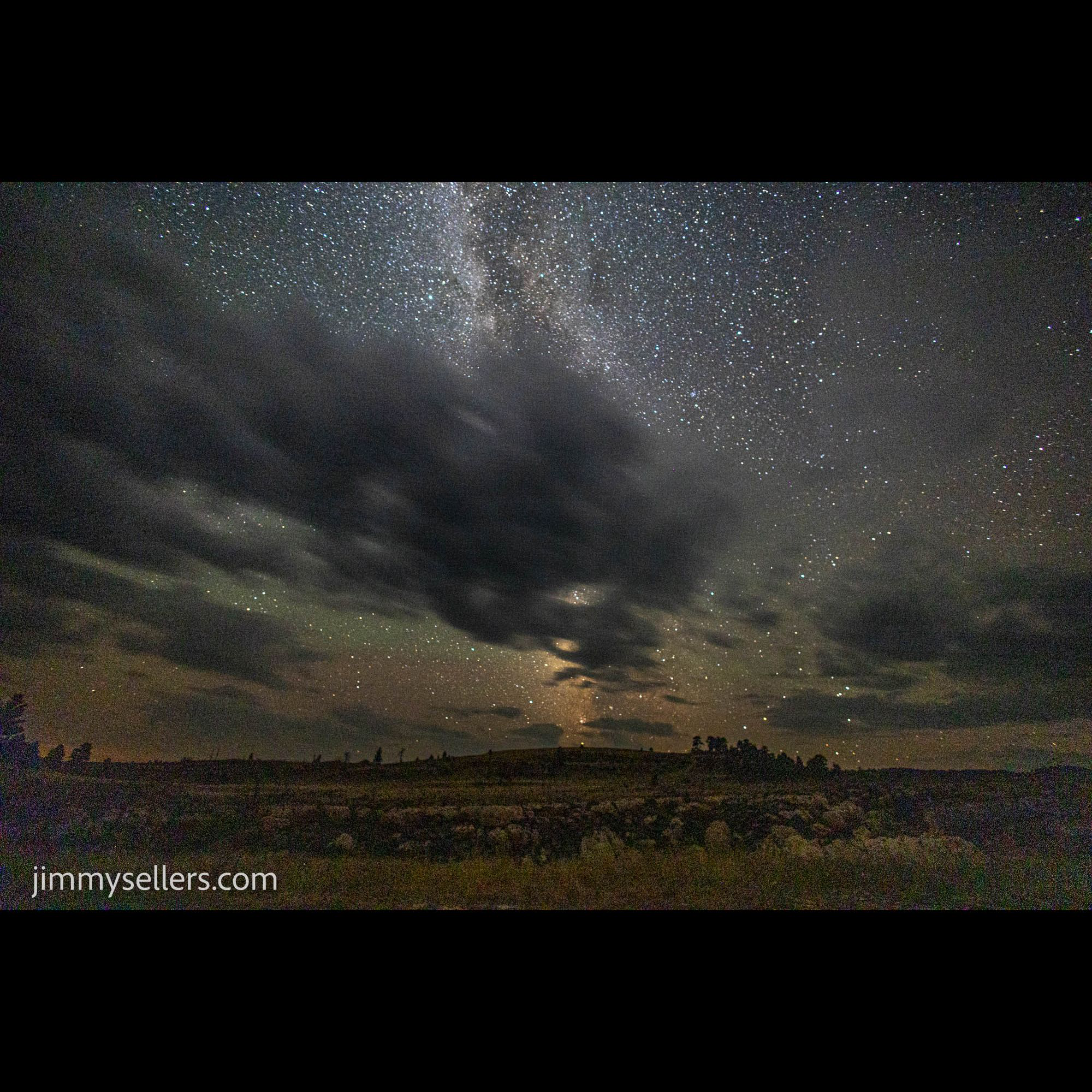 pictures, I have some of the best I have made yet.
All total, this could be the greatest uninterrupted, 24 hour period of my life.
Day 16:
Today I started late, only getting a few hours sleep, from sunrise until about 9. Once I woke, I had to pack up my camp and van, break down all my camera equipment, get cleaned up, and get on the road further west.
BUT before I did, I was going to avenge this nearby DNF from last time I was though here. The Hole in the Wall I could not get to. With this amazing 4wd adventure van, nothing was off limits. Boy was I wrong. I got a lot further than I did last time in my 4wd Tahoe, but I had to turn around when I was about 1.5 miles away. In the moment I panicked and was very anxious. I did not want to break my amazing baby, Pervvie. In hindsight I know I should have walked the last 2 miles. It was about 100 degrees, but I could have done 3 miles without issue. I just did not think of it then, I had self, and Pervvie preservation in mind. So alas, strike 2 at this same geocache in Wyoming. I have about 6 hours of my life invested. Maybe one day.
 After that it was time to get to the western edge of Wyoming. A not at all quick side trip to Capser to visit a truck wash, and hopefully I will be on my way soon.
Well, I ended up driving away from there. No bath for Pervvie, my home on wheels today.
I drove almost the entire width of Wyoming today. I have no idea how it could feel like I was the only person on earth. Boy, I really love it out here.
I learned a lot about all kinds of different trails. The Postal Pony Trail, The Book of Mormon Trail, the Pioneer Trail, and of course the Oregon Trail Trail. Lots of people used this area for travel cross country. Yeah, duh, I am doing it right now. Of course this is the path they took. It is blacktop all the way. I took pictures of an amazing sunset along the way. I found a few geocaches as well. I stopped about an hour from my next destination, Bridger-Teton. I had hoped because of the title it was closer to the Tetons than it is, never too much of a good thing.
Day 17:
I woke up about an hour drive from Bridger-Teton, the old geocache. First I went over to Big Springs. I came all this way for the old geocache nearby, why not make my way here. Boy, am I glad I did. The find itself was a little difficult. I ended up being glad I had some off-line logs saved, read those, and then bear down to make the find. I also spent at least an hour here between showers taking pictures of the waterfall and spring. It was the perfect time to be here, overcast skies, a light rain, the wildflowers colors were popping. So glad I decided to make this little sidetrack. Thanks for bringing me to this awesome place!
After that, I had to backtrack around a mountain, and go find Bridger-Teton. I slept near a lake about an hour away from here. As soon as I got on the road, the paved road ended. That was fine with me and Perrvie, I came equipped with an adventure van, I can handle anything, I hope. On our way to the Hams Fork campground, I decided to go to Springs first. After that we doubled back to the campground near our way to this old one.
I parked within a 400-foot uphill walk. Probably not the greatest idea I’ve ever had, possibly even the worst. But I made it there, getting out might be another story. Spoiler, I made it.
I found the ammunition can I was looking for, and saw that someone had already signed in before me today. I wonder if our paths crossed anywhere.
All total I spent about four hours, found two geocaches, and traveled about maybe 6 miles. Those are some good statistics.
After leaving Wyoming for good, and Bridger national Forest, I made my way to Utah. I have an agenda there of some old ones, the cache across America, and a few others that might get in my way. I hope to also spend some time in the Moab area.
 I made it to Clover Spring Campground early enough in the day. I’d bebopped around that whole area for several hours, finding some others and some challenge caches and a multi. I had a blast. Now it’s time to head off to Pony Boy.
The sun was starting to set as I got moving on the Pony Road. So many caches. It almost hurts to look at the map. I know what I am here for. I find the Pony Stash under light of a half moon, and a headlamp. Another 2000 found! I signed in on a few of the others that I stopped at for various reasons. Obviously, I went to the pet cemetery, and I also chose there to spend the night. Kinda cool, I know.
Sometimes I simply don’t understand this life I get to live.